Rudaki District
Rudaki District or Nohiyai Rudaki (Tajik: Ноҳияи Рӯдакӣ) is a district in the Region of Republican Subordination in Tajikistan. It stretches south from Dushanbe, bordering on Shahrinaw, Hisor, and Varzob districts from the north and northwest, Tajikistan's Khatlon Province from the south and the east, and Uzbekistan from the west. Its administrative capital is Somoniyon, a southern suburb of Dushanbe, called Leninskii in the Soviet period.[1]

Location in Tajikistan
A border guard training center is located here, used by the Tajik Border Troops.[2] In October 2013, the Tajik Interior Ministry opened a new police station in the district.[3]
Administrative divisions
The district is divided administratively into jamoats. They are as follows (and population).[4]
| Jamoats of Rudaki District | |
| Jamoat | Population |
|---|---|
| Chorteppa | 19410 |
| Guliston | 25905 |
| Ispechak | 14496 |
| Kiblai | 8682 |
| Kuktosh | 22348 |
| Kushtepin | 19232 |
| Lohur | 13061 |
| Oqkurgan | 22013 |
| Rohati | 22307 |
| Sardorov Karakhan | 13415 |
| Somoniyon | 15923 |
| Sultonobod | 10306 |
| Tojikiston | 22951 |
| Zainabobod | 30340 |
References
- Republic of Tajikistan, map showing administrative division as of January 1, 2004, "Tojikkoinot" Cartographic Press, Dushanbe
- "OSCE supports training for Tajik border guard services on refugees and asylum issues | OSCE". www.osce.org. Retrieved 2016-05-21.
- "In Rudaki district opened a new territorial police station". www.vkd.tj. Archived from the original on 2016-06-17. Retrieved 2016-05-21.
- "List of Jamoats". UN Coordination, Tajikistan. Archived from the original on July 16, 2011. Retrieved April 4, 2009.
Capital: Dushanbe | ||
| Districts | 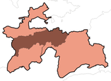 | |
| Main cities and towns | ||
| Geography | ||
This article is issued from Wikipedia. The text is licensed under Creative Commons - Attribution - Sharealike. Additional terms may apply for the media files.