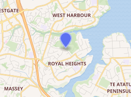
Royal Heights
Royal Heights is an Auckland suburb, which is under the local governance of Auckland Council.
Royal Heights | |
|---|---|
| |
| Country | New Zealand |
| Local authority | Auckland Council |
| Electoral ward | Waitākere Ward |
| Population (2018) | |
| • Total | 7,278 |
| Westgate | West Harbour | Hobsonville |
| Massey |
|
(Waitematā Harbour) |
| Massey | Lincoln | Te Atatū Peninsula |
Moire Park is a large park in Royal Heights, which has both sports grounds and areas of bush with walking tracks.[1][2] The Manutewhau Walkway in Moire Park follows the Manutewhau Stream.[3]
Demographics
| Historical population | ||
|---|---|---|
| Year | Pop. | ±% p.a. |
| 2006 | 6,465 | — |
| 2013 | 6,768 | +0.66% |
| 2018 | 7,278 | +1.46% |
| Source: [4] | ||


Royal Heights, comprising the statistical areas of Royal Heights North and Royal Heights South, had a population of 7,278 at the 2018 New Zealand census, an increase of 510 people (7.5%) since the 2013 census, and an increase of 813 people (12.6%) since the 2006 census. There were 2,160 households. There were 3,597 males and 3,678 females, giving a sex ratio of 0.98 males per female, with 1,635 people (22.5%) aged under 15 years, 1,734 (23.8%) aged 15 to 29, 3,168 (43.5%) aged 30 to 64, and 738 (10.1%) aged 65 or older.
Ethnicities were 54.1% European/Pākehā, 17.5% Māori, 21.8% Pacific peoples, 21.2% Asian, and 4.5% other ethnicities (totals add to more than 100% since people could identify with multiple ethnicities).
The proportion of people born overseas was 34.5%, compared with 27.1% nationally.
Although some people objected to giving their religion, 43.0% had no religion, 41.1% were Christian, and 9.4% had other religions.
Of those at least 15 years old, 1,140 (20.2%) people had a bachelor or higher degree, and 939 (16.6%) people had no formal qualifications. The employment status of those at least 15 was that 3,009 (53.3%) people were employed full-time, 714 (12.7%) were part-time, and 288 (5.1%) were unemployed.[4]
Education
Colwill School is a coeducational full primary school (years 1–8), with a roll of 196 students as of March 2020.[5][6]
Notes
- "Moire Park". Places New Zealand. Retrieved 25 June 2020.
- "Moire Park Path". Auckland Council. Retrieved 25 June 2020.
- "Manutewhau Walkway". Auckland Council. Retrieved 25 June 2020.
- "Statistical area 1 dataset for 2018 Census". Statistics New Zealand. March 2020. Royal Heights North (121600) and Royal Heights South (122300). 2018 Census place summary: Royal Heights North 2018 Census place summary: Royal Heights South
- "New Zealand Schools Directory". New Zealand Ministry of Education. Retrieved 26 April 2020.
- Education Counts: Colwill School