Rowallan Power Station
The Rowallan Power Station is a conventional hydroelectric power station located in north-western Tasmania, Australia. The station is located 25 kilometres (16 mi) south of Liena.
| Rowallan Dam | |
|---|---|
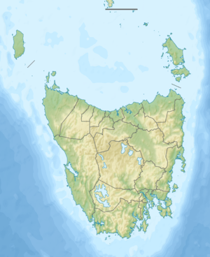 Location of the Rowallan Dam in Tasmania | |
| Country | Australia |
| Location | North-western Tasmania |
| Coordinates | 41°43′48″S 146°12′36″E |
| Purpose | Power |
| Status | Operational |
| Construction began | 1963 |
| Opening date | 1967 |
| Owner(s) | Hydro Tasmania |
| Dam and spillways | |
| Type of dam | Embankment dam |
| Impounds | Mersey River |
| Height | 43 metres (141 ft) |
| Length | 579 metres (1,900 ft) |
| Dam volume | 497 thousand cubic metres (17.6×10⁶ cu ft) |
| Spillways | 1 |
| Spillway type | Uncontrolled |
| Spillway capacity | 685 cubic metres per second (24,200 cu ft/s) |
| Reservoir | |
| Creates | Rowallan Lake |
| Total capacity | 130,490 megalitres (4,608×106 cu ft) |
| Catchment area | 345 square kilometres (133 sq mi) |
| Surface area | 88.6 hectares (219 acres) |
| Maximum length | 11 kilometres (6.8 mi) |
| Normal elevation | 488 metres (1,601 ft) |
| Rowallan Power Station | |
| Operator(s) | Hydro Tasmania |
| Commission date | 1968 |
| Type | Conventional |
| Hydraulic head | 49 metres (161 ft) |
| Turbines | 1 x 10.5 MW (14,100 hp) Maier Francis turbine |
| Installed capacity | 10.5 megawatts (14,100 hp) |
| Capacity factor | 0.95 |
| Annual generation | 45 gigawatt-hours (160 TJ) |
| Website hydro | |
| [1] | |
Technical details
Part of the Mersey–Forth scheme that comprises eight hydroelectric power stations, the Devils Gate Power Station is the first station in the scheme. The power station is located approximately 200 metres (660 ft) downstream of Rowallan Dam, which forms Lake Rowallan. The dam is one of the two main headwater storages in the Mersey Forth scheme and assists in regulating the water supply to four downstream power stations.[2]
The power station was commissioned in 1971 by the Hydro Electric Corporation (TAS) and the station has one Maier Francis turbine, with a generating capacity of 10.5 megawatts (14,100 hp) of electricity. The station output, estimated to be 45 gigawatt-hours (160 TJ) annually,[1] is fed to TasNetworks' transmission grid via a 22 kV/110 kV transmission line to the switchyard transformer.[3]
Rowallan Lake
The associated Rowallan Lake which is 11 kilometres (6.8 mi) long and 9 square kilometres (3.5 sq mi) in area, is 488 metres (1,601 ft) above sea level and is bordered by Clumner Bluff and Howells Bluff.[4] The reservoir is managed by the Tasmanian Inland Fisheries Service as a trout fishery; both Brown trout and Rainbow trout are stocked; there are also native Climbing galaxias, Spotted galaxias and River blackfish.[5] Lake Rowallan is also the starting point for walks into nearby highland areas including the Walls of Jerusalem National Park.[6] In 2010, concerns were raised about the integrity of the embankment dam.[7]
Etymology
Both the power station and lake are named in honour of Thomas Corbett, 2nd Baron Rowallan, the former Governor of Tasmania.[4]
References
- "Register of Large Dams in Australia" (Excel (requires download)). Dams information. Australian National Committee on Large Dams. 2010. Retrieved 23 June 2015.
- "Mersey - Forth". Energy. Hydro Tasmania. Retrieved 3 July 2015.
- "Rowallan Power Station: Technical fact sheet" (PDF). Mersey-Forth Catchment. Hydro Tasmania. Archived from the original (PDF) on 24 March 2012. Retrieved 3 July 2015.
- "2006 Legislative Council elections—dates announced" (PDF) (Press release). Tasmanian Electoral Commission. 23 March 2006. Retrieved 3 July 2015.
- http://www.ifs.tas.gov.au/ifs/goingfishing/access-brochures/access-brochures/Lake%20Rowallan%20Brochure%20for%20web.pdf
- https://web.archive.org/web/20110707075116/http://www.about-australia.com/travel-guides/tasmania/devonport-cradle-mountain/attractions/natural/lake-rowallan/. Archived from the original on 7 July 2011. Retrieved 26 February 2011. Missing or empty
|title=(help) - Ricketts, Andrew (22 March 2010). "Rowallan Dam fears: Is it being kept secret?". Tasmanian Times. Retrieved 3 July 2015.