Rothesay Parish, New Brunswick
Rothesay is a Canadian parish in Kings County, New Brunswick.[2]
Rothesay | |
|---|---|
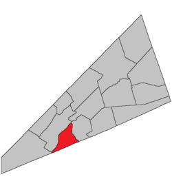 Location within Kings County, New Brunswick. | |
| Country | |
| Province | |
| County | Kings County |
| Established | 1870 |
| Area | |
| • Land | 7.26 km2 (2.80 sq mi) |
| Population (2016)[1] | |
| • Total | 325 |
| • Density | 44.8/km2 (116/sq mi) |
| • Change 2011-2016 | |
| • Dwellings | 136 |
| Time zone | UTC-4 (AST) |
| • Summer (DST) | UTC-3 (ADT) |
History
Rothesay Parish set off from Hampton Parish in 1870. The Name comes from Duke of Rothesay probably names after Edward VII who at the time was a duke.
Delineation
Rothesay Parish is defined in the Territorial Division Act[3] as being bounded:
- Westerly and northerly by the Kennebecasis Bay and River; easterly by Hampton Parish and southerly by the County line.
Communities
Parish population total does not include incorporated municipalities (in bold):
Bodies of water & Islands
This is a list of rivers, lakes, streams, creeks, marshes, Peninsulas and Islands that are at least partially in this parish
- Hunter Lake
Demographics
Access Routes
Highways and numbered routes that run through the parish, including external routes that start or finish at the parish limits:[6]
See also
References
- "Census Profile, 2016 Census: Rothesay, Parish [Census subdivision], New Brunswick". Statistics Canada. Retrieved September 19, 2019.
- "Rothesay Parish". New Brunswick Provincial Archives.
- "Territorial Division Act (R.S.N.B. 1973, c. T-3)". Government of New Brunswick website. Retrieved 24 August 2016.
- Statistics Canada: 2001, 2006 census
- 2011 Statistics Canada Census Profile: Rothesay Parish, New Brunswick
- Atlantic Canada Back Road Atlas ISBN 978-1-55368-618-7
External links
Places adjacent to Rothesay Parish, New Brunswick | ||||||||||
|---|---|---|---|---|---|---|---|---|---|---|
| ||||||||||
| Subdivisions |
|
|---|---|
| Cities | |
| Counties | |
| |
This article is issued from Wikipedia. The text is licensed under Creative Commons - Attribution - Sharealike. Additional terms may apply for the media files.