Rosston, Oklahoma
Rosston is a town in Harper County, Oklahoma, United States. The population was 31 at the 2010 census.
Rosston, Oklahoma | |
|---|---|
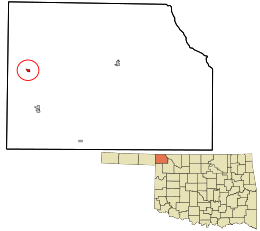 Location in Harper County and the state of Oklahoma. | |
| Coordinates: 36°48′45″N 99°56′0″W | |
| Country | United States |
| State | Oklahoma |
| County | Harper |
| Area | |
| • Total | 0.27 sq mi (0.71 km2) |
| • Land | 0.27 sq mi (0.71 km2) |
| • Water | 0.00 sq mi (0.00 km2) |
| Elevation | 2,139 ft (652 m) |
| Population (2010) | |
| • Total | 31 |
| • Estimate (2018)[2] | 32 |
| • Density | 116.79/sq mi (45.08/km2) |
| Time zone | UTC-6 (Central (CST)) |
| • Summer (DST) | UTC-5 (CDT) |
| ZIP code | 73855 |
| Area code(s) | 580 |
| FIPS code | 40-64050[3] |
| GNIS feature ID | 1097468[4] |
Geography
Rosston is located at 36°48′45″N 99°56′0″W (36.812364, -99.933401).[5]
According to the United States Census Bureau, the town has a total area of 0.3 square miles (0.78 km2), all land.
Demographics
| Historical population | |||
|---|---|---|---|
| Census | Pop. | %± | |
| 1920 | 181 | — | |
| 1930 | 185 | 2.2% | |
| 1940 | 143 | −22.7% | |
| 1950 | 85 | −40.6% | |
| 1960 | 58 | −31.8% | |
| 1970 | 56 | −3.4% | |
| 1980 | 66 | 17.9% | |
| 1990 | 54 | −18.2% | |
| 2000 | 66 | 22.2% | |
| 2010 | 31 | −53.0% | |
| Est. 2018 | 32 | [2] | 3.2% |
| U.S. Decennial Census[6] | |||
As of the census[3] of 2000, there were 66 people, 23 households, and 14 families residing in the town. The population density was 205.3 people per square mile (79.6/km²). There were 29 housing units at an average density of 90.2 per square mile (35.0/km²). The racial makeup of the town was 98.48% White, 1.52% from other races. Hispanic or Latino of any race were 10.61% of the population.
There were 23 households out of which 26.1% had children under the age of 18 living with them, 43.5% were married couples living together, 4.3% had a female householder with no husband present, and 34.8% were non-families. 30.4% of all households were made up of individuals and 17.4% had someone living alone who was 65 years of age or older. The average household size was 2.87 and the average family size was 3.73.
In the town, the population was spread out with 39.4% under the age of 18, 3.0% from 18 to 24, 21.2% from 25 to 44, 28.8% from 45 to 64, and 7.6% who were 65 years of age or older. The median age was 32 years. For every 100 females, there were 127.6 males. For every 100 females age 18 and over, there were 110.5 males.
The median income for a household in the town was $39,167, and the median income for a family was $42,500. Males had a median income of $23,000 versus $21,250 for females. The per capita income for the town was $7,297. There were 11.1% of families and 11.2% of the population living below the poverty line, including 7.4% of under eighteens and 33.3% of those over 64.
References
- "2018 U.S. Gazetteer Files". United States Census Bureau. Retrieved Feb 12, 2020.
- "Population and Housing Unit Estimates". Retrieved June 4, 2019.
- "U.S. Census website". United States Census Bureau. Retrieved 2008-01-31.
- "US Board on Geographic Names". United States Geological Survey. 2007-10-25. Retrieved 2008-01-31.
- "US Gazetteer files: 2010, 2000, and 1990". United States Census Bureau. 2011-02-12. Retrieved 2011-04-23.
- "Census of Population and Housing". Census.gov. Retrieved June 4, 2015.
Municipalities and communities of Harper County, Oklahoma, United States | ||
|---|---|---|
| Towns |  Harper County map | |
| Unincorporated community | ||
| Ghost towns | ||