Roman Bridge (Saint-Thibéry)
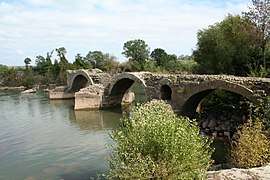
The Roman Bridge at Saint-Thibéry (French: Pont romain de Saint-Thibéry) was a Roman bridge on the Via Domitia in southern France.[1] The partly surviving structure crossed the river Hérault in Saint-Thibéry, 17 km east of Béziers.[2]
Roman Bridge | |
|---|---|
 | |
| Coordinates | 43.392887°N 3.432836°E |
| Carries | Via Domitia |
| Crosses | Hérault River |
| Locale | Saint-Thibéry, Hérault, France |
| Characteristics | |
| Design | Segmental arch bridge |
| Material | Stone |
| Total length | Ca. 150 m |
| Width | 4 m |
| Longest span | 12 m |
| No. of spans | 9 |
| History | |
| Construction end | Reign of Augustus (30 BC–14 AD) |
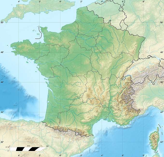 Roman Bridge Location in France | |
Construction
The ancient bridge had nine arches with spans of 10–12 m. The roadway rested on wide piers, which were protected on both sides by arched floodways and large cutwaters.[2] The original length of the structure is estimated as 150 m, its road width as 4 m.[2] The missing spans are known to have been destroyed by flood some time before 1536.[2]
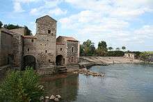
The remaining arches, with a span to rise ratio of 3.3:1 (115°) or more, show a visibly flatter profile than the semi-circular arches usually preferred by Roman engineers (180°).[1][2] The rib thickness varies between one-tenth to one-twentieth of the span, corresponding to a common ratio also observed at a number of other Roman stone bridges.[3] The structure is dated to the reign of emperor Augustus (30 BC–14 AD). Immediately upstream an old water mill and its millrace is located.[2]
See also
- List of Roman bridges
- Roman architecture
- Roman engineering
References
- O’Connor 1993, p. 171
- O’Connor 1993, pp. 98–99
- O’Connor 1993, p. 169f.
Sources
- O’Connor, Colin (1993), Roman Bridges, Cambridge University Press, pp. 98f. (G11), 169–171, ISBN 0-521-39326-4
External links
![]()
- Roman Bridge at Structurae
- Traianus – Technical investigation of Roman public works