Rodopoli
Rodopoli (Greek: Ροδόπολη, meaning "City of Roses", before 1981: Μπάλα - Bala[2]) is a suburban town in East Attica, Greece. Since the 2011 local government reform it is part of the municipality Dionysos, of which it is a municipal unit.[3] The municipal unit has an area of 9.550 km2.[4]
Rodopoli Ροδόπολη | |
|---|---|
 Rodopoli Location within the regional unit 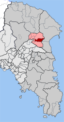 | |
| Coordinates: 38°6′N 23°52′E | |
| Country | Greece |
| Administrative region | Attica |
| Regional unit | East Attica |
| Municipality | Dionysos |
| • Municipal unit | 9.550 km2 (3.687 sq mi) |
| Elevation | 395 m (1,296 ft) |
| Population (2011)[1] | |
| • Municipal unit | 2,078 |
| • Municipal unit density | 220/km2 (560/sq mi) |
| Time zone | UTC+2 (EET) |
| • Summer (DST) | UTC+3 (EEST) |
| Postal code | 145 74 |
| Area code(s) | 210 |
Geography
Rodopoli is situated in the hills in the northeastern part of the Athens conurbation, at about 400 m elevation. It lies at the northwestern foot of the Penteliko Mountain. It is 1 km south of Stamata, 2 km north of Dionysos and 19 km northeast of Athens city centre. Its built-up area is continuous with those of the neighbouring towns Drosia and Dionysos. Part of Rodopoli has retained its old village character, while its eastern (and higher elevation) part has seen the development of higher quality residential properties.
Historical population
| Year | Population |
|---|---|
| 1981 | 786 |
| 1991 | 1,359 |
| 2001 | 2,090 |
| 2011 | 2,078 |
See also
- List of municipalities of Attica
References
- "Απογραφή Πληθυσμού - Κατοικιών 2011. ΜΟΝΙΜΟΣ Πληθυσμός" (in Greek). Hellenic Statistical Authority.
- Name changes of settlements in Greece
- Kallikratis law Greece Ministry of Interior (in Greek)
- "Population & housing census 2001 (incl. area and average elevation)" (PDF) (in Greek). National Statistical Service of Greece.