Riversway
Riversway is an electoral ward in Preston, Lancashire, England. The ward is named for its location close to the River Ribble, and the historical links to the former Port of Preston. The ward can be split into three distinct areas; the former Docklands, now a shopping area and residential community, with new build apartments and housing overlooking the dock; Broadgate, the residential area built during the Industrial Revolution; and Christ Church, a community of traditional terraced housing.
| Riversway | |
|---|---|
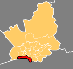 Location in the City of Preston district | |
 Riversway Location in Preston 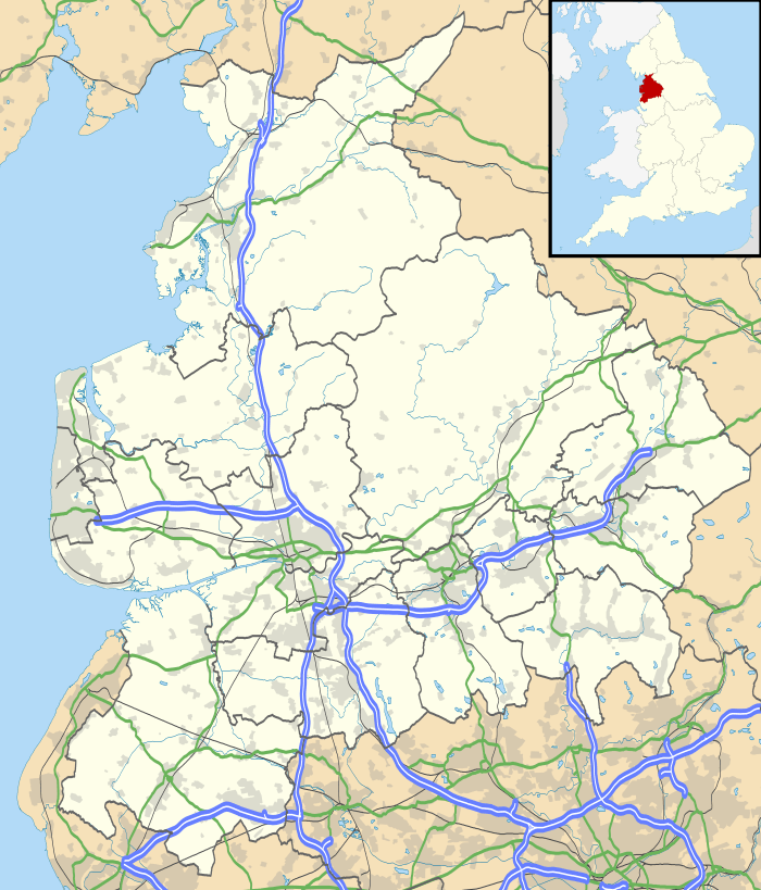 Riversway Location within Lancashire | |
| Population | 6,351 (2011) |
| District | |
| Ceremonial county | |
| Region | |
| Country | England |
| Sovereign state | United Kingdom |
| UK Parliament | |
| Councillors |
|

The ward contains the administrative headquarters of Lancashire County Council.
Riversway returns three members to Preston City Council, elected 'in thirds' in first past the post elections each year. The ward is currently represented by three Labour councillors.
The ward forms part of the Lancashire County Council electoral division of Preston City.
Current members
| Election | Member | Party | |
|---|---|---|---|
| 2007 Preston Council election | Bhikhu Patel | Labour | |
| 2010 Preston Council election | Dave Wilson | Labour | |
| Preston Council by-election 2010 | Linda Crompton | Labour | |
Demographics
From the 2001 census, Riversway ward had a population of 5,823. Of this figure, just over half (53.9) described themselves as Christian. With 11% and 10% respectively, the Hindu and Muslim populations are amongst the largest in the city; a Hindu temple is within the Broadgate area of the ward. Riversway had a population of 6351 in 2011.[1] Here is a 2011 ethnic breakdown of the ward.
| Riversway Compared 2011 | Riversway | City of Preston |
|---|---|---|
| White British | 64.5% | 75.7% |
| Other White | 6.8% | 3.5% |
| Asian | 21.3% | 15.5% |
| Black | 1.9% | 1.2% |
Geography
The ward is in the southwest of the city, curving along the route of the Ribble from Broadgate to the docklands, where the river eventually meets the Fylde coast, and ultimately the Irish Sea. The ward features the terrace streets and student hostels along Fishergate Hill towards Preston railway station, the Royal Mail sorting office, and many shops and businesses along the docklands development. The Penwortham by-pass is in this ward, joining the campus of the University of Central Lancashire to traffic on the western side of the city.
Riversway is also the home of the Ribble Steam Railway and its own railway station.
See also
- Preston local elections
References
- "Riversway - UK Census Data 2011". UK Census Data. Retrieved 8 November 2015.
Geography of the City of Preston district | |||||||
|---|---|---|---|---|---|---|---|
| Cities |  | ||||||
| Suburbs | |||||||
| Villages |
| ||||||
| Parishes | |||||||
| Topography |
| ||||||
| |||||||