Ripponlea, Victoria
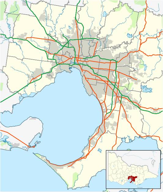
Ripponlea is an inner suburb of Melbourne, Victoria, Australia, named after the adjoining Rippon Lea Estate. It is 7 km south east of Melbourne's Central Business District. Its local government area is the City of Port Phillip. At the 2016 Census, Ripponlea had a population of 1,576.[1]
| Ripponlea Melbourne, Victoria | |||||||||||||||
|---|---|---|---|---|---|---|---|---|---|---|---|---|---|---|---|
 Edwardian shopfronts at Ripponlea village, Glen Eira Road. | |||||||||||||||
 Ripponlea | |||||||||||||||
| Coordinates | 37.88°S 144.999°E | ||||||||||||||
| Population | 1,576 (2016 census)[1] | ||||||||||||||
| • Density | 5,300/km2 (13,600/sq mi) | ||||||||||||||
| Postcode(s) | 3185 | ||||||||||||||
| Area | 0.3 km2 (0.1 sq mi) | ||||||||||||||
| Location | 7 km (4 mi) from Melbourne | ||||||||||||||
| LGA(s) | City of Port Phillip | ||||||||||||||
| State electorate(s) | Caulfield | ||||||||||||||
| Federal Division(s) | Macnamara | ||||||||||||||
| |||||||||||||||
Ripponlea is centred on the intersection of Glen Eira Road and Hotham Street. In terms of its cadastral division, Ripponlea is in the Parish of Prahran, within the County of Bourke.
History
The suburb is named after Rippon Lea Estate. After the death of Frederick Sargood in 1903, the estate's original owner, some of his property was subdivided to form the current suburb of Ripponlea.
Since 1909, Ripponlea has been the site of Caulfield Grammar School's senior school. The Australian Broadcasting Corporation's Ripponlea television studios were built in 1954 on land compulsorily acquired from the Rippon Lea Estate, by the Victorian State Government. The studios closed in 2017.
Transport
Ripponlea has the Ripponlea railway station, located on the Sandringham Line.
Gallery
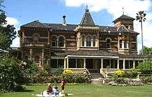 Rippon Lea Estate
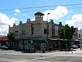 Shops at the corner of Glen Eira Road and Glen Eira Avenue
See also
- City of St Kilda - the former local government area of which Ripponlea was a part
References
- Australian Bureau of Statistics (27 June 2017). "Ripponlea (State Suburb)". 2016 Census QuickStats. Retrieved 13 April 2018.
