Richwood, Texas
Richwood is a city in Brazoria County, Texas, United States. The population was 3,510 at the 2010 census.[3]
Richwood, Texas | |
|---|---|
| Motto(s): "Rich in History, Focused on the Future" | |
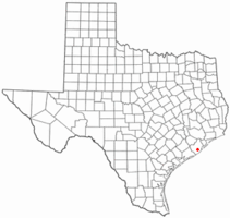 Location of Richwood, Texas | |
 | |
| Coordinates: 29°3′41″N 95°24′45″W | |
| Country | United States |
| State | Texas |
| County | Brazoria |
| Area | |
| • Total | 3.1 sq mi (8.1 km2) |
| • Land | 3.1 sq mi (8.0 km2) |
| • Water | 0.04 sq mi (0.1 km2) |
| Elevation | 16 ft (5 m) |
| Population (2010) | |
| • Total | 3,510 |
| • Density | 1,141/sq mi (440.7/km2) |
| Time zone | UTC-6 (Central (CST)) |
| • Summer (DST) | UTC-5 (CDT) |
| FIPS code | 48-61904[1] |
| GNIS feature ID | 1380437[2] |
| Website | www |
Geography
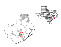
Richwood is located in south-central Brazoria County at 29°3′41″N 95°24′45″W (29.061512, -95.412597).[4] It is bordered to the southwest by Oyster Creek, which separates it from the cities of Lake Jackson and Clute. The city extends to the northeast along Bastrop Bayou. Angleton, the Brazoria County seat, is 8 miles (13 km) to the north, and Freeport on the Gulf of Mexico is 8 miles (13 km) to the south.
According to the United States Census Bureau, Richwood has a total area of 3.1 square miles (8.1 km2), of which 3.1 square miles (8.0 km2) is land and 0.04 square miles (0.1 km2), or 1.30%, is water.[3]
Demographics
| Historical population | |||
|---|---|---|---|
| Census | Pop. | %± | |
| 1960 | 649 | — | |
| 1970 | 1,452 | 123.7% | |
| 1980 | 2,591 | 78.4% | |
| 1990 | 2,732 | 5.4% | |
| 2000 | 3,012 | 10.2% | |
| 2010 | 3,510 | 16.5% | |
| Est. 2018 | 3,949 | [5] | 12.5% |
| U.S. Decennial Census[6] | |||
As of the census[1] of 2000, there were 3,012 people, 1,138 households, and 825 families residing in the city. The population density was 1,922.5 people per square mile (740.7/km²). There were 1,254 housing units at an average density of 800.4/sq mi (308.4/km²). The racial makeup of the city was 78.19% White, 8.50% African American, 0.37% Native American, 0.50% Asian, 0.07% Pacific Islander, 9.26% from other races, and 3.12% from two or more races. Hispanic or Latino of any race were 23.37% of the population.
There were 1,138 households out of which 40.3% had children under the age of 18 living with them, 58.2% were married couples living together, 9.9% had a female householder with no husband present, and 27.5% were non-families. 22.8% of all households were made up of individuals and 2.5% had someone living alone who was 65 years of age or older. The average household size was 2.65 and the average family size was 3.13.
In the city, the population was spread out with 28.8% under the age of 18, 12.8% from 18 to 24, 31.9% from 25 to 44, 20.6% from 45 to 64, and 6.0% who were 65 years of age or older. The median age was 29 years. For every 100 females, there were 99.3 males. For every 100 females age 18 and over, there were 98.6 males.
The median income for a household in the city was $45,000, and the median income for a family was $54,280. Males had a median income of $39,911 versus $22,773 for females. The per capita income for the city was $19,181. About 9.1% of families and 10.5% of the population were below the poverty line, including 13.0% of those under age 18 and 1.7% of those age 65 or over.
Education
The city is served by the Brazosport Independent School District (BISD).[7]
- Most areas are zoned to Polk Elementary School while some are zoned to Griffith Elementary School (both PK-4).[8]
- Those zoned to Polk and Griffith are zoned to Clute Intermediate School (grades 5-8) and Brazoswood High School (grades 9-12).[9]
Richwood is also served by Brazosport College,[10] and the Brazoria County Library System.
References
- "U.S. Census website". United States Census Bureau. Retrieved 2008-01-31.
- "US Board on Geographic Names". United States Geological Survey. 2007-10-25. Retrieved 2008-01-31.
- "Geographic Identifiers: 2010 Demographic Profile Data (G001): Richwood city, Texas". U.S. Census Bureau, American Factfinder. Archived from the original on February 12, 2020. Retrieved April 16, 2014.
- "US Gazetteer files: 2010, 2000, and 1990". United States Census Bureau. 2011-02-12. Retrieved 2011-04-23.
- "Population and Housing Unit Estimates". Retrieved November 12, 2019.
- "Census of Population and Housing". Census.gov. Retrieved June 4, 2015.
- "Current Richwood Zoning Map" (PDF). Richwood. Retrieved 2020-06-17. - Compare the indicated residential areas to BISD zoning maps.
- "Current elementary boundary maps". Brazosport Independent School District. Retrieved 2020-06-17. - Compare to a map of the Richwood city limits. Note new zoning map for 2021 does not change relevant boundaries for Richwood.
- "Feeder Patterns" (PDF). Brazosport Independent School District. Retrieved 2020-06-17.
- "Brazosport College Map" (PDF). Brazoria County Appraisal District. Retrieved 2020-06-18.
External links
Municipalities and communities of Brazoria County, Texas, United States | ||
|---|---|---|
| Cities | 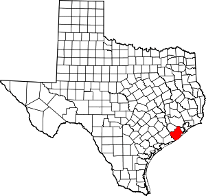 Brazoria County map | |
| Towns | ||
| Villages | ||
| CDPs | ||
| Other unincorporated communities | ||
| Footnotes | ‡This populated place also has portions in an adjacent county or counties | |