Randolph, Utah
Randolph is a town in Rich County, Utah, United States. As of the 2010 census, the town population was 464. It is the county seat of Rich County.[5] Randolph had the highest percentage of people of any city in the country vote for George W. Bush in the 2004 election, at 95.6%[6] Randolph's municipal classification was officially changed from a city to a town on January 1, 2009. The controversial WWASPS boarding school Old West Academy (formerly Majestic Ranch Academy) is located just outside Randolph.[7]
Randolph, Utah | |
|---|---|
 The Randolph Tabernacle, an early Latter-day Saint meetinghouse which is still used today after being in use for a little over a hundred years | |
 Location in Rich County and the state of Utah | |
 Location of Utah in the United States | |
| Coordinates: 41°39′52″N 111°11′0″W | |
| Country | United States |
| State | Utah |
| County | Rich |
| Founded | March 14, 1870 |
| Founded by | Randolph H. Stewart |
| Area | |
| • Total | 1.10 sq mi (2.85 km2) |
| • Land | 1.10 sq mi (2.85 km2) |
| • Water | 0.00 sq mi (0.00 km2) |
| Elevation | 6,283 ft (1,915 m) |
| Population (2010) | |
| • Total | 464 |
| • Estimate (2018)[2] | 498 |
| • Density | 452.73/sq mi (174.75/km2) |
| Time zone | UTC-7 (Mountain (MST)) |
| • Summer (DST) | UTC-6 (MDT) |
| ZIP code | 84064 |
| Area code(s) | 435 |
| FIPS code | 49-63020[3] |
| GNIS feature ID | 1431567[4] |
Geography and climate
According to the United States Census Bureau, the town has a total area of 1.0 square mile (2.7 km²), all land.
Randolph has a humid continental climate (Köppen Dfb), with long and cold winters, short summers with very warm days and cold nights, and fairly heavy winter snowfall totalling 61.3 inches or 1.56 metres during an average year. Between July 2008 and June 2009 there was as much as 98.9 inches (2.51 m), whilst the most precipitation in a calendar year has been 23.42 inches or 594.9 millimetres in 1998, although as much as 27.25 inches (692.1 mm) fell between July 1997 and June 1998. The driest calendar year has been 1989 with 7.87 inches or 199.9 millimetres, but as little as 6.28 inches (159.5 mm) fell between July 1988 and June 1989. The most precipitation in one day has been 2.26 inches (57.4 mm) on July 31, 1912, and the most in one month 5.16 inches (131.1 mm) in June 1998.
The hottest temperatures have been 97 °F (36.1 °C) on July 19, 1893 and 96 °F (35.6 °C) on July 13 and 14 of 2002, whilst the coldest has been −41 °F (−40.6 °C) on December 23, 1990.
| Climate data for Randolph, Utah (1981–2010) | |||||||||||||
|---|---|---|---|---|---|---|---|---|---|---|---|---|---|
| Month | Jan | Feb | Mar | Apr | May | Jun | Jul | Aug | Sep | Oct | Nov | Dec | Year |
| Average high °F (°C) | 27.5 (−2.5) |
30.3 (−0.9) |
41.7 (5.4) |
52.4 (11.3) |
62.3 (16.8) |
72.4 (22.4) |
81.5 (27.5) |
79.9 (26.6) |
69.9 (21.1) |
57.5 (14.2) |
40.5 (4.7) |
27.8 (−2.3) |
53.6 (12.0) |
| Daily mean °F (°C) | 15.2 (−9.3) |
17.8 (−7.9) |
29.4 (−1.4) |
38.5 (3.6) |
47.4 (8.6) |
56.1 (13.4) |
63.4 (17.4) |
61.2 (16.2) |
51.9 (11.1) |
40.7 (4.8) |
27.6 (−2.4) |
16.2 (−8.8) |
38.8 (3.8) |
| Average low °F (°C) | 2.9 (−16.2) |
5.3 (−14.8) |
17.2 (−8.2) |
24.7 (−4.1) |
32.5 (0.3) |
39.8 (4.3) |
45.2 (7.3) |
42.5 (5.8) |
34.0 (1.1) |
24.0 (−4.4) |
14.6 (−9.7) |
4.6 (−15.2) |
23.9 (−4.5) |
| Average precipitation inches (mm) | 0.86 (22) |
0.92 (23) |
0.88 (22) |
1.31 (33) |
1.68 (43) |
1.21 (31) |
0.90 (23) |
1.20 (30) |
1.44 (37) |
1.17 (30) |
1.08 (27) |
0.94 (24) |
13.59 (345) |
| Average snowfall inches (cm) | 10.7 (27) |
10.8 (27) |
8.0 (20) |
6.0 (15) |
2.1 (5.3) |
0.1 (0.25) |
0.0 (0.0) |
0.0 (0.0) |
1.2 (3.0) |
2.7 (6.9) |
7.8 (20) |
11.9 (30) |
61.3 (154.45) |
| Source: NOAA[8] | |||||||||||||
Demographics
| Historical population | |||
|---|---|---|---|
| Census | Pop. | %± | |
| 1870 | 76 | — | |
| 1880 | 446 | 486.8% | |
| 1890 | 472 | 5.8% | |
| 1900 | 821 | 73.9% | |
| 1910 | 533 | −35.1% | |
| 1920 | 586 | 9.9% | |
| 1930 | 447 | −23.7% | |
| 1940 | 656 | 46.8% | |
| 1950 | 562 | −14.3% | |
| 1960 | 537 | −4.4% | |
| 1970 | 500 | −6.9% | |
| 1980 | 659 | 31.8% | |
| 1990 | 488 | −25.9% | |
| 2000 | 483 | −1.0% | |
| 2010 | 464 | −3.9% | |
| Est. 2018 | 498 | [2] | 7.3% |
| U.S. Decennial Census[9] | |||
As of the census[3] of 2000, there were 483 people, 150 households, and 118 families residing in the town. The population density was 466.1 people per square mile (179.3/km²). There were 190 housing units at an average density of 183.4 per square mile (70.5/km²). The racial makeup of the city was 99.38% (480 people) White, 0.21% (one person) Asian, and 0.41% (two people) from two or more races. Hispanic or Latino of any race were 1.86% of the population (nine individuals).
There were 150 households out of which 49.3% had children under the age of 18 living with them, 73.3% were married couples living together, 2.7% had a female householder with no husband present, and 20.7% were non-families. 18.7% of all households were made up of individuals and 7.3% had someone living alone who was 65 years of age or older. The average household size was 3.21 and the average family size was 3.74.
In the town, the population was spread out with 38.5% under the age of 18, 7.2% from 18 to 24, 26.3% from 25 to 44, 16.8% from 45 to 64, and 11.2% who were 65 years of age or older. The median age was 30 years. For every 100 females, there were 101.3 males. For every 100 females age 18 and over, there were 102.0 males.
The median income for a household in the town was $34,792, and the median income for a family was $42,917. Males had a median income of $35,625 versus $20,833 for females. The per capita income for the city was $13,477. About 9.5% of families and 14.0% of the population were below the poverty line, including 17.6% of those under age 18 and 3.5% of those age 65 or over.
Notable people
- David M. Kennedy, Secretary of the Treasury from 1969–1971
- Reuben D. Law, college president, chairman of the Utah State Board of Education (1976-7)
References
- "2018 U.S. Gazetteer Files". United States Census Bureau. Retrieved Feb 16, 2020.
- "Population and Housing Unit Estimates". Retrieved June 4, 2019.
- "U.S. Census website". United States Census Bureau. Retrieved 2008-01-31.
- "US Board on Geographic Names". United States Geological Survey. 2007-10-25. Retrieved 2008-01-31.
- "Find a County". National Association of Counties. Retrieved 2011-06-07.
- Deseret News; ‘Utah town Bush’s No. 1 supporter’
- "WWASP Survivors | Majestic Ranch Academy/ Old West Academy". wwaspsurvivors.com. Retrieved 2018-05-04.
- "NOWData - NOAA Online Weather Data". National Oceanic and Atmospheric Administration. Retrieved May 5, 2013.
- "Census of Population and Housing". Census.gov. Retrieved June 4, 2015.
Places adjacent to Randolph, Utah | ||||||||||
|---|---|---|---|---|---|---|---|---|---|---|
| ||||||||||
Municipalities and communities of Rich County, Utah, United States | ||
|---|---|---|
| Towns | 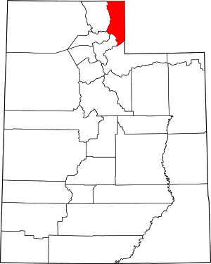 Map of Utah highlighting Rich County | |
| CDP | ||
| Ghost town | ||
| Authority control |
|
|---|