Rancho de la Parita, Texas
Rancho de la Parita is a small unincorporated community in northwestern Jim Wells County, Texas, United States west of Owl Ranch-Amargosa. It lies at 28°1′10″N 98°13′9″W (28.0194596, -98.2191730), at an elevation of 351 feet (107 m). Rancho de la Parita appears on the Anna Rose U.S. Geological Survey Map.[1]
Rancho de la Parita | |
|---|---|
| Coordinates: 28.019°N 98.219°W | |
| Country | United States |
| State | Texas |
| County | Jim Wells County |
| Elevation | 351 ft (107 m) |
| Time zone | CST |
| • Summer (DST) | CDT |
| Area code(s) | 361 |
References
- Geographic Names Information System Feature Detail Report, Geographic Names Information System, 2004-02-20. Accessed 2008-02-07.
Municipalities and communities of Jim Wells County, Texas, United States | ||
|---|---|---|
| Cities | 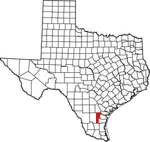 Jim Wells County map | |
| Village | ||
| CDPs | ||
| Other unincorporated communities | ||
| Footnotes | ‡This populated place also has portions in an adjacent county or counties | |
This article is issued from Wikipedia. The text is licensed under Creative Commons - Attribution - Sharealike. Additional terms may apply for the media files.