Ramillies, Belgium
Ramillies is a Walloon municipality located in the Belgian province of Walloon Brabant. On January 1, 2012, Ramillies had a total population of 6,211. The total area is 48.68 km² which gives a population density of 128 inhabitants per km².
Ramillies | |
|---|---|
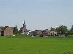 Petit-Rosière | |
 Coat of arms | |
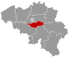
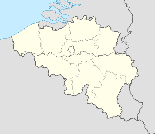 Ramillies Location in Belgium
The municipality of Ramillies in Walloon Brabant  | |
| Coordinates: 50°38′N 04°54′E | |
| Country | Belgium |
| Community | French Community |
| Region | Wallonia |
| Province | Walloon Brabant |
| Arrondissement | Nivelles |
| Government | |
| • Mayor | Jean-Jacques Mathy (REM) |
| • Governing party/ies | REM/ECOLO |
| Area | |
| • Total | 48.68 km2 (18.80 sq mi) |
| Population (2018-01-01)[1] | |
| • Total | 6,394 |
| • Density | 130/km2 (340/sq mi) |
| Postal codes | 1367 |
| Area codes | 081 |
| Website | www.ramillies.be |
The municipality consists of the following sub-municipalities: Autre-Eglise, Bomal, Geest-Gérompont-Petit-Rosière, Grand-Rosière-Hottomont, Huppaye, Mont-Saint-André, and Ramillies-Offus.
The former Roman road from Bavay to Cologne passes through Ramillies. Just to the north of the road, also within the municipality, the Hottomont tumulus is one of the most significant tumuli in Belgium.
See also
References
- "Wettelijke Bevolking per gemeente op 1 januari 2018". Statbel. Retrieved 9 March 2019.
External links

- Municipality website
Places adjacent to Ramillies, Belgium | ||||||||||
|---|---|---|---|---|---|---|---|---|---|---|
| ||||||||||
This article is issued from Wikipedia. The text is licensed under Creative Commons - Attribution - Sharealike. Additional terms may apply for the media files.