Ramgarh, Jammu and Kashmir
Ramgarh is a town and a notified area committee in Samba District in the Indian union territory of Jammu and Kashmir. Ramgarh is 9 km from Vijaypur city National Highway.
Ramgarh | |
|---|---|
city | |
 Ramgarh Location in Jammu and Kashmir, India  Ramgarh Ramgarh (India) | |
| Coordinates: 32.5167°N 74.9500°E | |
| Country | |
| State | Jammu and Kashmir |
| District | Samba |
| Population (2001) | |
| • Total | 4,540 |
| Languages | |
| • Official | English Urdu |
| • Others | Hindi Punjabi Dogri Mirpuri |
| Time zone | UTC+5:30 (IST) |
Attractions
Baba Chamliyal A Hindu-Muslim shrine
Demographics
As of 2001 India census,[1] Ramgarh had a population of 4540. Males constitute 52% of the population and females 48%. Ramgarh has an average literacy rate of 67%, higher than the national average of 59.5%: male literacy is 75%, and female literacy is 59%. 14% of the population of Ramgarh is under 6 years of age.
Gallery
 Gurdwara Sahib Sikh Temple Ramgarh
 Ramgarh Main Market
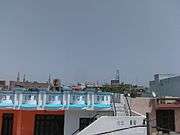 Houses Architecture in Ramgarh Town
References
- "Census of India 2001: Data from the 2001 Census, including cities, villages and towns (Provisional)". Census Commission of India. Archived from the original on 16 June 2004. Retrieved 1 November 2008.
This article is issued from Wikipedia. The text is licensed under Creative Commons - Attribution - Sharealike. Additional terms may apply for the media files.