Quinto, Ponce, Puerto Rico
Quinto (Barrio Quinto) is one of the 31 barrios of the municipality of Ponce, Puerto Rico. Together with Primero, Segundo, Tercero, Cuarto, and Sexto, Quinto is one the municipality's six original urban barrios. It was organized in 1878.[1]
.jpg)
Barrio Quinto | |
|---|---|
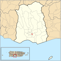 Location of barrio Quinto within the municipality of Ponce shown in red | |
| Commonwealth | |
| Municipality | |
| Area | |
| • Total | 0.11 sq mi (0.3 km2) |
| • Land | 0.11 sq mi (0.3 km2) |
| • Water | 0.00 sq mi (0.0 km2) |
| Population (2000) | |
| • Total | 724 |
| • Density | 6,582/sq mi (2,541/km2) |
| Source: 2000 Census | |
Location
Quinto is an urban barrio located in the southern section of the municipality, within the Ponce city limits, and northeast of the traditional center of the city, Plaza Las Delicias.
Boundaries
.jpg)
Barrio Quinto is bounded on the North by Guadalupe Street, on the South by Isabel Street, on the West by Atocha Street, and on the East by Rio Portugues.[2]
In terms of barrio-to-barrio boundaries, Quinto is bounded in the North by Sexto, in the South by Tercero, in the West by Segundo, and in the East by Machuelo Abajo.
.jpg)
Features and demographics
Quinto has 0.1 square miles (260,000 m2) of land area and no water area. In 2000, the population of Qinto was 724. The population density in Quinto was 6,811 persons per square mile.[3]
Notable landmarks
Quinto is home to the Museo Francisco Pancho Coimbre. Also, the Isabel II Marketplace (Plaza del Mercado de Ponce) is located here. NRHP-listed landmarks in Barrio Quinto include the Font-Ubides House, the Mercado de las Carnes (Plaza Juan Ponce de León), and the old Spanish Military Headquarters/city jail.
Gallery
.jpg) Argentinian restaurant on Calle Salud
Argentinian restaurant on Calle Salud.jpg) Italian restaurant on Calles Isabel and Salud
Italian restaurant on Calles Isabel and Salud.jpg) Sports bar on Calle Isabel
Sports bar on Calle Isabel_y_C._Lolita_Tizol_Bo._Quinto%2C_Ponce%2C_PR%2C_mirando_al_noroeste_(DSC01961).jpg) Puerto Rican 'Criollo' food restaurant on Calle Isabel
Puerto Rican 'Criollo' food restaurant on Calle Isabel
See also
References
- Barrios de Ponce. Antepasados Esclavos.(From: Pedro Tomás de Córdoba. Memorias geográficas, históricas, económicas y estadísticas de la Isla de Puerto Rico.) Retrieved 28 November 2014.
- General Purpose Population Data, Census 2000. Unidad de Sistemas de Información Geográfica, Área de Tecnología de Información Gubernamental, Oficina de Gerencia y Presupuesto. Gobierno de Puerto Rico. Archived 12 August 2010 at the Wayback Machine Retrieved 18 February 2010.
- City Melt Retrieved 17 February 2010.
- U.S. Geological Survey Geographic Names Information System: Quinto Barrio