Pyecombe
Pyecombe is a village and civil parish in the Mid Sussex District of West Sussex, England. The parish lies wholly with the South Downs National Park. The planning authority for Pyecombe is therefore the South Downs National Park Authority (SDNPA), the statutory planning authority for the National Park area.[3]
| Pyecombe | |
|---|---|
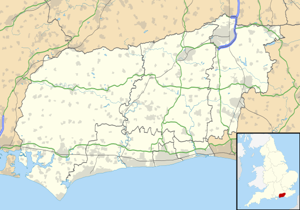 Pyecombe Location within West Sussex | |
| Area | 8.87 km2 (3.42 sq mi) [1] |
| Population | 200 [1] 2001 Census 237 (2011 Census)[2] |
| • Density | 23/km2 (60/sq mi) |
| OS grid reference | TQ292126 |
| • London | 42 miles (68 km) N |
| Civil parish |
|
| District | |
| Shire county | |
| Region | |
| Country | England |
| Sovereign state | United Kingdom |
| Post town | BRIGHTON |
| Postcode district | BN45 |
| Dialling code | 01273 |
| Police | Sussex |
| Fire | West Sussex |
| Ambulance | South East Coast |
| UK Parliament |
|
| Website | Pycombe |
Pyecombe is located 7 miles (11 km) to the north of Brighton. The civil parish covers an area of 887 hectares (2,190 acres) and has a population of 200 (2001 census), increasing at the 2011 Census to a population of 237.[2]
History
The word 'Pyecombe' is thought to derive from the Saxon name "peac cumb" which means 'the peak valley'.
The parish of Pyecombe comprises two settlements, one called 'Pyecombe' and the other 'Pyecombe Street'. These are about a quarter of a mile apart. The reason for the gap between the two parts of the village is unclear but it is generally thought to be a consequence of plague in the 17th century which necessitated the temporary abandonment of the main settlement and its church.
The village lies on the London to Brighton Way Roman road, as well as on 18th and 19th century turnpike roads over Clayton Hill.[4]
Listed Buildings and Scheduled Monuments
Pyecombe civil parish contains seven listed buildings. Of these, one is Grade I and the remaining six are Grade II. The parish contains five scheduled monuments.
Listed buildings
Grade I listed buildings:
- The Parish Church (Church of the Transfiguration) (List Entry Number 1025593). Chancel and nave 12th century, tower 13 century; 'an attractive small medieval building'.[5]
Scheduled monuments
- Roman road and 18th century coaching road north of Pyecombe church (List Entry Number 1005821). The monument includes a Roman road and a late 18th century coaching road, the Brighton to Lovell Heath Turnpike, with 19th century realignments.[4]
- Cross dyke and bowl barrow 310m south east of Wolstonbury Camp (List Entry Number 1015226), a univallate cross dyke and a bowl barrow situated on a chalk spur which projects to the south east from Wolstonbury Hill.[6]
- Platform barrow 300m south of Wolstonbury Camp (List Entry Number 1015227), a roughly circular, flat-topped mound situated on a chalk spur which projects to the south east from Wolstonbury Hill.[7]
- Romano-British farmstead, field system and trackway on Wolstonbury Hill (List Entry Number 1015228), a farmstead dating to the late Romano-British period and its associated field system and trackway, on the north eastern slope of Wolstonbury Hill.[8]
- Wolstonbury Camp: a Ram's Hill type enclosure on Wolstonbury Hill and associated later remains (List Entry Number 1016153), a Late Bronze Age Ram's Hill type enclosure situated on Wolstonbury Hill, a clay-with-flints capped chalk hill.[9]
The Church of the Transfiguration

The Church of the Transfiguration is the Church of England parish church of Pyecombe. The chancel and nave are 12th century; the tower was built in the 13th century. A small kitchen / toilet extension was built on the south side of the church in 2014, finished in flint to match the rest of the church. The extension won the Sussex Heritage Trust ecclesiastical award in 2015.[10] The church is a Grade I listed building, described in the National Heritage List for England as an ‘Attractive small medieval building’.[5]
Wolstonbury Hill
Wolstonbury Hill is a chalk prominence located within the parish, owned and maintained by the National Trust. It is the location of four scheduled monuments (see above)[6][7][8][9] and a Site of Special Scientific Interest.[11]
Other notable features
Opposite the church is the old forge where the Pyecombe hook was first made in the 19th century by Mr Berry, the blacksmith. The village inn is the Plough; and there is Pyecombe Golf Club just to the north of the village. There is also The Three Greys riding school and Brendon Stud in the locality.
References
- "2001 Census: West Sussex – Population by Parish" (PDF). West Sussex County Council. Archived from the original (PDF) on 8 June 2011. Retrieved 10 April 2009.
- "Civil Parish population 2011". Neighbourhood Statistics. Office for National Statistics. Retrieved 2 October 2016.
- "Planning". South Downs National Park. South Downs National Park Authority. Retrieved 1 February 2020.
- Historic England. "Roman road and 18th century coaching road N of Pyecombe church (1005821)". National Heritage List for England.
- Historic England. "The Parish Church (1025593)". National Heritage List for England.
- Historic England. "Cross dyke and bowl barrow 310m south east of Wolstonbury Camp (1015226)". National Heritage List for England.
- Historic England. "Platform barrow 300m south of Wolstonbury Camp (1015227)". National Heritage List for England.
- Historic England. "Romano-British farmstead, field system and trackway on Wolstonbury Hill (1015228)". National Heritage List for England.
- Historic England. "Wolstonbury Camp: a Ram's Hill type enclosure on Wolstonbury Hill and associated later remains (1016153)". National Heritage List for England.
- "Pyecombe Church - a partnership funded community project" (PDF). South Downs National Park. South Downs National Park Authority. November 2016. Retrieved 6 January 2020.
- "SSSI Citation — Wolstonbury Hill" (PDF). Natural England. Retrieved 4 April 2009. Cite journal requires
|journal=(help)
External links
| Wikimedia Commons has media related to Pyecombe. |
- The Downland Benefice: Pyecombe Church
- Roughwood web site: Church of the Transfiguration, Pyecombe, West Sussex - Photographs of the church, taken on 18 January 2004