Punta Gabarró
Punta Gabarró or Punta de Gabarró is a mountain of the Montcalm Massif. Located in the Pyrenees, at the border between France and Spain, it has an elevation of 3,105 metres (10,187 ft) above sea level.[1]
| Punta Gabarró | |
|---|---|
 Punta Gabarró seen from Pica d'Estats | |
| Highest point | |
| Elevation | 3,105 m (10,187 ft) |
| Prominence | 25 m (82 ft) |
| Isolation | 229 m (751 ft) to Pica d'Estats |
| Coordinates | 42°40′4.919″N 1°23′48.75″E |
| Geography | |
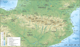 Punta Gabarró Location in the Pyrenees | |
| Location | Ariège, France Pallars Sobirà, Spain |
| Parent range | Montcalm Massif, Pyrenees |
| Geology | |
| Mountain type | Granite |
| Climbing | |
| First ascent | Unknown |
| Easiest route | From Vallferrera, Alins |
This peak was named after Pere Gabarró i Garcia, a Catalan mountaineer who found a new route to climb the Pica d'Estats.[2]
This mountain is included in the Parc Natural de l'Alt Pirineu together with Pica d'Estats and Pic Verdaguer.
References
- "Mapa Topogràfic de Catalunya". Institut Cartogràfic de Catalunya. Retrieved May 22, 2010..
- Acadèmia de Ciències Mèdiques i de la Salut de Catalunya i de Balears, Pere Gabarró i Garcia, l’home
This article is issued from Wikipedia. The text is licensed under Creative Commons - Attribution - Sharealike. Additional terms may apply for the media files.