Punkin Center, Colorado
Punkin Center is a small, rural Unincorporated community in Lincoln County, Colorado, United States at the intersection of State Highway 94 and State Highway 71.[3][4] John Stevens built the first store at the farmers crossroads in 1920. He painted each new building a pumpkin color, inspiring the name. Everything burned in the 1950s.[1] Its mostly white population was 4 according to a Denver Post article.[5] There is a communication tower near the intersection of the highways, and a larger communication tower about 3 miles southwest of the intersection. The Post Offices at Hugo (ZIP Code 80821) and Ordway (ZIP 81063) serve Punkin Center postal addresses.[2]
Punkin Center, Colorado | |
|---|---|
 On State Highway 94, looking west through the intersection of State Highway 94 and State Highway 71. The highways run through the community. | |
| Nickname(s): Pumpkin Center | |
 Punkin Center  Punkin Center | |
| Coordinates: 38°51′07″N 103°42′02″W | |
| Country | |
| State | |
| Counties | Lincoln[1] |
| Elevation | 5,364 ft (1,635 m) |
| Time zone | UTC-7 (MST) |
| • Summer (DST) | UTC-6 (MDT) |
| ZIP codes | |
| Area code(s) | 719 |
| GNIS feature ID | 195180 |
References
- "Search for: Punkin Center, Colorado". Geographic Names Information System (GNIS). USGS. 13 October 1978.
- "Punkin Center, CO". ZIP Code Lookup. United States Postal Service. Retrieved November 15, 2010.
- "Punkin Center". PlaceNames.com. Archived from the original on 2009-09-11. Retrieved 2010-11-17.
- "Punkin Center - Lincoln County, CO". Topographic Maps. Trails.com. Retrieved 2010-11-17.
- Lincoln County Information Office
Municipalities and communities of Lincoln County, Colorado, United States | ||
|---|---|---|
| Towns | 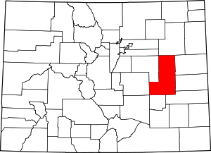 Map of Colorado highlighting Lincoln County | |
| Unincorporated communities | ||
This article is issued from Wikipedia. The text is licensed under Creative Commons - Attribution - Sharealike. Additional terms may apply for the media files.