Prabuty
Prabuty [praˈbutɨ] (German: Riesenburg) is a town in Kwidzyn County within the Pomeranian Voivodeship of northern Poland. Between 1975 and 1998, Prabuty were part of the Elbląg Voivodeship.
Prabuty | |
|---|---|
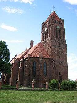 Cathedral in Prabuty | |
 Flag  Coat of arms | |
 Prabuty | |
| Coordinates: 53°45′21″N 19°11′51″E | |
| Country | |
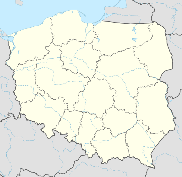
| Voivodeship | Pomeranian |
| County | Kwidzyn |
| Gmina | Prabuty |
| Town rights | 1330 |
| Government | |
| • Mayor | Marek Szulc |
| Area | |
| • Total | 7.92 km2 (3.06 sq mi) |
| Elevation | 90 m (300 ft) |
| Population (2006) | |
| • Total | 8,488 |
| • Density | 1,100/km2 (2,800/sq mi) |
| Time zone | UTC+1 (CET) |
| • Summer (DST) | UTC+2 (CEST) |
| Postal code | 82–550 |
| Area code(s) | +48 55 |
| Car plates | GKW |
| Website | http://www.prabuty.pl |
Geographical location
Prabuty is located approximately 18 kilometers east of Kwidzyn, 100 kilometers southeast of Gdańsk, 100 kilometers west of Olsztyn, and 133 kilometers southwest of Kaliningrad.
History

In 1236, the Teutonic Knights under Henry III, Margrave of Meissen, destroyed an Old Prussian fortress between the lakes Sorgensee[1] (jez. Dzierzgon) and Liwieniec. The town was first mentioned in 1250 as Riesenburg. The village grew around the castle and received Culm law city rights on 30 October 1330[2] from bishop Rudolf of Pomerania (1322–1332).
In 1451, the town council joined the Prussian Confederation that opposed the Teutonic Order, but bishop Kaspar Linke expelled the councilors and confiscated their property. After the Battle of Chojnice, in which Polish forces were defeated, the town sided with the Order again.
After the Thirteen Years' War and the Second Peace of Thorn (1466), the town became a Polish fief, although Pomesanian bishops retained their rule over the area. In 1556, a synod was held in the town. In 1525 the town became part of Ducal Prussia, a vassal state of Poland.
Riesenburg suffered during the 17th century Polish-Swedish wars. In 1628, half of it was burnt down, and in 1688 the remainder was burned.[3] In 1722, fire caused destruction once again.[3]
In 1701, as part of Ducal Prussia, the town became a part of the Kingdom of Prussia and part of the newly created province of West Prussia in 1773. In 1871, the town became part of the German Empire in the framework of the Prussian-led unification of Germany. Until 1919, Riesenburg belonged to the administrative district of Regierungsbezirk Marienwerder in the Province of West Prussia.
After World War I, a referendum was held concerning the future nationality of the town, which remained part of Weimar Germany. From 1920 to 1939, Riesenburg belonged to the administrative district of Regierungsbezirk Westpreußen in the Province of East Prussia and from 1939 until 1945 to the district of Regierungsbezirk Marienwerder in the province of Reichsgau Danzig-West Prussia.
The town was captured by the Soviet Red Army in 1945 during World War II. It then became part of Poland. Most of the native East-Prussian inhabitants were expelled and resettled by Poles from regions east of the Curzon Line, in particular from the former Polish Eastern Borderlands.
Heinz Heydrich (1905–44), brother of Reinhard Heydrich, is buried in a soldier cemetery Riesenburg, according to the Deutsche Dienststelle (WASt).
.jpg)
Number of inhabitants by year
| Year | Number |
|---|---|
| 1777 | 1,797 |
| 1782 | 1,878 |
| 1831 | 2,722 |
| 1875 | 3,542 |
| 1880 | 3,718 |
| 1890 | 4,586 |
| 1900 | 5,032 |
| 1905 | 4,826 |
| 1925 | 5,340 |
| 1933 | 6,116 |
| 1939 | 8,093 |
| 2006 | 8,488 |
Notable residents
- Peter I, Grand Duke of Oldenburg (1755–1829) the Regent of the Duchy of Oldenburg for his incapacitated cousin William I from 1785-1823 and then served himself as Duke from 1823–1829.
- Adolf Treichel (1869–1926), German politician, President of the Volkstag (Free City of Danzig)
- Charlotte Wolff (1897–1986) a German-British physician who worked as a psychotherapist and wrote on sexology and hand analysis. Her writings on lesbianism and bisexuality were influential early works in the field.
- Karl F. Masuhr (born 1939), German author
References
- ostpreussen.net Geschichte von Prabuty – Riesenburg
- "History of Prabuty". Archived from the original on 2008-04-30. Retrieved 2009-01-12.
- Johann Friedrich Goldbeck: Volständige Topographie des Königreichs Preussen. Part II: Topographie von West-Preussen, Marienwerder 1789, p. 6, no 2.
- Meyers Großes Konversations-Lexikon, 6th edition, Vol. 16, Leipzig 1909, pp. 925–926.
- Michael Rademacher: Deutsche Verwaltungsgeschichte Provinz Westpreußen, Kreis Rosenberg (2006).
- August Eduard Preuß: Preußische Landes- und Volkskunde. Königsberg 1835, p. 441.
External links
- Municipal website (in Polish)
- Independent Municipal Website (in Polish)
- History and Forum City (in Polish)
- Futbol Team Website (in Polish)
| Authority control |
|---|