Pomfret, Vermont
Pomfret is a town in Windsor County, Vermont, United States. The population was 904 at the 2010 census.[3]
Pomfret, Vermont | |
|---|---|
 Abbott Memorial Library in South Pomfret | |
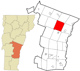 Location in Windsor County and the state of Vermont. | |
 Pomfret, Vermont Location in the United States | |
| Coordinates: 43°41′51″N 72°31′13″W | |
| Country | United States |
| State | Vermont |
| County | Windsor |
| Area | |
| • Total | 39.5 sq mi (102.2 km2) |
| • Land | 39.4 sq mi (102.0 km2) |
| • Water | 0.1 sq mi (0.2 km2) |
| Elevation | 1,499 ft (457 m) |
| Population (2010) | |
| • Total | 904 |
| • Density | 23/sq mi (8.8/km2) |
| Time zone | UTC-5 (Eastern (EST)) |
| • Summer (DST) | UTC-4 (EDT) |
| ZIP code | 05053, 05067 |
| Area code(s) | 802 |
| FIPS code | 50-56350[1] |
| GNIS feature ID | 1462177[2] |
| Website | pomfretvt |
History
The town was named after the Earl of Pomfret.[4] Pomfret was chartered in 1761 by Benning Wentworth, who was the governor of New Hampshire. The first settler (1770) was Bartholomew Durkee, who came from Pomfret, Connecticut. Pomfret was called "New Pomfret" at first because most of the people who settled there came from the town in Connecticut.
One of the earliest ski tows in the United States was established at South Pomfret in 1934, and became known as Suicide Six. Suicide Six has now developed into a small ski resort with a moderate-size lodge, a quad chairlift installed in 2017, and large snowmaking capabilities.
In 1976, then-cardinal Karol Wojtyla visited North Pomfret during the summer for a vacation. He later became Pope John Paul II and was canonized a saint.[5]
Geography
According to the United States Census Bureau, the town has a total area of 39.5 square miles (102.2 km2), of which 39.4 square miles (102.0 km2) is land and 0.1 square mile (0.2 km2) (0.15%) is water. The Ottauquechee River flows along a portion of the southern boundary of the town.[6] The Pomfret town hall is located in the center of town, on the watershed divide between the White River (North Pomfret) and the Ottauquechee River (South Pomfret).
Demographics
| Historical population | |||
|---|---|---|---|
| Census | Pop. | %± | |
| 1790 | 710 | — | |
| 1800 | 1,106 | 55.8% | |
| 1810 | 1,433 | 29.6% | |
| 1820 | 1,635 | 14.1% | |
| 1830 | 1,867 | 14.2% | |
| 1840 | 1,774 | −5.0% | |
| 1850 | 1,546 | −12.9% | |
| 1860 | 1,376 | −11.0% | |
| 1870 | 1,251 | −9.1% | |
| 1880 | 1,139 | −9.0% | |
| 1890 | 865 | −24.1% | |
| 1900 | 777 | −10.2% | |
| 1910 | 703 | −9.5% | |
| 1920 | 732 | 4.1% | |
| 1930 | 728 | −0.5% | |
| 1940 | 686 | −5.8% | |
| 1950 | 586 | −14.6% | |
| 1960 | 600 | 2.4% | |
| 1970 | 620 | 3.3% | |
| 1980 | 856 | 38.1% | |
| 1990 | 874 | 2.1% | |
| 2000 | 997 | 14.1% | |
| 2010 | 904 | −9.3% | |
| Est. 2014 | 894 | [7] | −1.1% |
| U.S. Decennial Census[8] | |||
As of the census[1] of 2000, there were 997 people, 404 households, and 288 families residing in the town. The population density was 25.3 people per square mile (9.8/km2). There were 544 housing units at an average density of 13.8 per square mile (5.3/km2). The racial makeup of the town was 98.09% White, 0.10% African American, 0.50% Asian, 0.40% Pacific Islander, and 0.90% from two or more races. Hispanic or Latino of any race were 1.40% of the population.
There were 404 households out of which 33.2% had children under the age of 18 living with them, 60.9% were married couples living together, 6.9% had a female householder with no husband present, and 28.7% were non-families. 22.0% of all households were made up of individuals and 7.4% had someone living alone who was 65 years of age or older. The average household size was 2.47 and the average family size was 2.89.
In the town, the population was spread out with 26.3% under the age of 18, 3.9% from 18 to 24, 24.5% from 25 to 44, 31.3% from 45 to 64, and 14.0% who were 65 years of age or older. The median age was 42 years. For every 100 females, there were 95.9 males. For every 100 females age 18 and over, there were 95.0 males.
The median income for a household in the town was $51,800, and the median income for a family was $56,250. Males had a median income of $31,063 versus $26,354 for females. The per capita income for the town was $27,922. About 3.4% of families and 4.8% of the population were below the poverty line, including 5.3% of those under age 18 and 5.9% of those age 65 or over.
Notable people
- Elmer Bragg Adams, United States federal judge
- William Arkin, political commentator, activist and journalist[9]
- Judah Dana, US senator from Maine[10]
- Rush Hawkins, Union general in the American Civil War
- Luke S. Johnson, leader in the Latter Day Saint movement
- Lyman E. Johnson, leader in the Latter Day Saint movement[11]
- Scott Milne, (1959- ) businessman and 2014 Republican gubernatorial candidate[12]
- Joe Perry, guitarist for Aerosmith[13]
- John C. Sherburne, Chief Justice of the Vermont Supreme Court[14]
- Dana Stone, Vietnam War journalist and photographer[15]
- John Throop, early resident of Pomfret, militia officer, and judge[16]
- Phineas White, United States Representative[17]
References
- "U.S. Census website". United States Census Bureau. Retrieved 2008-01-31.
- "US Board on Geographic Names". United States Geological Survey. 2007-10-25. Retrieved 2008-01-31.
- "Profile of General Population and Housing Characteristics: 2010 Demographic Profile Data (DP-1): Pomfret town, Windsor County, Vermont". United States Census Bureau. Retrieved July 31, 2012.
- "Profile for Pomfret, Vermont". ePodunk. Retrieved 2010-05-10.
- Young Cardinal Wojtyla visited Vermont, later named pope, saint. Vermont Catholic. Burlington: Diocese of Burlington, Vermont. 2015. pp. 38–39.
- DeLorme (1996). Vermont Atlas & Gazetteer. Yarmouth, Maine: DeLorme. ISBN 0-89933-016-9
- "Annual Estimates of the Resident Population for Incorporated Places: April 1, 2010 to July 1, 2014". Archived from the original on May 23, 2015. Retrieved June 4, 2015.
- "U.S. Decennial Census". United States Census Bureau. Retrieved May 16, 2015.
- "About William M. Arkin". Washington Post. Washington, DC. 1999. Retrieved January 5, 2018.
- "DANA, Judah, (1772 - 1845)". Biographical Directory of the United States Congress. Retrieved October 30, 2012.
- Young, Brigham (1865). "History of Lyman E. Johnson". The Latter-Day Saints' Millennial Star. Vol. XXVII. Liverpool, England: Latter-Day Saints' Book Depot. p. 102.
- Hallenbeck, Terri (June 29, 2014). "Scott Milne: A complicated candidate". Burlington Free Press. Burlington, VT.
- "Sleepy Hollow Farm – Home to Rock 'n' Roll". New England Photography. Retrieved January 10, 2014.
- Stone, Arthur F. (1929). The Vermont of Today. III. New York, NY: Lewis Historical Publishing Company. p. 29.
- Publishers Weekly. 207, Part 1. New York, NY: R. R. Bowker Company. 1975. p. 55.
- Walton, Eliakim Persons (1874). Records of the Governor and Council of the State of Vermont. II. Montpelier, VT: J & J. M. Poland.
- "WHITE, Phineas, (1770 - 1847)". Biographical Directory of the United States Congress. Retrieved October 30, 2012.
External links
| Wikimedia Commons has media related to Pomfret, Vermont. |
Municipalities and communities of Windsor County, Vermont, United States | ||
|---|---|---|
Shire town: Woodstock | ||
| Towns |  Map of Vermont highlighting Windsor County | |
| Villages | ||
| CDPs | ||
| Other communities | ||