Pomeroy, Washington
Pomeroy is a city in Garfield County, Washington, United States. The population was 1,425 at the 2010 census. It is the county seat of and only city in Garfield County.[5]
Pomeroy | |
|---|---|
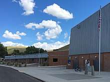
 Downtown Pomeroy circa 1988 | |
 Location of Pomeroy, Washington | |
| Coordinates: 46°28′24″N 117°35′53″W | |
| Country | United States |
| State | Washington |
| County | Garfield |
| Area | |
| • Total | 1.78 sq mi (4.60 km2) |
| • Land | 1.78 sq mi (4.60 km2) |
| • Water | 0.00 sq mi (0.00 km2) |
| Elevation | 1,857 ft (566 m) |
| Population | |
| • Total | 1,425 |
| • Estimate (2019)[3] | 1,395 |
| • Density | 793.92/sq mi (306.47/km2) |
| Time zone | UTC-8 (Pacific (PST)) |
| • Summer (DST) | UTC-7 (PDT) |
| ZIP code | 99347 |
| Area code | 509 |
| FIPS code | 53-55120 |
| GNIS feature ID | 1512575[4] |
| Website | pomeroy-wa.com |
Geography
Pomeroy is located at 46°28′24″N 117°35′53″W (46.473334, -117.598119).[6]
According to the United States Census Bureau, the city has a total area of 1.78 square miles (4.61 km2), all of it land.[7]
History
The Nez Perce trail existed in the area before history was recorded, and the first written record of caucasians passing through the area were Lewis and Clark in 1805. Captain Benjamin Bonneville also passed through the future site of the town while he was surveying for the US government in 1834. In 1860, an Irish settler named Parson Quinn settled just east of present-day Pomeroy, and lived there for the next 40 years. Rancher Joseph M. Pomeroy purchased the land in 1864,[8] and platted the town's site in May 1878.[9][10]
Pomeroy was officially incorporated on February 3, 1886. The town has been the seat of Garfield County since 1882, despite fierce competition in the 1880s with neighboring towns Pataha and Asotin. The struggle to name a county seat would continue through both houses of the Washington Territorial Legislature in 1883, to Governor William A. Newell of the Washington Territory, and eventually reached the Congress in 1884.[8]
On July 18, 1900 (despite a city ordinance which mandated fire-proof materials for downtown buildings; there had been fires in 1890 and 1898 as well) fire destroyed half of the small town's business district. The recovery took two years as the destroyed buildings were rebuilt using brick - a building boom for the small community.[11] In 1912, the City voted to outlaw the manufacture or sale of alcohol. This prohibition quickly led to rampant bootlegging and corruption which lasted until the 21st Amendment passed in 1933.[12]

On August 21, 2003, following efforts by the Pomeroy Historic Committee, a 10-block section of Pomeroy's downtown was placed on the National Historic Register.[13]
Demographics
| Historical population | |||
|---|---|---|---|
| Census | Pop. | %± | |
| 1890 | 661 | — | |
| 1900 | 953 | 44.2% | |
| 1910 | 1,605 | 68.4% | |
| 1920 | 1,804 | 12.4% | |
| 1930 | 1,600 | −11.3% | |
| 1940 | 1,723 | 7.7% | |
| 1950 | 1,775 | 3.0% | |
| 1960 | 1,677 | −5.5% | |
| 1970 | 1,823 | 8.7% | |
| 1980 | 1,716 | −5.9% | |
| 1990 | 1,393 | −18.8% | |
| 2000 | 1,517 | 8.9% | |
| 2010 | 1,425 | −6.1% | |
| Est. 2019 | 1,395 | [3] | −2.1% |
| U.S. Decennial Census[14] 2018 Estimate[15] | |||
2010 census
As of the census[2] of 2010, there were 1,425 people, 642 households, and 401 families residing in the city. The population density was 800.6 inhabitants per square mile (309.1/km2). There were 723 housing units at an average density of 406.2 per square mile (156.8/km2). The racial makeup of the city was 94.9% White, 0.3% Native American, 1.3% Asian, 1.3% from other races, and 2.2% from two or more races. Hispanic or Latino of any race were 3.2% of the population.
There were 642 households of which 25.1% had children under the age of 18 living with them, 50.8% were married couples living together, 7.5% had a female householder with no husband present, 4.2% had a male householder with no wife present, and 37.5% were non-families. 34.0% of all households were made up of individuals and 19.4% had someone living alone who was 65 years of age or older. The average household size was 2.16 and the average family size was 2.74.
The median age in the city was 50 years. 19.6% of residents were under the age of 18; 5.1% were between the ages of 18 and 24; 18.6% were from 25 to 44; 32.5% were from 45 to 64; and 24.4% were 65 years of age or older. The gender makeup of the city was 47.5% male and 52.5% female.
2000 census
As of the census of 2000, there were 1,517 people, 645 households, and 408 families residing in the city. The population density was 852.2 people per square mile (329.1/km²). There were 740 housing units at an average density of 415.7 per square mile (160.5/km²). The racial makeup of the city was 96.37% White, 0.53% Native American, 0.40% Asian, 0.07% Pacific Islander, 1.52% from other races, and 1.12% from two or more races. Hispanic or Latino of any race were 2.24% of the population.
There were 645 households out of which 25.3% had children under the age of 18 living with them, 51.0% were married couples living together, 7.3% had a female householder with no husband present, and 36.7% were non-families. 33.0% of all households were made up of individuals and 18.1% had someone living alone who was 65 years of age or older. The average household size was 2.29 and the average family size was 2.92.
In the city, the age distribution of the population shows 25.5% under the age of 18, 5.6% from 18 to 24, 20.1% from 25 to 44, 23.5% from 45 to 64, and 25.2% who were 65 years of age or older. The median age was 44 years. For every 100 females, there were 91.1 males. For every 100 females age 18 and over, there were 84.9 males.
The median income for a household in the city was $28,958, and the median income for a family was $38,750. Males had a median income of $32,500 versus $21,118 for females. The per capita income for the city was $15,782. About 11.7% of families and 15.1% of the population were below the poverty line, including 22.9% of those under age 18 and 9.5% of those age 65 or over.
Climate
Pomeroy, as is typical for this region, has a borderline Mediterranean/continental Mediterranean climate (Köppen Csb/Dsb) with dry summers featuring warm to hot afternoons and cool to warm mornings, and chilly, cool, or cold and snowy, if not severe, and wetter winters.
| Climate data for Pomeroy, Washington (normals 1981−2010; extremes 1891-2016) | |||||||||||||
|---|---|---|---|---|---|---|---|---|---|---|---|---|---|
| Month | Jan | Feb | Mar | Apr | May | Jun | Jul | Aug | Sep | Oct | Nov | Dec | Year |
| Record high °F (°C) | 67 (19) |
71 (22) |
80 (27) |
98 (37) |
101 (38) |
102 (39) |
112 (44) |
109 (43) |
102 (39) |
93 (34) |
78 (26) |
72 (22) |
112 (44) |
| Average high °F (°C) | 39.1 (3.9) |
43.8 (6.6) |
52.1 (11.2) |
58.7 (14.8) |
66.6 (19.2) |
74.8 (23.8) |
84.8 (29.3) |
84.5 (29.2) |
75.1 (23.9) |
61.2 (16.2) |
46.5 (8.1) |
36.6 (2.6) |
60.3 (15.7) |
| Daily mean °F (°C) | 32.2 (0.1) |
35.2 (1.8) |
41.7 (5.4) |
47.4 (8.6) |
54.5 (12.5) |
61.4 (16.3) |
68.6 (20.3) |
67.9 (19.9) |
59.8 (15.4) |
48.5 (9.2) |
38.1 (3.4) |
30.2 (−1.0) |
48.8 (9.3) |
| Average low °F (°C) | 25.3 (−3.7) |
26.5 (−3.1) |
31.3 (−0.4) |
36.2 (2.3) |
42.4 (5.8) |
48.0 (8.9) |
52.5 (11.4) |
51.3 (10.7) |
44.5 (6.9) |
35.8 (2.1) |
29.7 (−1.3) |
23.8 (−4.6) |
37.3 (2.9) |
| Record low °F (°C) | −22 (−30) |
−17 (−27) |
6 (−14) |
11 (−12) |
20 (−7) |
30 (−1) |
35 (2) |
33 (1) |
24 (−4) |
5 (−15) |
−13 (−25) |
−27 (−33) |
−27 (−33) |
| Average precipitation inches (mm) | 2.03 (52) |
1.71 (43) |
1.63 (41) |
1.35 (34) |
1.59 (40) |
1.15 (29) |
0.63 (16) |
0.82 (21) |
0.87 (22) |
1.19 (30) |
2.09 (53) |
2.06 (52) |
17.12 (433) |
| Source: NOAA (normals, 1981−2010) [16] | |||||||||||||
Education
Students in Pomeroy are part of Pomeroy School District 110 and complete their secondary public school education at Pomeroy Junior/Senior High School.[17]
Notable people
- Samuel G. Cosgrove (1847–1909), sixth Governor of the state of Washington[18]
- Elgin V. Kuykendall (1870–1958), attorney, judge, and member of the Washington State Senate.[19]
- Michael P. Malone (1940-1999) Former President Montana State University; Montana Historian.
Events
The following events are organized annually by the Pomeroy Chamber of Commerce:[20]
- Pioneer Day & Tumbleweed Festival - second weekend in June
- Garfield County Fair - Sept. 16-19
- Starlight Parade & Festival of Trees - Friday after Thanksgiving
Footnotes
- "2018 U.S. Gazetteer Files". United States Census Bureau. Retrieved February 16, 2020.
- "U.S. Census website". United States Census Bureau. Retrieved December 19, 2012.
- "Annual Estimates of the Resident Population for Incorporated Places in Washington: April 1, 2010 to July 1, 2019". United States Census Bureau, Population Division. Retrieved May 26, 2020.
- "US Board on Geographic Names". United States Geological Survey. October 25, 2007. Retrieved January 31, 2008.
- "Find a County". National Association of Counties. Retrieved June 7, 2011.
- "US Gazetteer files: 2010, 2000, and 1990". United States Census Bureau. February 12, 2011. Retrieved April 23, 2011.
- "US Gazetteer files 2010". United States Census Bureau. Archived from the original on January 24, 2012. Retrieved December 19, 2012.
- http://historylink.org/index.cfm?DisplayPage=output.cfm&file_id=7728
- "Pomeroy". Washington Place Names database. Tacoma Public Library. Archived from the original on March 9, 2009. Retrieved 2009-03-06.
- Tussing, Annette (December 6, 1964). "A big birthday for Pomeroy: town will be 100 Tuesday". Lewiston Morning Tribune. p. 1, section 2.
- http://historylink.org/index.cfm?DisplayPage=output.cfm&file_id=7694
- E. V. Kuykendall, The History of Garfield County (Fairfield, Washington: Ye Galleon Press, 1984), 86–88.
- http://www.historicpomeroy.com/nomination/certificate.htm
- United States Census Bureau. "Census of Population and Housing". Retrieved October 3, 2013.
- "Population Estimates". United States Census Bureau. Retrieved June 22, 2019.
- "Climatography of the United States NO.81". National Oceanic and Atmospheric Administration. Retrieved August 8, 2018.
- "Pomeroy Jr/Sr High," Archived April 7, 2014, at the Wayback Machine Pomeroy School District, www.psd.wednet.edu/
- "Washington Governor Samuel G. Cosgrove". National Governors Association. Retrieved October 10, 2012.
- W.D. Lyman, Lyman's History of Old Walla Walla County, Embracing Walla Walla, Columbia, Garfield and Asotin Counties. Chicago: S.J. Clarke Publishing Co., 1918; vol. 2, pp. 132–136.
- Pomeroy Chamber of Commerce. "Events". Pomeroy Chamber of Commerce. Archived from the original on October 28, 2010. Retrieved January 8, 2013.
External links
- History of Pomeroy at HistoryLink
- Garfield County Heritage. Digitized resources from the Denny Ashby Library, Eastern Washington Agricultural Museum, and Garfield County Museum.
- A website for the Historic Preservation Committee
- A website with historical information
- Denny Ashby Library (Public library, Pomeroy, WA).
- A website with current information
Municipalities and communities of Garfield County, Washington, United States | ||
|---|---|---|
| City | 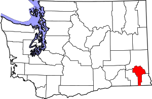 Map of Washington highlighting Garfield County | |
| Unincorporated communities | ||
| Ghost town | ||
| Authority control |
|
|---|