Polur
Polur is a town and a Municipality in Tiruvannamalai district at the state of Tamil Nadu in India. Located at the foothills of Javvadhi hills, a popular section of Eastern Ghats, Polur is often regarded as Gateway of Eastern ghats. The famous Chittor - Cuddalore road (C.C. Road)passes through the town. The town is located at 29 Kilometres north of city of Tiruvannamalai and 45 kilometres south of Vellore Metropolis.
Polur | |
|---|---|
Town | |
| Nickname(s): gateway of Eastern ghats | |
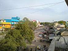
 Polur Location in Tamil Nadu, India | |
| Coordinates: 12.5°N 79.13°E | |
| Country | |
| State | Tamil Nadu |
| District | Tiruvannamalai |
| Elevation | 171 m (561 ft) |
| Population (2011) | |
| • Total | 55,000 |
| • Density | 2,500/km2 (6,000/sq mi) |
| Languages | |
| • Official | Tamil |
| Time zone | UTC+5:30 (IST) |
| PIN | 606803 |
| Telephone code | 04181 |
Geography
Polur is located at 12.5°N 79.13°E.[1] It has an average elevation of 171 metres (561 ft).
Along with many places of worship, Polur has a huge mountain temple dedicated to Lord Narasimha. This mountain temple was historically referred to as Sampathgiri, which in Sanskrit means "mountain of wealth". From the top of the hill, one can have a clear view of the Tiruvannamalai Arunachala Hill. A small hill named Kunnathur Hill is also seen on the outskirts of Polur. The same term was referred to in Tamil as "Porulur", literally translating to Porul oor (place of wealth), now referred to as Polur. It is situated in the Tiruvannamalai District, it takes around 30 minutes to reach the Tiruvannamalai and Silk City of Arani. It takes about 1 hour to reach Vellore.
Situated within 40 km are the villages of Kalambur, Athuvambadi, Thurinjikuppam, Kunnathur, Renderipattu Santhavasal, Padai Veedu, Kalasapakkam, Kannamangalam, Kaniyambadi and Vannangulam. The nearest Village is Kelur which is situated on the Vellore-Thirvannamalai Highway.
About 20 km east of Polur is the remote town of Devikapuram, the site of Periyanayaki Amman Temple. Some 20 km from Polur is the Parvathamalai with a temple of Lord Shiva on its top. The town is about 193 km from Chennai and there are frequent buses (TNSTC - Villupuram) from the Chennai Mofussil Bus Terminus CMBT, plying on Route # 148 (Chennai - Polur) via Tambaram, Chengalepat, Utthiramerur, Vandavasi, Chetpet. The nearest airport is at Chennai.

The remote village Sothukanni is 8 km east of Polur. It is famous for Kanum Pongal.
Kalambur town is 17 km away and is famous for rice production.
Polur Railway Station is on the Vellore-Thiruvannamalai rail route. The station is served by the Southern Railway. The station is located about 35 km from Thiruvannamalai. Going north, Vellore Cantonment Railway Station is the main station next to Polur. Traveling south, Thiruvannamalai Railway Station is the nearest major station.
The original name (with diacritics) of the town is Polūr.
Airports nearest to Polur are sorted by the distance to the airport from the city centre.
- Vellore Airport (45 km)
- Pondicherry Airport (94 km)
- Neyveli Airfield (110 km)
- Tambaram Airfield (120 km)
- Chennai International Airport (130 km)
As of 2001 India census,[2] Polur had a population of 43,492. Males constituted 49% of the population and females 51%. Polur had an average literacy rate of 72%, higher than the national average of 59.5%: male literacy was 79%, and female literacy was 65%. In Polur, 11% of the population were under 6 years of age.

| Historical population | ||
|---|---|---|
| Year | Pop. | ±% |
| 1901 | 9,767 | — |
| 1911 | 9,946 | +1.8% |
| 1921 | 12,330 | +24.0% |
| 1931 | 13,098 | +6.2% |
| 1941 | 13,967 | +6.6% |
| 1951 | 15,212 | +8.9% |
| 1961 | 16,441 | +8.1% |
| 1981 | 23,462 | +42.7% |
| 1991 | 30,196 | +28.7% |
| 2001 | 41,376 | +37.0% |
| 2011 | 55,278 | +33.6% |
| Sources: | ||
Tourism in Polur
This place is famous for three Jain caves which consists of a long statue of Nimanatha in one of its caves and the length of the statue is 16 meters(highest in Tamil Nadu).
This place is very close to Renderipattu Ancient Digambar Jain Temple.The primary deity of the temple is Neminath which is 1000 years old.
This place is very close to Jawadhu Hills, which is really worth a ride in bike. This ride would be completely inside an ecofriendly route and it is about 60 km one way. There are few tribal villages in Javadi hills and it is forested with sandal woods.
This place is famous for Kavalur Observatory and Beeman Falls. Also there are couple of spots to hangout near by on the same route. Parvatha hills is a nice place for trekking which is 10 km away from Polur. In Polur to Athimoor root - Vitobaswamigal Madam Is placed. It's a Tomb of VITOBASWAMIGAL. In "Kuruvimalai" way to Changam there one stone 50 feet Vishnu Statue is on work so its tells that Polur is a Sculpture city and way to all Tourist places.
Arahanthgiri Jain Math
Arahanthgiri Jain Math is a Jain Math that was established at the ancient Jain site of Tiruvannaamalai in August, 1998.[4] The complex includes three Jain caves, four Jain temples and a 16 meter high sculpture of Neminatha thought to date from the 12th century that is the tallest Jain image in Tamil Nadu.
References
- Falling Rain Genomics, Inc - Polur
- "Census of India 2001: Data from the 2001 Census, including cities, villages and towns (Provisional)". Census Commission of India. Archived from the original on 16 June 2004. Retrieved 1 November 2008.
- "Population Details". Tiruvannamalai municipality. 2011. Archived from the original on 27 February 2014. Retrieved 29 December 2012.
- "Arihantagiri - Tirumalai". Archived from the original on 7 November 2012. Retrieved 10 April 2012.