Pingtang County
Pingtang County (Chinese: 平塘县; pinyin: Píngtáng Xiàn) is a county in the Qiannan Buyei and Miao Autonomous Prefecture of Guizhou province, China, bordering Guangxi to the south. It is a high mountain valley and is inhabited mainly by members of the Buyei and Miao ethnic minorities, who together make up 55% of the county's population.[1]
Pingtang County 平塘县 | |
|---|---|
County | |
 Pingtang Location of the seat in Guizhou 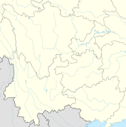 Pingtang Pingtang (Southwest China) | |
| Coordinates (Pingtang County government): 25°49′21″N 107°19′21″E | |
| Country | People's Republic of China |
| Province | Guizhou |
| Autonomous prefecture | Qiannan |
| Area | |
| • Total | 2,799.08 km2 (1,080.73 sq mi) |
| Population (2010) | |
| • Total | 228,377 |
| • Density | 82/km2 (210/sq mi) |
| Time zone | UTC+8 (China Standard) |
The county's area is 2,799.08 square km and at the 2010 Census its population was 228,560. The county's government is based in the town of Pinghu.
The Five Hundred Meter Aperture Spherical Telescope (FAST) is located in the southwestern part of Pingtan County, near its Kedu and Tangbian Towns and Dongjia Township of the adjacent Luodian County.
Administrative divisions
The towns and townships under the jurisdiction of Pingtang County include:
Towns
Townships
- Bailong (Chinese: 白龙乡; pinyin: Báilóng xiāng)
- Xintang (新塘乡; Xīntáng xiāng)
- Kapu Maonan Ethnic Township (卡蒲毛南族乡; Kǎpú Máonánzú xiāng)
- Xiliang (西凉乡; Xīliáng xiāng)
- Kaluo (卡罗乡; Kǎluó xiāng)
- Gudong (谷洞乡; Gǔdòng xiāng)
- Zhangbu (掌布乡; Zhǎngbù xiāng)
- Shuchang (鼠场乡; Shǔcháng xiāng)
- Ganzhai (甘寨乡; Gānzhài xiāng)
- Miao'erhe (苗二河乡; Miáo'èrhé xiāng)
Curiosities
In June 2002, Chinese researchers announced the discovery of a 270-million-year-old stone called Hidden character stone inscribed with six Chinese characters, reading "中国共产党亡" ("the Communist Party of China Perish") at the Zhangbu Scenic Spot in Zhangbu village (掌布乡).[2][3]
Climate
| Climate data for Pingtang (1981−2010) | |||||||||||||
|---|---|---|---|---|---|---|---|---|---|---|---|---|---|
| Month | Jan | Feb | Mar | Apr | May | Jun | Jul | Aug | Sep | Oct | Nov | Dec | Year |
| Record high °C (°F) | 24.6 (76.3) |
32.2 (90.0) |
32.8 (91.0) |
35.4 (95.7) |
34.9 (94.8) |
34.2 (93.6) |
36.1 (97.0) |
36.6 (97.9) |
35.8 (96.4) |
33.5 (92.3) |
30.3 (86.5) |
27.9 (82.2) |
36.6 (97.9) |
| Average high °C (°F) | 11.1 (52.0) |
13.5 (56.3) |
17.9 (64.2) |
23.3 (73.9) |
26.6 (79.9) |
28.6 (83.5) |
30.1 (86.2) |
30.5 (86.9) |
28.1 (82.6) |
23.2 (73.8) |
19.0 (66.2) |
14.1 (57.4) |
22.2 (71.9) |
| Daily mean °C (°F) | 6.8 (44.2) |
9.0 (48.2) |
12.8 (55.0) |
17.9 (64.2) |
21.6 (70.9) |
24.0 (75.2) |
25.2 (77.4) |
24.7 (76.5) |
22.1 (71.8) |
18.0 (64.4) |
13.5 (56.3) |
8.7 (47.7) |
17.0 (62.7) |
| Average low °C (°F) | 4.0 (39.2) |
5.9 (42.6) |
9.3 (48.7) |
14.2 (57.6) |
17.9 (64.2) |
20.8 (69.4) |
22.0 (71.6) |
21.1 (70.0) |
18.3 (64.9) |
14.7 (58.5) |
10.0 (50.0) |
5.3 (41.5) |
13.6 (56.5) |
| Record low °C (°F) | −4.0 (24.8) |
−4.1 (24.6) |
−1.7 (28.9) |
2.4 (36.3) |
6.8 (44.2) |
12.5 (54.5) |
13.8 (56.8) |
15.1 (59.2) |
10.0 (50.0) |
4.9 (40.8) |
−1.2 (29.8) |
−5.1 (22.8) |
−5.1 (22.8) |
| Average precipitation mm (inches) | 25.4 (1.00) |
31.8 (1.25) |
50.9 (2.00) |
100.5 (3.96) |
186.6 (7.35) |
214.4 (8.44) |
194.3 (7.65) |
124.3 (4.89) |
90.8 (3.57) |
72.7 (2.86) |
45.5 (1.79) |
20.6 (0.81) |
1,157.8 (45.57) |
| Average relative humidity (%) | 78 | 77 | 77 | 78 | 78 | 82 | 83 | 83 | 80 | 80 | 79 | 76 | 79 |
| Source: China Meteorological Data Service Center | |||||||||||||
References
- Kuang MG (July 1986). "[Develop family planning work based on the reality of minority regions]". Renkou Yanjiu (in Chinese) (4): 40–1. PMID 12159294.
- 2.7亿年“中国共产党亡”字样地质奇观惊现贵州(图). News.xinhuanet.com. 2003-12-08. Retrieved 2011-06-27.
- “救星石” 两亿七千万年的神秘天书-搜狐新闻. News.sohu.com. Retrieved 2011-06-27.