Petersville, Alaska
Petersville is a census-designated place (CDP) in Matanuska-Susitna Borough, Alaska, United States. It is part of the Anchorage, Alaska Metropolitan Statistical Area. The population was four at the 2010 Census, down from 27 in 2000.
Petersville, Alaska | |
|---|---|
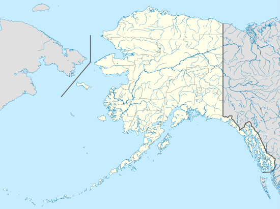
 Location in Matanuska-Susitna Borough and the state of Alaska. | |
 Petersville, Alaska Location within the state of Alaska | |
| Coordinates: 62°22′37″N 150°44′49″W | |
| Country | United States |
| State | Alaska |
| Borough | Matanuska-Susitna |
| Government | |
| • Borough mayor | Michele Stevens |
| • State senator | Mike Dunleavy (R) |
| • State rep. | David Eastman (R) |
| Area | |
| • Total | 355.4 sq mi (920.4 km2) |
| • Land | 354.1 sq mi (917.0 km2) |
| • Water | 1.3 sq mi (3.4 km2) |
| Elevation | 1,617 ft (493 m) |
| Population (2010) | |
| • Total | 4 |
| • Density | 0.011/sq mi (0.0043/km2) |
| Time zone | UTC-9 (Alaska (AKST)) |
| • Summer (DST) | UTC-8 (AKDT) |
| Area code(s) | 907 |
| FIPS code | 02-60460 |
| GNIS feature ID | 1407927 |
Geography
Petersville is located at 62°22′37″N 150°44′49″W (62.376890, -150.746952).[1]
According to the United States Census Bureau, the CDP has a total area of 355.4 square miles (920 km2), of which, 354.1 square miles (917 km2) of it is land and 1.3 square miles (3.4 km2) of it (0.37%) is water.
Climate
Petersville is categorized as being within the 3a USDA hardiness zone, meaning temperatures can get as low as -40 to -35 °F.[2]
| Climate data for Petersville (1,617 feet above sea level) | |||||||||||||
|---|---|---|---|---|---|---|---|---|---|---|---|---|---|
| Month | Jan | Feb | Mar | Apr | May | Jun | Jul | Aug | Sep | Oct | Nov | Dec | Year |
| Average high °F (°C) | 18.0 (−7.8) |
22.0 (−5.6) |
30.0 (−1.1) |
42.0 (5.6) |
54.0 (12.2) |
65.0 (18.3) |
66.0 (18.9) |
62.0 (16.7) |
52.0 (11.1) |
35.0 (1.7) |
23.0 (−5.0) |
21.0 (−6.1) |
40.8 (4.9) |
| Daily mean °F (°C) | 11.0 (−11.7) |
14.0 (−10.0) |
19.5 (−6.9) |
30.5 (−0.8) |
42.5 (5.8) |
53.0 (11.7) |
55.5 (13.1) |
52.0 (11.1) |
42.5 (5.8) |
27.5 (−2.5) |
16.0 (−8.9) |
14.0 (−10.0) |
31.5 (−0.3) |
| Average low °F (°C) | 4.0 (−15.6) |
6.0 (−14.4) |
9.0 (−12.8) |
19.0 (−7.2) |
31.0 (−0.6) |
41.0 (5.0) |
45.0 (7.2) |
42.0 (5.6) |
33.0 (0.6) |
20.0 (−6.7) |
9.0 (−12.8) |
7.0 (−13.9) |
22.2 (−5.5) |
| Average precipitation inches (mm) | 2.23 (57) |
2.14 (54) |
1.43 (36) |
1.38 (35) |
1.03 (26) |
1.65 (42) |
3.92 (100) |
5.83 (148) |
5.82 (148) |
3.24 (82) |
2.44 (62) |
2.91 (74) |
34.02 (864) |
| Source: Weather Channel[3] | |||||||||||||
Demographics
| Historical population | |||
|---|---|---|---|
| Census | Pop. | %± | |
| 2000 | 27 | — | |
| 2010 | 4 | −85.2% | |
| U.S. Decennial Census[4] | |||
Petersville first appeared on the 2000 U.S. Census as a census-designated place (CDP).
As of the census[5] of 2000, there were 27 people, 17 households, and 7 families residing in the CDP. The population density was 0.1 people per square mile (0.0/km²). There were 189 housing units at an average density of 0.5/sq mi (0.2/km²). The racial makeup of the CDP was 88.89% White, 7.41% Native American and 3.70% Pacific Islander.
There were 17 households out of which 5.9% had children under the age of 18 living with them, 29.4% were married couples living together, and 58.8% were non-families. 58.8% of all households were made up of individuals and 11.8% had someone living alone who was 65 years of age or older. The average household size was 1.59 and the average family size was 2.00.
In the CDP, the population was spread out with 3.7% under the age of 18, 18.5% from 25 to 44, 63.0% from 45 to 64, and 14.8% who were 65 years of age or older. The median age was 52 years. For every 100 females, there were 200.0 males. For every 100 females age 18 and over, there were 225.0 males.
The median income for a household in the CDP was $43,750, and the median income for a family was $0. Males had a median income of $0 versus $0 for females. The per capita income for the CDP was $43,200. There were no families and none of the population living below the poverty line, including no under eighteens and none of those over 64.
See also
- Yentna Cache-Creek Mining District
References
- "US Gazetteer files: 2010, 2000, and 1990". United States Census Bureau. 2011-02-12. Retrieved 2011-04-23.
- "USDA Plant Hardiness Zone Map". United States Department of Agriculture. Archived from the original on 27 February 2014. Retrieved 25 August 2018.
- "Petersville, AK Monthly Weather Forecast". Weather Channel. Retrieved 25 August 2018.
- "U.S. Decennial Census". Census.gov. Retrieved June 6, 2013.
- "U.S. Census website". United States Census Bureau. Retrieved 2008-01-31.
External links
Municipalities and communities of Matanuska-Susitna Borough, Alaska, United States | ||
|---|---|---|
Borough seat: Palmer | ||
| Cities | 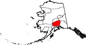 Matanuska-Susitna Borough map | |
| CDPs | ||
| Unincorporated communities |
| |
| Authority control |
|
|---|