Peters, Texas
Peters is an Unincorporated community in Austin County in the U.S. state of Texas. No longer marked on maps, the tiny community is situated along State Highway 36 (SH 36) 5.8 miles (9.3 km) north of Sealy. The settlement was founded along a railroad line around 1880 but decreased in population after the 1920s. The BNSF Railway still exists but there are currently only a few homes, a Boy Scout camp and two churches in the immediate area.
Peters, Texas | |
|---|---|
Unincorporated community | |
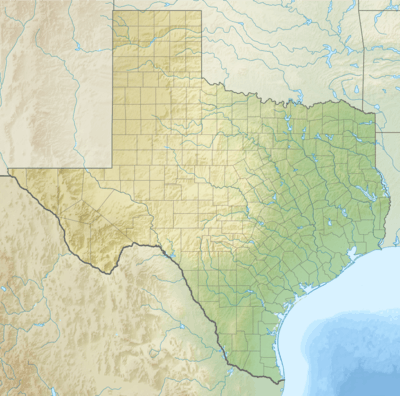 Peters, Texas Location within the state of Texas | |
| Coordinates: 29°51′36″N 96°11′12″W | |
| Country | United States |
| State | Texas |
| County | Austin |
| Elevation | 169 ft (52 m) |
| Time zone | UTC-6 (Central (CST)) |
| • Summer (DST) | UTC-5 (CDT) |
| ZIP code | 77474 |
| Area code(s) | 979 |
Geography
The community of Peters is situated at 29°51′36″N 96°11′12″W.[1] This location is 5.8 miles (9.3 km) north of Sealy and 7.7 miles (12.4 km) south of Bellville on SH 36 at Peters San Felipe Road. The location is bracketed by Farm to Market Road 949 which is 1.0 mile (1.6 km) north on SH 36 and Farm to Market Road 331 which is 1.6 miles (2.6 km) south. The BNSF Railway runs parallel with SH 36 between Sealy and Bellville. On the west side of SH 36, Peters San Felipe Road goes south-southwest 0.5 miles (0.8 km) to end at Trenckmann Road. On the east side of SH 36, Peters San Felipe Road heads 6.3 miles (10.1 km) southeast to San Felipe. Two places of worship, the All Around Cowboy Church and the Christian City Fellowship are on the east side of SH 36 just to the south of Trenckmann Road.[2] Camp Brosig, owned by the Boy Scouts of America, is located nearby at 1893 Trenckmann Road 1.6 miles (2.6 km) to the northwest of SH 36.[3]
History
Austin County was first settled by Anglo-Americans in the 1820s, but Peters did not come into existence until the Gulf, Colorado and Santa Fe Railway was built between Sealy and Bellville in the 1880s. A station on the railroad, the community received a post office in 1883 and was named for Albert Peters, an early settler. The population reached as high as 125 in 1925 but declined to 70 by 1943. The post office closed in the 1940s at a time when there were two local businesses. In 1968 there were about 100 in the area. In the early 1980s the community boasted a hospital, three commercial establishments, a church and a clubhouse. From 1990 to 2000, there were approximately 95 persons living in the area.[4]
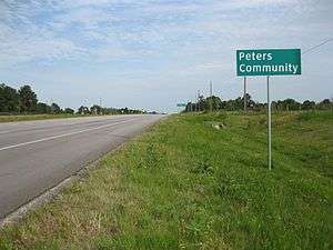 Peters Community sign is on State Highway 36, looking to the southeast.
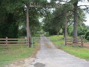 Camp Brosig on Trenckmann Road is owned by Sam Houston Area Council, Boy Scouts of America.
 Peters Hall at Trenckmann and Peters San Felipe Roads is an old octagonal dance hall.
References
- U.S. Geological Survey Geographic Names Information System: Peters, Texas
- Google (May 17, 2013). "Peters, Texas" (Map). Google Maps. Google. Retrieved May 17, 2013.
- "Camp Brosig". Sam Houston Area Council. Archived from the original on August 30, 2012. Retrieved May 17, 2013.
- Jackson, Charles Christopher. "Handbook of Texas Online: PETERS, TX". Texas State Historical Association. Retrieved May 17, 2013.
Municipalities and communities of Austin County, Texas, United States | ||
|---|---|---|
| Cities | 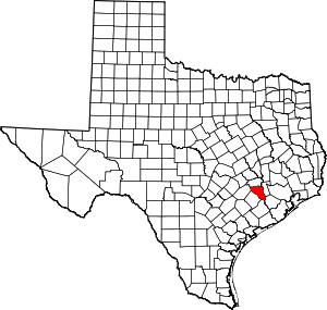 Austin County map | |
| Towns | ||
| Unincorporated communities | ||
| Ghost towns |
| |
| Footnotes | ‡This populated place also has portions in an adjacent county or counties | |