Peru Township, Miami County, Indiana
Peru Township is one of fourteen townships in Miami County, Indiana, United States. As of the 2010 census, its population was 11,291 and it contained 5,536 housing units.[2]
Peru Township | |
|---|---|
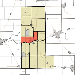 Location in Miami County | |
| Coordinates: 40°46′25″N 86°05′14″W | |
| Country | |
| State | |
| County | Miami |
| Government | |
| • Type | Indiana township |
| Area | |
| • Total | 25.48 sq mi (66.0 km2) |
| • Land | 25.01 sq mi (64.8 km2) |
| • Water | 0.48 sq mi (1.2 km2) 1.88% |
| Elevation | 673 ft (205 m) |
| Population (2010) | |
| • Total | 11,291 |
| • Density | 451.5/sq mi (174.3/km2) |
| Time zone | UTC-5 (Eastern (EST)) |
| • Summer (DST) | UTC-4 (EDT) |
| ZIP code | 46970 |
| GNIS feature ID | 453729 |
History
Peru Township was organized in 1834.[3]
Geography
According to the 2010 census, the township has a total area of 25.48 square miles (66.0 km2), of which 25.01 square miles (64.8 km2) (or 98.16%) is land and 0.48 square miles (1.2 km2) (or 1.88%) is water.[2] The Wabash River defines the southern border of the township.
Cities, towns, villages
- Peru (northwest three-quarters)
Unincorporated towns
(This list is based on USGS data and may include former settlements.)
Extinct towns
Cemeteries
The township contains these three cemeteries: Bowman, Mount Hope and Schrock.
Major highways


Airports and landing strips
- Benner Field
School districts
- Peru Community Schools
Political districts
- Indiana's 5th congressional district
- State House District 23
- State Senate District 18
References
- "Peru Township, Miami County, Indiana". Geographic Names Information System. United States Geological Survey. Retrieved 2009-09-29.
- United States Census Bureau 2008 TIGER/Line Shapefiles
- IndianaMap
- "US Board on Geographic Names". United States Geological Survey. October 25, 2007. Retrieved 2017-05-09.
- "Population, Housing Units, Area, and Density: 2010 - County -- County Subdivision and Place -- 2010 Census Summary File 1". United States Census. Archived from the original on 2020-02-12. Retrieved 2013-05-10.
- Bodurtha, Arthur Lawrence (1914). History of Miami County, Indiana: A Narrative Account of Its Historical Progress, Its People and Its Principal Interests. Lewis Pub. pp. 139.
External links
- Indiana Township Association
- United Township Association of Indiana
- City-Data.com page for Peru Township
Places adjacent to Peru Township, Miami County, Indiana | |
|---|---|
Municipalities and communities of Miami County, Indiana, United States | ||
|---|---|---|
| City | Map of Indiana highlighting Miami County | |
| Towns | ||
| Townships | ||
| CDP | ||
| Other unincorporated communities | ||
| Ghost towns | ||
| Footnotes | ‡This populated place also has portions in an adjacent county or counties | |
This article is issued from Wikipedia. The text is licensed under Creative Commons - Attribution - Sharealike. Additional terms may apply for the media files.