Pechenga (urban-type settlement), Murmansk Oblast
Pechenga (Russian: Пече́нга; Finnish and Swedish: Petsamo; Norwegian: Petsjenga; Northern Sami: Beahcán; Skolt Sami: Peäccam) is an urban locality (an urban-type settlement) in Pechengsky District, Murmansk Oblast, Russia. Municipally, it is incorporated as Pechenga Urban Settlement of Pechengsky Municipal District. Population: 3,188 (2010 Census);[1] 2,959 (2002 Census);[5] 2,671 (1989 Census).[6]
Pechenga Печенга | |
|---|---|
Urban-type settlement | |
.png) Flag  Coat of arms | |
Location of Pechenga %2C%2BMurmansk%2BOblast%26groups%3D_5631d6c34a89336d9a74d5b2d963ae3dec8ea189.svg)
| |
 Pechenga Location of Pechenga 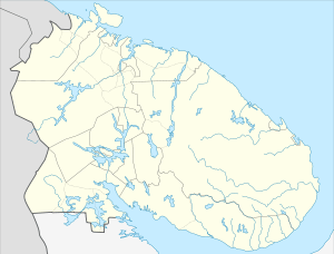 Pechenga Pechenga (Murmansk Oblast) | |
| Coordinates: 69°33′38″N 31°13′40″E | |
| Country | Russia |
| Federal subject | Murmansk Oblast |
| Administrative district | Pechengsky District |
| Area | |
| • Total | 150.55 km2 (58.13 sq mi) |
| Elevation | 5 m (16 ft) |
| Population | |
| • Total | 3,188 |
| • Estimate (2018)[2] | 3,128 (-1.9%) |
| • Density | 21/km2 (55/sq mi) |
| • Capital of | Pechengsky District |
| • Municipal district | Pechengsky Municipal District |
| • Urban settlement | Pechenga Urban Settlement |
| Time zone | UTC+3 (MSK |
| Postal code(s)[4] | 184410 |
| Dialing code(s) | +7 81554 |
| OKTMO ID | 47615162051 |
History
The Pechenga area has been indigenously inhabited by the Finnic Kvens[7] and the Sami.
The settlement was founded as the Pechenga Monastery in 1533 at the influx of the Pechenga River into the Barents Sea, 135 km west of modern Murmansk, by St. Tryphon of Pechenga, a monk from Novgorod. In 1533, the area became part of Russia.
Inspired by the model of the Solovki, Tryphon wished to convert the local Sami population to Christianity and to demonstrate how faith could flourish in the most inhospitable lands. His example was eagerly followed by other Russian monks. By 1572, the Pechenga Monastery counted about 50 brethren and 200 lay followers. Six years after Tryphon's death in 1583, the wooden monastery was raided and burnt down by the Swedes. It is said that the raid claimed the lives of 51 monks and 65 lay brothers. The monastery was moved closer to the Norwegian border. It was destroyed in 1764, but restored in 1880, and exists to this day.[8]
On 18 May 1918 the Finnish government declared war on Soviet Russia. During the war the area around Pechenga was occupied by the Finnish forces, and as a result of the Treaty of Tartu in 1920 became a part of Finland, renamed Petsamo. Nickel was discovered in 1921 and began to be exploited commercially in 1935. The area was captured by the Soviets during the Winter War in 1940 but returned to Finland at the conclusion of the war. During the Second World War, between 1941 through 1944, Petsamo was used as a staging post for attacks on Murmansk by Finland and Germany. Aircraft from the British aircraft carrier HMS Furious attacked the port on July 30, 1941. The area was captured by the Red Army during the Petsamo–Kirkenes Offensive in 1944 and in 1947, after the subsequent Paris Peace Treaty, incorporated into the Soviet Union.
After the war the area was a military zone due to its proximity to the Norwegian border. Nickel mining has led to ecological problems in the area.
The 200th Independent Motor Rifle Brigade is stationed at the settlement.
References
- Russian Federal State Statistics Service (2011). "Всероссийская перепись населения 2010 года. Том 1" [2010 All-Russian Population Census, vol. 1]. Всероссийская перепись населения 2010 года [2010 All-Russia Population Census] (in Russian). Federal State Statistics Service.
- http://murmanskstat.gks.ru/wps/wcm/connect/rosstat_ts/murmanskstat/resources/dc3.
- "Об исчислении времени". Официальный интернет-портал правовой информации (in Russian). June 3, 2011. Retrieved January 19, 2019.
- "Archived copy" ИНФОРМАЦИЯ ОБ ОБЪЕКТЕ ПОЧТОВОЙ СВЯЗИ (in Russian). Russian Post. Archived from the original on March 3, 2016. Retrieved March 16, 2010.CS1 maint: archived copy as title (link)
- Russian Federal State Statistics Service (May 21, 2004). "Численность населения России, субъектов Российской Федерации в составе федеральных округов, районов, городских поселений, сельских населённых пунктов – районных центров и сельских населённых пунктов с населением 3 тысячи и более человек" [Population of Russia, Its Federal Districts, Federal Subjects, Districts, Urban Localities, Rural Localities—Administrative Centers, and Rural Localities with Population of Over 3,000] (XLS). Всероссийская перепись населения 2002 года [All-Russia Population Census of 2002] (in Russian).
- "Всесоюзная перепись населения 1989 г. Численность наличного населения союзных и автономных республик, автономных областей и округов, краёв, областей, районов, городских поселений и сёл-райцентров" [All Union Population Census of 1989: Present Population of Union and Autonomous Republics, Autonomous Oblasts and Okrugs, Krais, Oblasts, Districts, Urban Settlements, and Villages Serving as District Administrative Centers]. Всесоюзная перепись населения 1989 года [All-Union Population Census of 1989] (in Russian). Институт демографии Национального исследовательского университета: Высшая школа экономики [Institute of Demography at the National Research University: Higher School of Economics]. 1989 – via Demoscope Weekly.
- Julku, Kyösti: Kvenland - Kainuunmaa. With English summary: The Ancient territory of Kainuu. Oulu, 1986.
- "Archived copy". Archived from the original on February 28, 2001. Retrieved April 6, 2010.CS1 maint: archived copy as title (link)
External links
| Administrative districts | |||
|---|---|---|---|
| Closed administrative-territorial formations | |||
| Cities and towns (all levels) | |||
| Urban-type settlements | |||