Patoka Township, Gibson County, Indiana
Patoka Township is one of ten townships in Gibson County, Indiana, United States. As of the 2010 census, its population was 11,864 and it contained 5,341 housing units. It is the largest township in population, accounting for roughly 30% of the county's total population.[3]
Patoka Township Gibson County | |
|---|---|
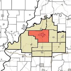 Location of Patoka Township within Gibson County | |
| Coordinates: 38°21′03″N 87°35′28″W | |
| Country | United States |
| State | Indiana |
| County | Gibson |
| Named for | Patoka River |
| Government | |
| • Type | Indiana township |
| • Trustee | Brad Schmitt |
| Area | |
| • Total | 68.92 sq mi (178.5 km2) |
| • Land | 68.49 sq mi (177.4 km2) |
| • Water | 0.43 sq mi (1.1 km2) |
| Elevation | 446 ft (136 m) |
| Population | |
| • Total | 11,880 |
| • Density | 172.37/sq mi (66.55/km2) |
| Time zone | UTC-6 (CST) |
| • Summer (DST) | UTC-5 (CDT) |
| ZIP codes | 47670 47671 |
| Area code(s) | 812 - 385 / 386 / 387 / 388 / 724 / 779 |
| FIPS code | 18-58338[2] |
| GNIS feature ID | 453709 |
| Largest Township in Gibson County by population | |
History
Patoka Township was organized in 1813.[4] It took its name from the Patoka River.[5]
The Lyles Consolidated School was listed on the National Register of Historic Places in 1999.[6]
Geography
According to the 2010 census, the township has a total area of 68.92 square miles (178.5 km2), of which 68.49 square miles (177.4 km2) (or 99.38%) is land and 0.43 square miles (1.1 km2) (or 0.62%) is water.[3]
Cities and towns
- Princeton (the county seat and largest community)
Unincorporated towns
(This list is based on USGS data and may include former settlements.)
Adjacent townships
- White River Township (north)
- Washington Township (northeast)
- Center Township (east)
- Union Township (south)
- Montgomery Township (southwest)
Cemeteries
The township contains seven cemeteries: Archer, Hitch, Maple Hill, Odd Fellows, Saint Josephs, Sand Hill and Warnock.
Major highways
- U.S. Route 41
- State Road 64
- State Road 65
Education
Public education in Patoka Township is administered by the North Gibson School Corporation.
Public Schools
- Brumfeld Elementary School
- Lowell Elementary School
- Princeton Community Middle School
- Princeton Community High School
Private Schools
- St. Joseph Catholic School
Higher Education
- Vincennes University Workforce Development
Museums
- Lyles Station Schoolhouse Museum - Lyles Station (2 miles WNW of Princeton)
References
- "US Board on Geographic Names". United States Geological Survey. 2007-10-25. Retrieved 2008-01-31.
- "U.S. Census website". United States Census Bureau. Retrieved 2008-01-31.
- "Population, Housing Units, Area, and Density: 2010 - County -- County Subdivision and Place -- 2010 Census Summary File 1". United States Census. Archived from the original on 2020-02-10. Retrieved 2013-05-10.
- Stormont, Gil R. (1914). History of Gibson County, Indiana: Her People, Industries and Institutions. B.F. Bowen. pp. 340.
- History of Gibson County, Indiana: With Illustrations Descriptive of Its Scenery, and Biographical Sketches of Some of Its Prominent Men and Pioneers. Jas. T. Tartt & Co. 1884. p. 153.
- "National Register Information System". National Register of Historic Places. National Park Service. July 9, 2010.
External links
Municipalities and communities of Gibson County, Indiana, United States | ||
|---|---|---|
| Cities |  Map of Indiana highlighting Gibson County | |
| Towns | ||
| Townships | ||
| Unincorporated communities | ||
| Ghost town | ||
| Footnotes | ‡This populated place also has portions in an adjacent county or counties | |