Pata Anjasi
Pata Anjasi (possibly from Quechua pata elevated place; above, at the top; edge; bank (of a river), shore, anqasi cobalt salt used for dyeing,[2][3]) is a mountain in the Vilcanota mountain range in the Andes of Peru, about 5,000 metres (16,404 ft) high. It is located in the Puno Region, Carabaya Province, Corani District. Pata Anjasi is situated east of the large glaciated area of Quelccaya (Quechua for "snow plain") and the peaks of Jatun Quenamari, and southeast of Cuncunani.
| Pata Anjasi | |
|---|---|
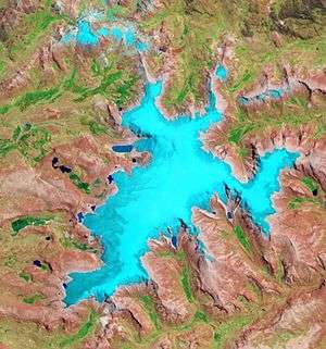 The glaciated Quelccaya area with Pata Anjasi shown in the lower right part of this satellite image (NASA, 2010) | |
| Highest point | |
| Elevation | 5,000 m (16,000 ft) [1] |
| Coordinates | 13°56′55″S 70°45′46″W |
| Geography | |
 Pata Anjasi Peru | |
| Location | Peru, Puno Region |
| Parent range | Andes, Vilcanota |
References
- escale.minedu.gob.pe - UGEL map of the Carabaya Province (Puno Region)
- Teofilo Laime Ajacopa, Diccionario Bilingüe Iskay simipi yuyayk'ancha, La Paz, 2007 (Quechua-Spanish dictionary)
- Diccionario Quechua - Español - Quechua, Academía Mayor de la Lengua Quechua, Gobierno Regional Cusco, Cusco 2005 (Quechua-Spanish dictionary)
This article is issued from Wikipedia. The text is licensed under Creative Commons - Attribution - Sharealike. Additional terms may apply for the media files.