Passu
Passu (Urdu: پسو) is a small village located in the Gilgit Baltistan region of northern Pakistan. Situated along the Karakoram Highway in Upper Hunza, Passu is a popular tourist destination because of its easily accessible sweeping landscapes, and vistas of the 7,478 m (24,534 ft) tall Passu Sar mountain, the Passu Glacier, and Tupopdan 6,106m (20,033 ft).
Passu پسو | |
|---|---|
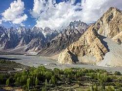 Tupopdan and the Hunza River, viewed from the Karakoram Highway in Passu | |
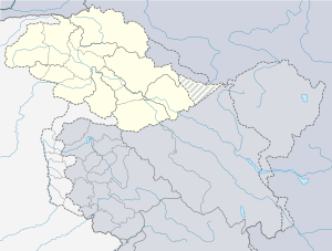 Passu Location in Pakistan  Passu Passu (Pakistan) | |
| Coordinates: | |
| Country | |
| Autonomous state | |
| District | Gilgit District |
| Time zone | UTC+5 (PST) |
Geography
Passu is located along the Hunza River, about 20 kilometres (12 mi) from Gulmit[1], the Tehsil headquarters of Gojal, in the Gilgit-Baltistan region of Pakistan, and about 147 kilometres (91 mi) upriver from Gilgit.[2] Passu is located in Gojal Valley, sub division of District Hunza.
It lies very near the tongue of the Passu Glacier, and just south of the tongue of the Batura Glacier. The latter is the seventh longest non-polar glacier in the world at 56 kilometres (35 mi), and reaches very near to the highway. Borith Lake is a large water feature below the Hussaini village in the area.[3][4]
Tupopdan 6,106 metres (20,033 ft) also known as 'Passu Cones' or 'Passu Cathedral', lies to the north of the Gulmit village in Gojal Valley. It is the most photographed peak of the region.[5] Also nearby are the high peaks of Pasu Sar, Shispare Sar, and Batura.
Demographics
The people are predominantly Wakhi[6] and speak the Wakhi Language. Religiously they are Ismaili, a sect of Shia Islam.
Gallery

 Batura Glacier moraine lake near Passu village
 Tupopdan (6,106m)
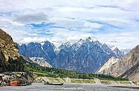 Tupopdan from the Hunza River
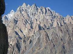 Upper slopes of Tupopdan
 Passu village
 Nabod area of Passu
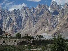 The west ridge of Tupopdan just north of the Karakoram Highway
References
- "Passu on map". Google Maps. Retrieved 18 September 2019.
- "Distance from Gilgit to Passu". Google Map. Retrieved 18 September 2019.
- https://www.gigaplaces.com/en/article-hike-passu-lake-borit/
- Borith Lake
- Taylor, Alan (27 November 2017). "A Photo Trip Along the Ancient Silk Road". The Atlantic. Retrieved 18 September 2019.
- Salopek, Paul (2 January 2018). "Walking Grass". National Geographic. Retrieved 2 January 2018.
The inhabitants of this austere landscape, many of them ethnic Wakhi farmers, have learned to trap this explosive blessing through the filter of grass.
| Wikimedia Commons has media related to Passu. |