Parksdale, California
Parksdale is a census-designated place (CDP) in Madera County, California, United States. It is part of the Madera–Chowchilla Metropolitan Statistical Area. The population was 2,621 at the 2010 census, down from 2,688 at the 2000 census.
Parksdale | |
|---|---|
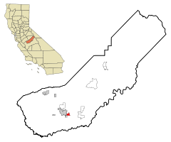 Location in Madera County and the state of California | |
 Parksdale Location in the United States | |
| Coordinates: 36°56′50″N 120°01′23″W | |
| Country | |
| State | |
| County | Madera |
| Area | |
| • Total | 1.811 sq mi (4.691 km2) |
| • Land | 1.811 sq mi (4.691 km2) |
| • Water | 0 sq mi (0 km2) 0% |
| Elevation | 279 ft (85 m) |
| Population (2010) | |
| • Total | 2,621 |
| • Density | 1,400/sq mi (560/km2) |
| Time zone | UTC-8 (Pacific (PST)) |
| • Summer (DST) | UTC-7 (PDT) |
| ZIP code | 93630 |
| Area code(s) | 559 |
| FIPS code | 06-55751 |
| GNIS feature ID | 1867048 |
Geography
Parksdale is located at 36°56′50″N 120°01′23″W.[2]
According to the United States Census Bureau, the CDP has a total area of 1.8 square miles (4.7 km2), all of it land.
Demographics
2010
At the 2010 census Parksdale had a population of 2,621. The population density was 1,447.2 people per square mile (558.8/km²). The racial makeup of Parksdale was 1,155 (44.1%) White, 56 (2.1%) African American, 65 (2.5%) Native American, 18 (0.7%) Asian, 3 (0.1%) Pacific Islander, 1,231 (47.0%) from other races, and 93 (3.5%) from two or more races. Hispanic or Latino of any race were 2,278 persons (86.9%).[3]
The whole population lived in households, no one lived in non-institutionalized group quarters and no one was institutionalized.
There were 569 households, 347 (61.0%) had children under the age of 18 living in them, 345 (60.6%) were opposite-sex married couples living together, 104 (18.3%) had a female householder with no husband present, 51 (9.0%) had a male householder with no wife present. There were 52 (9.1%) unmarried opposite-sex partnerships, and 4 (0.7%) same-sex married couples or partnerships. 48 households (8.4%) were one person and 13 (2.3%) had someone living alone who was 65 or older. The average household size was 4.61. There were 500 families (87.9% of households); the average family size was 4.76.
The age distribution was 959 people (36.6%) under the age of 18, 335 people (12.8%) aged 18 to 24, 651 people (24.8%) aged 25 to 44, 502 people (19.2%) aged 45 to 64, and 174 people (6.6%) who were 65 or older. The median age was 25.4 years. For every 100 females, there were 111.2 males. For every 100 females age 18 and over, there were 113.9 males.
There were 614 housing units at an average density of 339.0 per square mile, of the occupied units 366 (64.3%) were owner-occupied and 203 (35.7%) were rented.The homeowner vacancy rate was 1.3%; the rental vacancy rate was 3.8%. 1,596 people (60.9% of the population) lived in owner-occupied housing units and 1,025 people (39.1%) lived in rental housing units.
2000
At the 2000 census there were 2,688 people, 594 households, and 513 families in the CDP. The population density was 1,498.2 people per square mile (579.8/km²). There were 628 housing units at an average density of 350.0 per square mile (135.5/km²). The racial makeup of the CDP was 32.11% White, 3.01% African American, 3.16% Native American, 0.07% Asian, 0.19% Pacific Islander, 53.91% from other races, and 7.55% from two or more races. Hispanic or Latino of any race were 81.77%.[4]
Of the 594 households 55.2% had children under the age of 18 living with them, 61.1% were married couples living together, 16.3% had a female householder with no husband present, and 13.5% were non-families. 9.3% of households were one person and 3.9% were one person aged 65 or older. The average household size was 4.53 and the average family size was 4.69.
The age distribution was 40.1% under the age of 18, 12.7% from 18 to 24, 26.4% from 25 to 44, 14.8% from 45 to 64, and 6.0% 65 or older. The median age was 23 years. For every 100 females, there were 110.3 males. For every 100 females age 18 and over, there were 109.2 males.
The median household income was $29,821 and the median family income was $28,287. Males had a median income of $26,181 versus $24,219 for females. The per capita income for the CDP was $7,129. About 30.8% of families and 34.7% of the population were below the poverty line, including 41.3% of those under age 18 and 10.8% of those age 65 or over.
Government
In the California State Legislature, Parksdale is in the 12th Senate District, represented by Democrat Anna Caballero, and the 5th Assembly District, represented by Republican Frank Bigelow.[5]
In the United States House of Representatives, Parksdale is in California's 16th congressional district, represented by Democrat Jim Costa.[6]
References
- "2010 Census Gazetteer Files - Places - California". United States Census Bureau. Retrieved March 26, 2015.
- U.S. Geological Survey Geographic Names Information System: Parksdale, California
- "2010 Census Interactive Population Search: CA - Parksdale CDP". U.S. Census Bureau. Archived from the original on July 15, 2014. Retrieved July 12, 2014.
- "U.S. Census website". United States Census Bureau. Retrieved 2008-01-31.
- "Statewide Database". Regents of the University of California. Archived from the original on February 1, 2015. Retrieved March 26, 2015.
- "California's 16th Congressional District - Representatives & District Map". Civic Impulse, LLC.
Municipalities and communities of Madera County, California, United States | ||
|---|---|---|
| Cities | 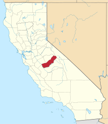 Madera County map | |
| CDPs | ||
| Unincorporated communities |
| |
| Indian reservations | ||
| Ghost towns | ||