Parent Lake
Parent Lake is an enlargement of the Bell River, flowing north-west into the Matagami Lake. It is located in a swampy area of Abitibi Regional County Municipality, a short distance north-east of Senneterre and about 65 kilometres (40 mi) northeast of Val-d'Or.[1]
| Parent Lake | |
|---|---|
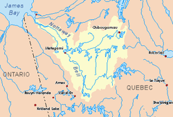 Watershed of Nottaway River | |
| Location | Senneterre |
| Coordinates | 48°39′08″N 77°03′49″W |
| Primary inflows |
|
| Primary outflows | Bell River. |
| Basin countries | Canada |
| Max. length | 53.0 kilometres (32.9 mi) |
| Max. width | 6.0 kilometres (3.7 mi) |
| Surface area | 122 kilometres (76 mi) |
| Surface elevation | 301 metres (988 ft) |
Recreational tourism activities, including boating, are developed in this sector. From the Senneterre railway bridge, it is possible to sail north on the 50 kilometres (31 mi) via the "Chenal de l'Épinette" which joins Parent Lake, up to at the mouth of the Robin River (Parent Lake). Pleasure craft may navigate up to an additional 4.2 kilometres (2.6 mi) in the formed delta, using either the Robin River (Parent Lake) or 2.7 kilometres (1.7 mi) in Ignace Bay, where the Delestres River flows, and partly up these rivers.
The Parent Lake watershed is serviced on the west side by route 113, which connects Senneterre and Lebel-sur-Quévillon.
Geography
This large, irregularly shaped lake is fed by numerous streams, including the Robin and Delestres rivers to the northeast, and Mégiscane River, to the southeast.
This lake has a length of 53 kilometres (33 mi), a width of 6 kilometres (3.7 mi) and an area of almost 122 km². The main islands are Wigwam Island (the largest in area), Bannerman Island and Prospect Island. Among the other small islands identified: White Island, Round Island and Real Island. The "Passe de l’Esturgeon” (English: Sturgeon Pass) is located between the east shore of the lake and Wigwam Island. The "Passe de l’Épinette” (English: Spruce Pass), which is located between the west bank of the Bell River and the northward peninsula, connects the Senneterre Lake upstream.
Fishing
Fishing for walleye, pike and yellow perch is excellent.
Toponymy
Replacing the Algonquin name of Chabogama or Shabogama, the channel lake in 1921, this hydronym pays tribute to Simon-Napoléon Parent (1855–1920), former mayor of the city of Québec and former premier of province of Quebec, for his entire public career.[1]
Notes and references
- "Fiche descriptive". toponymie.gouv.qc.ca.
See also
- Nottaway River, a watercourse
- Matagami Lake, a body of water
- Bell River, a watercourse
- Rupert Bay
- James Bay
- Senneterre (parish)
- Senneterre
- James Bay
- Senneterre Lake, a body of water
- Boucane River, a watercourse
- Robin River (Parent Lake), a stream
- Delestres River, a watercourse
- Hibou River (Parent Lake), a stream
- Brassier River, a watercourse
- Mégiscane River, a watercourse
- Senneterre River, a watercourse
- List of lakes of Canada