Pakotai
Pakotai (Māori: Pakōtai) is a locality in the Mangakahia River Valley of Northland, New Zealand. Kaikohe is about 37 km to the north, and Maungatapere is about 34 km to the south east.[1][2]
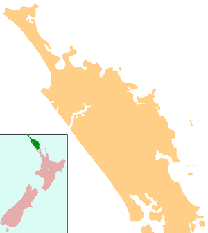
Pakotai | |
|---|---|
 Pakotai | |
| Coordinates: 35°41′20″S 173°54′0″E | |
| Country | New Zealand |
| Region | Northland Region |
| District | Whangarei District |
Copper was mined at Pakotai from 1947 to 1951.[3]
Marae
The village has two local marae affiliated with the Ngāpuhi hapū of Ngāti Horahia, Ngāti Moe, Ngāti Te Rino, Ngāti Toki, Te Kumutu, Ngāti Whakahotu and Te Parawhau: Te Oruoru Marae, and Te Tārai o Rāhiri Marae and Nukutawhiti meeting house.[4][5]
Education
Pakotai School is a coeducational full primary (years 1-8) school with a decile rating of 2 and a roll of 24.[6] The school was founded in 1905.[7][8]
Notes
- Peter Dowling (editor) (2004). Reed New Zealand Atlas. Reed Books. pp. map 7. ISBN 0-7900-0952-8.CS1 maint: extra text: authors list (link)
- Roger Smith, GeographX (2005). The Geographic Atlas of New Zealand. Robbie Burton. pp. map 23. ISBN 1-877333-20-4.
- "Mining and Mineral Resources - Other Metallic Ores". Encyclopedia of New Zealand (1966).
- "Māori Maps". maorimaps.com. Te Potiki National Trust.
- "Te Kāhui Māngai directory". tkm.govt.nz. Te Puni Kōkiri.
- "Te Kete Ipurangi - Pakotai School". Ministry of Education.
- "Pakotai School 100 Year Centenary". Education Gazette New Zealand. 84 (7). 25 April 2005. Archived from the original on 16 October 2008.
- Gail Rika, Rene Baker (1980). Te Oruora Pakotai School: 75 Years 1905-1980.
This article is issued from Wikipedia. The text is licensed under Creative Commons - Attribution - Sharealike. Additional terms may apply for the media files.