Pano Zodeia
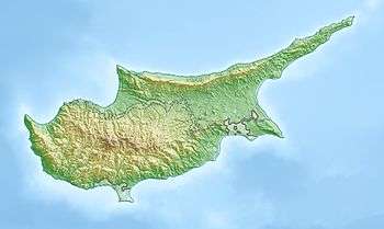
Pano Zodeia (Greek: (η) Πάνω Ζώδεια; Turkish: Yukarı Bostancı) is a village on the island of Cyprus, east of Morphou. De facto, it is under the control of Northern Cyprus.[2]
Pano Zodeia | |
|---|---|
 Pano Zodeia | |
| Coordinates: 35°09′49″N 33°00′57″E | |
| Country (de jure) | |
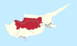
| • District | Nicosia District |
| Country (de facto) | |
| • District | Güzelyurt District |
| Time zone | UTC+2 (EET) |
| • Summer (DST) | UTC+3 (EEST) |
Green Line crossing
Pano Zodeia is the location of one of six Green Line crossings between the Republic of Cyprus and Northern Cyprus. The town on the Republic side of the border is Astromeritis. The crossing is only for vehicular traffic. It was opened on 31 August 2005.
References
- In 1983, the Turkish Republic of Northern Cyprus unilaterally declared independence from the Republic of Cyprus. The de facto state is not recognised by any UN state except Turkey.
- "PANO ZODEIA". www.prio-cyprus-displacement.net. Archived from the original on 2018-09-03. Retrieved 2018-09-03.
| Settlements | 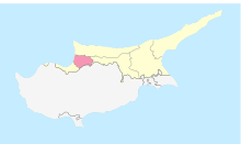 | |
|---|---|---|
This article is issued from Wikipedia. The text is licensed under Creative Commons - Attribution - Sharealike. Additional terms may apply for the media files.