Pandavapura
Pandavapura is a Municipality Town in Mandya district in the Indian state of Karnataka.
Pandavapura | |
|---|---|
city | |
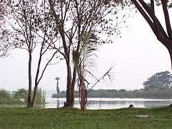 Pandavapura Lake | |
| Coordinates: 12.5°N 76.67°E | |
| Country | |
| State | Karnataka |
| District | Mandya |
| Population (2001) | |
| • Total | 18,236 |
| Languages | |
| • Official | Kannada |
| Time zone | UTC+5:30 (IST) |
| Website | www |
Geography
Pandavapura is located at 12.5°N 76.67°E.[1] It has an average elevation of 709 metres (2326 feet). Earlier, Pandavapura was known as Hirode , Dandu , and French Rocks.
Demographics
As of 2001 India census,[2] Pandavapura had a population of 18,236. Males constitute 51% of the population and females 49%. Pandavapura has an average literacy rate of 67%, higher than the national average of 59.5%: male literacy is 72%, and female literacy is 62%. In Pandavapura, 12% of the population is under 6 years of age.
History
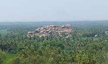
The name Pandavapura means "Town of Pandavas". Mythology states that the Pandavas during their period of exile stayed here for some time, and Kunti, mother of the Pandavas, liked the hillock so much that it became one of her favorite haunts. The town is also named after the Pandavas because of their brief stay in this region. The name "French Rock" dates back to India's Pre-Independence days, the place was used as the camping ground by the French army, which came to help Tippu Sultan in his war against the British. It is believed that French named the small town as "French Rocks", as the town is in the vicinity of two rocky hills. After Indian Independence, these rocky hills called as "Kunti Betta" by locals. There was another smaller hill called "Kauravara betta" on the western side of the town which has been mined out of existence for its stones.
Pandavapura is approximately 130 km from Bangalore and 25 km from Mysore.
About the Town
Pandavapura town is surrounded by beautiful paddy and sugar cane fields. Agriculture is the main occupation around the town. The town is surrounded by many villages and the town is the central point for farmers everyday business. Every Thursday, a farmer's market (called as "Santhe" in Kannada) is held in the heart of the town, where farmers directly sell their agricultural products. Apart from agricultural products, you can also find handicrafts, ayurvedic products etc., Surrounding villages have Jaggery manufacturing units and it is a nice experience to watch the process of making Jaggery out of sugar cane. The Visweswarayya Canal (VC Canal) flows in the heart of the town, by dividing the town into two halves. The water for this canal is sourced from the Krishnaraja Sagar (KRS), which is Reservoir across the river Cauvery.
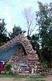
Harohalli French Cemetery
There is a French cemetery in Harohalli, in the outskirts of Pandavapura, where the French who came to aid Tipu Sultan are buried. The beautiful cemetery is more than 250 years old, has fallen into neglect and vandalism. The French soldiers and family members mostly died from malaria, fatigue or in battle. The land for the French cemetery was granted by Tippu Sultan. Only 35 graves remain, most in a bad state. Iron grilles, bricks, metal plaques and expensive marble have been removed from the graves, and many have no headstone.[3]
Transport
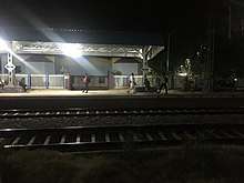
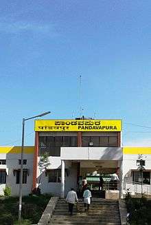
Pandavapura is well connected by trains and buses. Most of the trains which run between Bangalore and Mysore stop in Pandavapura. The Pandavapura railway station is 4 km away from the town. There are very few direct buses runs from Bengaluru to Pandavapura. However, travelers from Bengaluru can reach Mandya town by bus, and change for a Pandavapura bus at the Mandya KSRTC bus stand. The train is the best and easiest mode of transportation to Pandavapura from Bangalore. .[4]
Tourism
Pandavapura town is surrounded by well-known tourist spots.
Following are tourist spots:
1. Melukote
2. Krishnaraja Sagar
3. Kunti Hill (Near Pandavapura)
4. Kere Thonnur, Pandavapura.
5. Cauvery Sai Dharma. Riverside temple
6. Thotada Mane, paddy field picnic center.
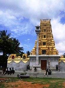
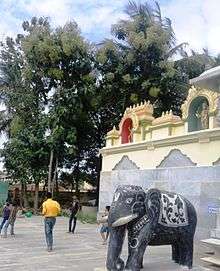
Temples
1. Mahankaleshwari temple (in town).
2. Subramanya temple (in town).
3. Chandramouleshwara temple (in town).
4. Vasalu Maramma (Near Harohalli)
5. Eluramma Thaayi (Katteri)
6. Sree Devi Manchamma Temple, hirode beedi, Pandavapura
7. KODI BAAYI ANJANEYA Swamy Temple (DUDDA GHATTA)
8. Aarathi Ukkada (Ahalya maathe Temple).
9. Sree Bhuvaraha Swamy Temple (Varahanatha Kallahalli-ganjigere KRS Back water)
10. Lakshmi Narayanaswamy Riverside Temple, Harohalli - 2 km from Pandavapura Town .
11. Sree Lakshmidevi Temple K.Bettahalli
12. Sri Krishna Temple Kere Thannur
13.Venugopala Swamy Temple (KRS Dam Back Water more than 100 years old
Educational Institutions
- Vijaya High School and Degree College. Vijaya High school is the oldest higher secondary institution in Pandavapura Taluk, established at the time of Indian Independence.
- STG Public School, Pandavapura.
- Government College Pandavapura.
- Kuvempu high school.
- Buds Foundation, Pandavapura.
- Nilgiris Convent, Pandavapura.
- Jnana bandhu vidyalaya, pandavapura
- Nirmala Convent , pandavapura
Image gallery
 Assumption Church
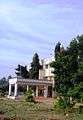 Taluk hospital
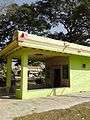 Amma Temple
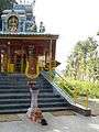 Temple on highway
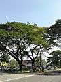 Mysore Road
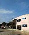 Bus Station
See also
Pandavapura
Areas of Pandavapura | ||||||||||
|---|---|---|---|---|---|---|---|---|---|---|
| ||||||||||
References
| Wikivoyage has a travel guide for Pandavapura. |
| Wikimedia Commons has media related to Pandavapura. |
- Falling Rain Genomics, Inc - Pandavapur
- "Census of India 2001: Data from the 2001 Census, including cities, villages and towns (Provisional)". Census Commission of India. Archived from the original on 16 June 2004. Retrieved 1 November 2008.
- B, Mahadeva (29 October 2013). "Uneasy lie the fallen here" (Bangalore). Dean Herald. Retrieved 22 January 2015.
- "Archived copy". Archived from the original on 6 March 2012. Retrieved 20 February 2013.CS1 maint: archived copy as title (link)