Panaitoliko
Panaitoliko (Greek: Παναιτωλικό) is a former municipality in Aetolia-Acarnania, West Greece, Greece. Since the 2011 local government reform it is part of the municipality Agrinio, of which it is a municipal unit.[2] The municipal unit has an area of 105.976 km2.[3] Population 1,386 (2011). The seat of the municipality was in Skoutera.
Panaitoliko Παναιτωλικό | |
|---|---|
 Panaitoliko Location within the regional unit 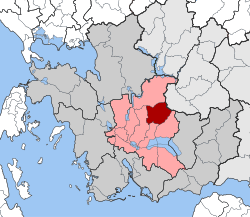 | |
| Coordinates: 38°41′N 21°29′E | |
| Country | Greece |
| Administrative region | West Greece |
| Regional unit | Aetolia-Acarnania |
| Municipality | Agrinio |
| • Municipal unit | 105.98 km2 (40.92 sq mi) |
| Elevation | 467 m (1,532 ft) |
| Population (2011)[1] | |
| • Municipal unit | 1,386 |
| • Municipal unit density | 13/km2 (34/sq mi) |
| Time zone | UTC+2 (EET) |
| • Summer (DST) | UTC+3 (EEST) |
External links
- Municipality of Panaitoliko (in Greek)
References
- "Απογραφή Πληθυσμού - Κατοικιών 2011. ΜΟΝΙΜΟΣ Πληθυσμός" (in Greek). Hellenic Statistical Authority.
- Kallikratis law Greece Ministry of Interior (in Greek)
- "Population & housing census 2001 (incl. area and average elevation)" (PDF) (in Greek). National Statistical Service of Greece.
This article is issued from Wikipedia. The text is licensed under Creative Commons - Attribution - Sharealike. Additional terms may apply for the media files.