Palivuk
Palivuk (Паливук) is a sparsely populated town in Bosnia and Herzegovina, Republika Srpska, Kotor-Varoš Municipality.[1] In 1991, the village had 391 residents,[2] but by 2013 that number had dropped to just 24 citizens.
Palivuk – Паливук | |
|---|---|
Village | |
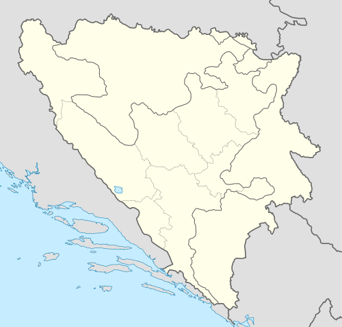 Palivuk – Паливук Location in Bosnia and Herzegovina | |
| Coordinates: 44.4311°N 17.6103°E | |
| Country | |
| Entity | Republika Srpska |
| Municipality | Kotor Varoš |
| Highest elevation | 710 m (2,330 ft) |
| Lowest elevation | 750 m (2,460 ft) |
| Population (2013) | |
| • Total | 24 |
| Time zone | Central European |
| Area code(s) | +387 (051) |
Geography
Palivuk is located on a conspicuous hill on the slopes of the right bank of the Vrbanja river in Bosnia-Herzegovina. It stands at an elevation of approximately 2,560 feet. The local roads are connected to the regional route R-540: Kruševo Brdo – Šiprage – Obodnik – Kotor Varoš – Banja Luka.[3][4][5]
History
The location of Palivuk is a very old settlement. It is believed that its history is related to events related to old indigenous Bosnian settlements in the valley of the Vrbanja River and Illyrian.
During World War II, the village took part in the resistance against Nazi occupation and was a small Yugoslav Partisan refuge in January 1944. The town received a large number of wounded resistance fighters who were evacuated from areas in the gorge around theCakewalk river (near Šiprage) during the Sixth enemy offensive. Because of Palivuk's distance and remoteness from larger local population centers, the village was a safe refuge for many residents of the region when the German Nazi forces advanced.
During the War in Bosnia (1992–95), Army of Republika Srpska (VRS) police and paramilitary forces demolished the surrounding Bosniaks villages. The demolition was particularly concentrated upstream from Palivuk, along the Vrbanja to Kruševo Brdo, as well as all Bosnian villages downstream to Banja Luka.[6][7][8][9][10] Many local residents were killed, and the majority were expelled from the region. After the end of the war in 1996, many Bosnian villages around Šiprage were partly restored via efforts from the new Government and the soldiers of Bhe ELUGA (battalion abbv. Belgium – Luxembourg – Greece – Austria);, with ctivities of EUFOR-SFOR-Missiona. However, Palivuk was not involved in theisprogram aofrenewal.[11][12][13][14][15][16][17]
Population
References
- "Općina Kotor Varoš". nasbih.com. Retrieved 2015-09-15.
- Zolić H. Ed. (1993): Knjiga: Nacionalni sastav stanovništva - Rezultati za Republiku po opštinama i naseljenim mjestima 1991. Izdanje Državnog zavoda za statistiku Republike Bosne i Hercegovine, Sarajevo.
- http://www.kartabih.com/
- Vojnogeografski institut, Izd. (1963): Šiprage (List karte 1:25.000, Izohipse na 10 m). Vojnogeografski institut, Beograd.
- Mučibabić B., Ur. (1998): Geografski atlas Bosne i Hercegovine. Geodetski zavod BiH, Sarajevo, ISBN 9958-766-00-0.
- Gutman R. (1993): A witness to genocide: The 1993 Pulitzer Prize-Winning Dispatches on the "Ethnic Cleansing" of Bosnia. Macmillan Publishing Company, Inc., New York, ISBN 9780020329954.
- Beč J. (1997): Pucanje duše. Samizdat B92, Beograd, ISBN 86-7208-010-6.
- "Archived copy". Archived from the original on 2015-12-26. Retrieved 2015-11-06.CS1 maint: archived copy as title (link)
- "Archived copy". Archived from the original on 2015-12-26. Retrieved 2015-11-06.CS1 maint: archived copy as title (link)
- Fena, Agencija (2013): Obilježavanje 21. godišnjice stradanja Bošnjaka u Kotor-Varoši – Još se traži 277 osoba. Avaz, 03. 11. 2013.
- http://www.euforbih.org/
- http://www.aimpress.ch/dyn/pubs/archive/data/199803/80307-001-pubs-sar.htm
- https://web.archive.org/web/20090424065325/http://www.nato.int/SFOR/
- http://www.military.ie/overseas/current-missions/eufor-sfor/
- https://web.archive.org/web/20150403215914/http://www.geetha.mil.gr/media/EIRINEYTIKES_DRASTIRIOTITES/english/12_Bosnia_Herzegovina_IFOR_SFOR.doc
- http://www.nato.int/sfor/organisation/mission.htm
- Zolić H. Ed. (1992): Book: "Nacionalni sastav stanovništva - Rezultati za Republiku po opštinama i naseljenim mjestima 1991.", statistički bilten br. 234, Izdanje Državnog zavoda za statistiku Republike Bosne i Hercegovine, Sarajevo.
- Internet – Source: "Popis po mjesnim zajednicama" - "Archived copy" (PDF). Archived from the original (PDF) on 2013-10-05. Retrieved 2013-10-05.CS1 maint: archived copy as title (link).