Pahiatua
Pahiatua is a rural service town in the south-eastern North Island of New Zealand with a population of 2,550. It is between Masterton and Woodville on State Highway 2 and the Wairarapa Line railway, 60 kilometres (37 mi) north of Masterton and 30 kilometres (19 mi) east of Palmerston North. It is usually regarded as being in the Northern Wairarapa. However, for local government purposes it is in the Tararua District part of the Manawatū-Whanganui region; which encompasses Eketahuna, Pahiatua, Woodvillle and Dannevirke.
Pahiatua | |
|---|---|
 | |
 Pahiatua | |
| Coordinates: 40°27′12″S 175°50′27″E | |
| Country | |
| Region | Manawatū-Whanganui |
| District | Tararua District |
| Founded | 1881 |
| Settled | 28 February 1882 |
| Incorporated (borough) | 25 July 1892 |
| Founded by | W. W. McCardle |
| Electorate | Wairarapa |
| Government | |
| • Mayor | Tracey Collis[1] |
| Elevation | 103 m (341 ft) |
| Population (June 2019)[2] | |
| • Total | 2,550 |
| Time zone | UTC+12 (NZST) |
| • Summer (DST) | UTC+13 (NZDT) |
| Postcode(s) | 4910 |
| Area code(s) | 06 |
| Website | [ ] |
Unusually for a town of its size Pahiatua has retained several amenities that were lost to similar towns around New Zealand in the 1980s and 1990s, in particular banking, postal services, and a cinema. The town is served by two banks, a post office, a supermarket, three schools (2 Primary, 1 Secondary),[3] a volunteer fire brigade,[4] and a public library.[5]
There are conflicting accounts of how the town acquired its name. When translated from Māori, the name Pahiatua means "god's resting place". The explanation accompanying this translation is that a chief fleeing from his enemies was led by his war god to this hill to seek refuge.[6] However, the town's founder, William Wilson McCardle, claims to have given it its name.[6][7]
History and culture
Township
The Wellington Land Board decided in December 1880 to offer land in the Pahiatua Block for settlement. This consisted of 12,000 acres (4,900 ha), of which 3,000 acres (1,200 ha) was offered on a deferred payment basis. Applications for the land closed in February the following year, but there seems to have been little interest at first. Sales of land from the original offer continued over the next few years.
The Pahiatua village was not a settlement initiated by the government, but rather one that had its origin in land speculation. Several subdivisions were established by private landholders including W. W. McCardle, H. Manns, A. W. and Henry Sedcole, and W. Wakeman. It is claimed that the first settlers were John Hall who arrived on 28 February 1881, followed by John Hughes the next day. These men, plus the brothers of Hughes and their families, comprised Pahiatua's population the first summer. Precisely when the town of Pahiatua came into being is not clear as it has not been established when McCardle's first land sale took place. However, by the summer of 1883 he was advertising grassed suburban sections, "improved" acres, and other unimproved lots. In November 1885 he sought to dispose of a large portion of one of his subdivisions at an auction in Napier.
Development of the land quickly produced results, and by August 1883 5,000 acres (2,000 ha) had been cleared, several hundred head of cattle were being grazed, and the population stood at 150. The efforts of the early settlers were sufficient to attract storekeepers and even a hotel.
The government belatedly decided to get involved and agreed to survey a township reserve in December 1882. They later changed their minds and postponed any decision, citing the need to wait for the final determination of the route of the railway. The settlers, also desirous of being close to the railway to improve land values, made strenuous efforts to have the line run through the town, but like their southern counterparts in Greytown, were ultimately unsuccessful. The legacy of this plan can be seen today in the unusual width of Pahiatua's Main Street which was designed to accommodate the railway down the centre. The intended railway reserve became a grassed median after it was decided to build the railway line to the west of the town.
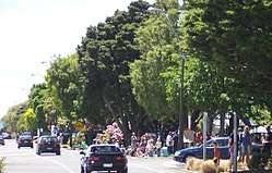
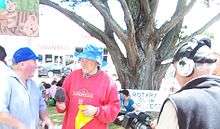
In 1981 Pahiatua celebrated its centennial with a weekend full of historical events, and in 2006 its 125th anniversary with a grand parade of 125 floats, vehicles and horses.
Refugees
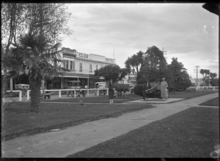
.jpg)
the camp in 1944
On 1 November 1944 838 Polish refugees, of which 733 were children, were sent to a refugee camp about 2 kilometres (1.2 mi) south of the town. The camp had been used as an internment camp for foreigners at the start of World War II. The settlement was expected to be a temporary measure, but with the rise of communism in eastern Europe after the end of the war, the refugees stayed on at the camp until 1949 at which point they were naturalised.[8][9][10]
In 1951 the camp was used for over 900 refugees from Eastern Europe.
In 2004 the New Zealand Polish community celebrated its 60th anniversary and the 65th anniversary celebrations were held in 2009 at which former Polish president Lech Wałęsa was to have been the guest of honour.[11][12] The local museum opened a new exhibit in 2017 to tell the story of the refugees' experience in New Zealand.[13]
Hospital
Pahiatua had its own hospital, located on a site at the southern end of the town, since 1902. In November 1997 the hospital, then under the jurisdiction of Palmerston North-based Mid Central Health, was informed that it would soon close as the Health Funding Authority could no longer afford to keep it open. This was despite numerous assurances given to the town from 1992 by successive health authorities that the hospital was in no danger of being closed. The closure date was set at 30 June 1998, by which time the only services offered by the hospital were an x-ray department, maternity, a general ward, and geriatric, palliative, convalescent, and rehabilitation care. However, part of the complex remained open until the last patients could be relocated to a new facility at Waireka Home that was still under construction.[14]
Politics
The residents of Pahiatua were politically active from early on, advocating for their own Roads Board around June 1883. By August 1886 Pahiatua had gained town district status and only two years later, in October 1888, the Pahiatua County Council was established. The town was constituted as a borough on 25 July 1892.[15] The council remained the political master of the town and surrounding area until the local government reforms of 1989 merged the town into the Tararua District Council.
At central government level, Pahiatua was located in the Wairarapa seat until 1881, at which point the electorate was split into Wairarapa North and Wairarapa South (later to become Masterton and Wairarapa respectively in 1887). Part of the Masterton seat was divided off into the new Pahiatua seat in 1896 which remained the political home of Pahiatua until the electorate was amalgamated with the Wairarapa seat in 1996.
Natural disasters
Pahiatua was the location of one of New Zealand's most powerful earthquakes when on 5 March 1934 a magnitude 7.6 quake struck at Horoeka. It was felt as far away as Auckland and Dunedin.[16][17]

Demographics
Historical population counts show a steady increase in the size of the town throughout most of the 20th century.
| Population | 1886 | 1896 | 1906 | 1926 | 1945 | 1961 | 1975 |
|---|---|---|---|---|---|---|---|
| Pahiatua | 473 | 1158 | 1370 | 1477 | 1749 | 2578 | 2630 |
As of the 2013 census, Pahiatua had a resident population of 2,412 residents in 990 dwellings. This was a decrease of 147 people since the previous census. Of these, 1,089 were male and 1,320 were female, while 20.9% were aged 65 or over and 22.1% were aged under 15 years.[20]
Pahiatua is one of several northern-Wairarapa towns to have experienced an increase in popularity as a place to live as evidenced by a 43% increase in average residential property prices between 2005 and 2008.[21] The ethnic composition of the population was European, 86.0%; Māori, 21.5%; Pacific Islanders, 1.8%; Asian, 2.4%; Middle Eastern/Latin American/African, 0.3; Other, 2.6%.[20]
Economy
The economy is based on support for sheep and beef farming and the dairy industry with the Fonterra Dairy factory and Tui Brewery both located on the outskirts of the town.
The Pahiatua dairy factory is a significant employer in the area. It was origianlly commissioned by the Tui Dairy Company in 1976; Tui merged with Hāwera-based Kiwi Dairies in 1996, who in turn merged with the New Zealand Dairy Group in 2001 to form Fonterra.[22] Other major employers include Betacraft and the Tui Brewery at Mangatainoka.[9]
Transportation
The town's public transport now consists of a single trip from Tuesday to Friday and on Sunday Masterton – Palmerston North and return bus service (with an extra service on Fridays) run by Tranzit Coachlines.[23]

An electric tramway system was considered for Pahiatua but never constructed.[24]
Rail transport to Pahiatua was available from 3 May 1897 when the town's railway station opened, marking the completion of the Wairarapa Line as far north as the town. The line was completed through to Pahiatua's northern neighbour, Woodville, several months later on 11 December 1897. Improvements made to the region's road network in the latter half of the 20th century led to a decline in the popularity of rail for public transport. The service was finally withdrawn in 1988 when the last passenger train between Palmerston North and Masterton stopped at Pahiatua on Friday, 29 July.[25]
Pahiatua is the home of the Pahiatua Railcar Society, a non-profit railway heritage organisation based at the town's railway station, whose purpose is to preserve and restore to working order railcars formerly in revenue service on New Zealand's railway network. Some of the notable vehicles in their collection include a Standard class railcar (RM31), a Wairarapa class railcar (RM5), and a Twin Set railcar (RM121). The society leases the railway station from KiwiRail and opens their museum to the public once a month.
Healthcare
Healthcare in Pahiatua used to be provided via private doctor's clinics and the town's hospital. Following the closure of the hospital in 1998, hospital-level care has been provided at Palmerston North hospital as the town is in the jurisdiction of Mid Central Health.[14]
Also subsequent to the closing of the town's hospital was the establishment of the Pahiatua Medical Centre which now dispenses general practice health care to the town's residents and, via outreach clinics, to residents of Eketahuna and Woodville. It is run by the Tararua PHO (Primary Health Organisation).[26]
The old Pahiatua hospital complex has been refurbished and converted into a private conference and accommodation business called Masters Hall.[27]
Communications
The area code for Pahiatua is 06 as for telecommunications purposes it is part of the Manawatu-Wairarapa-Hawkes Bay region in the lower North Island. Local numbers generally begin with 376, with the next digit being 0, 6, 7 or 8.
Broadband internet is available to customers in Pahiatua using digital subscriber line technology. Incumbent telecommunications operator Telecom is planning to upgrade their infrastructure in Pahiatua, which will improve the delivery of broadband internet services, by October 2011.[28]
The Tararua District Council formed an alliance with the telecommunications companies Inspire Net, Inspired Networks, Digital Nation and FX Networks to link the four major towns in its jurisdiction to Palmerston North with a fibre optic cable. The link between Palmerston North and Pahiatua was expected to go live on 31 July 2008.[29] The service is now available to some rural residents and urban customers.[30]
Tararua College is one of 14 schools nationwide set to become the first to benefit from the government's broadband in schools initiative. Funding of $34 million has been allocated for the programme, of which the schools will receive $5 million for upgrades to their information technology equipment.[31]
Media
Free-to-air television broadcasts are available in Pahiatua, including the major national channels offered by TVNZ and Prime from Sky Television. Also available is digital television from both Sky Television (via satellite) and Freeview (either via UHF terrestrial broadcasts or by satellite).
Pahiatua is the home of regional television station Tararua Television. The founders Hart Udy and Jonathan McLean had a vision to broadcast free-to-air family-friendly television programs and the vision came to life. The channel began in a studio at Tararua College in 2004 and officially opened by Martin Matthews CEO of Culture and Heritage. The studio then moved to Pahiatua Christian Fellowship where they produced their first live program, celebrating their first birthday. At that time, TTV was broadcasting to an audience of approximately 5,000 in Pahiatua and Woodville. A local fund-raising effort enabled the station to increase its coverage to Palmerston North, Foxton, Bulls, Marton, Feilding and Ashhurst and a ceremony to mark the occasion was held on 1 May 2008.[32]
With the switch off of analogue television services within the Manawatu-Whanganui Region on 29 September 2013 and to ensure business continuity, Tararua Television has secured resource consent and licensing to broadcast on DTV27 via Freeview from its own stand-alone transmission site on Wharite capturing a potential primary audience in excess of 133,000 throughout the Manawatu-Whanganui Region predominantly in the Manawatu, Horowhenua, Rangitikei and Tararua districts. From small beginnings Tararua Television continually strives to succeed and grow within an environment dominated by mainstream television and today is a force to be reckoned with. Locally owned and operated Tararua Television provides an alternative viewing platform of locally produced community-focused and family-safe television programmes from throughout the region that involve the community yet are non-judgmental. Tararua Television is a member of the Regional Broadcasters Association (RTB) and is the only regional television station between Nelson in the south to Hawke's Bay in the East and Central TV Matamata in the North.
Education
Tararua College, a co-educational state secondary school, is located in Pahiatua.[33][34] It was established in 1960,[35] and has a roll of 387 as of March 2020.[36]
Pahiatua School is a co-educational state primary school,[37][38] with a roll of 403.[39]
St Anthony's School is a co-educational state-integrated Catholic primary school,[40][41] with a roll of 91.[42]
A consultation document proposing the reorganisation of educational facilities in the Tararua District was released by the Bush Education Plan working group in July 2009. Amongst its recommendations was the closure of several schools in the district, such as Hillcrest School, and for their rolls to be merged into other schools such as Pahiatua School.[43] The plan was scrapped a month later when the working group was dissolved after a vitriolic response from local residents and a statement from the Minister of Education that she had no plans to close any schools in the region against the wishes of the local community.[44]
See also
References
- "Meet your Mayor". Tararua District Council. Retrieved 5 April 2017.
- "Subnational Population Estimates: At 30 June 2019". Statistics New Zealand. 22 October 2019. Retrieved 11 January 2020.
- "School Directory". Ministry of Education. Archived from the original on 8 July 2009. Retrieved 1 July 2009.
- "Pahiatua Volunteer Fire Brigade". New Zealand Fire Service. 15 August 2008. Archived from the original on 22 October 2008. Retrieved 1 July 2009.
- DUFF, MICHELLE (15 December 2009). "Library cover charge hits membership numbers". Manawatu Standard. Palmerston North: Fairfax New Zealand. Retrieved 27 December 2009.
- Reed, A. W. (2010). Peter Dowling (ed.). Place Names of New Zealand. Rosedale, North Shore: Raupo. p. 299. ISBN 9780143204107.
- Cyclopedia Company Limited (1897). "Old Settlers, &C". The Cyclopedia of New Zealand : Wellington Provincial District. Wellington: The Cyclopedia of New Zealand. Retrieved 29 June 2012.
- Roy-Wojciechowski, John (July 1999). "Pahiatua Children". Auckland: Consulate of the Republic of Poland in New Zealand. Archived from the original on 1 August 2009. Retrieved 29 June 2009.
- DYKES, MERVYN (11 May 2009). "Forever Pahiatua". Manawatu Standard. Palmerston North: Fairfax New Zealand. Retrieved 29 June 2009.
- "The Polish Children's Camp in Pahiatua". New Zealand Electronic Text Centre. Victoria University of Wellington. Retrieved 30 June 2009.
- DONOGHUE, TIM (3 September 2009). "Former Polish president to visit Wellington". The Dominion Post. Wellington: Fairfax New Zealand. Retrieved 16 October 2009.
- LOTTER, MICHELLE (5 November 2009). "Polish past revealed". North Shore Times. Auckland: Fairfax New Zealand. Retrieved 27 December 2009.
- "Museum tells the story of 700 Polish Kiwis". Stuff. Fairfax New Zealand. 7 September 2017. Retrieved 7 September 2017.
- FORDE, RACHEL (18 July 1998). "Pahiatua hospital loses its brave fight for survival". Wairarapa Times-Age. Masterton: APN News & Media. Archived from the original on 19 August 2007. Retrieved 29 June 2009.
- Davis, Brian Newton; Dollimore, Edward Stewart (18 September 2007). "PAHIATUA". Te Ara – The Encyclopedia of New Zealand. Ministry for Culture and Heritage. Retrieved 29 June 2009.
- "NZ's biggest quakes". Fairfax New Zealand. 4 September 2010.
- "'No big quakes for 7000 years'". The Dominion Post. Wellington: Fairfax New Zealand. 15 February 2008.
- "Te Kāhui Māngai directory". tkm.govt.nz. Te Puni Kōkiri.
- "Māori Maps". maorimaps.com. Te Potiki National Trust.
- 2013 Census QuickStats about a place : Pahiatua
- "Eketahuna leads the way in Tararua towns' rising popularity". Manawatu Standard. Palmerston North: Fairfax New Zealand. 22 October 2008. Retrieved 27 December 2009.
- McKay, Christine (25 June 2015). "Dairy plant shapes up as world leader". NZ Herald. ISSN 1170-0777. Retrieved 14 June 2020.
- "MPN Palmerston North – Masterton". Timetables. Metlink. Archived from the original on 23 May 2010. Retrieved 7 January 2010.
- Stewart, Graham (1993) [1973]. "The Final Spread of the Steel Web". In Rogers, Anna (ed.). The End of the Penny Section: When Trams Ruled the Streets of New Zealand (Revised enlarged ed.). Wellington: Grantham House Publishing. p. 101. ISBN 1-86934-037-X.
- Churchman & Hurst 2001, p. 160.
- "Pahiatua Medical Centre". Central Health. 28 June 2009. Retrieved 29 June 2009.
- "Run-down Pahiatua Hospital has been reborn". Manawatu Standard. Palmerston North: Fairfax New Zealand. 13 December 2008. Retrieved 29 June 2009.
- "Region to get speedier internet". Manawatu Standard. Palmerston North: Fairfax New Zealand. 27 September 2008. Retrieved 27 December 2009.
- "Cabling depends on money". Manawatu Standard. Palmerston North: Fairfax New Zealand. 26 June 2008. Retrieved 29 June 2009.
- MILLER, GRANT (12 September 2009). "Super fast and a super help". Manawatu Standard. Palmerston North: Fairfax New Zealand. Retrieved 22 September 2009.
- "Tararua College to get a broadband boost". Wairarapa Times-Age. APN News & Media. 17 September 2009. Archived from the original on 20 July 2011. Retrieved 18 September 2009.
- "Tararua TV widens reach". Manawatu Standard. Palmerston North: Fairfax New Zealand. 2 May 2008. Retrieved 29 June 2009.
- "Tararua College Official School Website". tararuacollege.school.nz.
- "Tararua College Ministry of Education School Profile". educationcounts.govt.nz. Ministry of Education.
- "Tararua College 50th Jubilee Reunion". Pahiatua: Tararua College. May 2009. Archived from the original on 22 March 2009. Retrieved 29 June 2009.
- "Tararua College Education Review Office Report". ero.govt.nz. Education Review Office.
- "Pahiatua School Official School Website". pahiatua.school.nz.
- "Pahiatua School Ministry of Education School Profile". educationcounts.govt.nz. Ministry of Education.
- "Pahiatua School Education Review Office Report". ero.govt.nz. Education Review Office.
- "St Anthony's School Official School Website". stanthony.ac.nz.
- "St Anthony's School Ministry of Education School Profile". educationcounts.govt.nz. Ministry of Education.
- "St Anthony's School Education Review Office Report". ero.govt.nz. Education Review Office.
- JACKSON, LAURA; KATIE CHAPMAN; JANINE RANKIN (30 July 2009). "Schools fight to survive". Manawatu Standard. Palmerston North: Fairfax New Zealand. Retrieved 3 August 2017.
- CHAPMAN, KATIE (18 August 2009). "Tararua schools avoid the axe". The Manawatu Standard. Palmerston North: Fairfax New Zealand. Retrieved 3 August 2017.
Further reading
- Bagnall, A. G. Wairarapa: An Historical Excursion. Masterton: Hedley's Bookshop for the Masterton Trust Lands Trust.
- Churchman, Geoffrey B; Hurst, Tony (2001) [1990, 1991]. The Railways of New Zealand: A Journey through History (Second ed.). Transpress New Zealand. ISBN 0-908876-20-3.