Pärnu Bay
Pärnu Bay (Estonian: Pärnu laht) is a bay in the northeastern part of the Gulf of Livonia (Gulf of Riga), in southern Estonia.
| Pärnu Bay | |
|---|---|
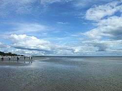 View of the bay in Pärnu. | |
| Coordinates | 58°18′00″N 24°24′00″E |
| Native name | Pärnu laht |
| River sources | Pärnu |
| Ocean/sea sources | Gulf of Riga, Baltic Sea |
| Surface area | 400 km2 (150 sq mi) |
| Max. depth | 12 m (39 ft) |
| Salinity | 5.5 ppm |
| Shore length1 | 140 km (87 mi) |
| Settlements | Pärnu |
| 1 Shore length is not a well-defined measure. | |
Geography
It has an area of 411 km².[1] The maximum depth in the mouth of the bay is 12 m.[2] The banks are low-lying, sandy in some places. The salinity of the water in the bay is 0-0,8 ppm in the spring and up to 5.5 ppm in autumn.
There are several rivers flowing into the gulf, the largest is the Pärnu River.
The bay is also Estonia's most important coastal fishing area.[2]
References
- Pärnu River Basin Management Plan Retrieved May 8, 2015.
- "Pärnu laht". Eesti Entsüklopeedia (in Estonian). Archived from the original on 1 May 2018. Retrieved 8 May 2015.
This article is issued from Wikipedia. The text is licensed under Creative Commons - Attribution - Sharealike. Additional terms may apply for the media files.