Otsego Lake (New York)
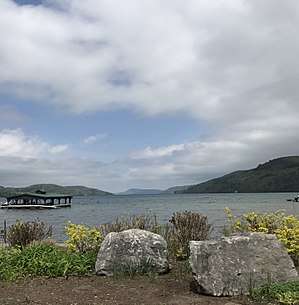
Otsego Lake is a 4,046-acre (16.37 km2) lake located in Otsego County in the U.S. State of New York. It is the source of the Susquehanna River and largest lake in Otsego County.[1][2] The Village of Cooperstown is located at the lake's southern end. Glimmerglass State Park is located on the lake's northeastern shore, and includes Hyde Hall, a large mansion constructed in 1817 that overlooks the lake. Glimmerglass Opera is located on the western shore.[4][5][6]
| Otsego Lake | |
|---|---|
.jpg) | |
 Otsego Lake Location within New York  Otsego Lake Otsego Lake (the United States) | |
| Location | Otsego County, New York, United States |
| Coordinates | 42°45′23″N 74°53′46″W[1] |
| Primary inflows | Hayden Creek, Shadow Brook, Trout Brook, Cripple Creek, Leatherstocking Creek, Willow Brook, Mohican Brook, Brookwood Creek, Glimmer Glen Creek |
| Primary outflows | Susquehanna River |
| Catchment area | 74 sq mi (190 km2)[2] |
| Basin countries | United States |
| Max. length | 7.8 mi (12.6 km) |
| Surface area | 4,046 acres (16.37 km2) |
| Average depth | 82 ft (25 m) |
| Max. depth | 167 ft (51 m) |
| Water volume | 117,000,000,000 US gal (440,000,000 m3)[3] |
| Surface elevation | 1,191 feet (363 m)[1] |
| Islands | Sunken Island (sunken), Eel Island (sunken) |
| Settlements | Cooperstown, New York |
The lake takes its name from the Iroquois Indians, who inhabited the area around the lake in and before the 17th cemtury. The name Otsego is from a Mohawk or Oneida word meaning "place of the rock", referring to the large boulder near the lake's outlet, today known as Council Rock.
Description
Otsego Lake is 7.8 miles (12.6 km) long with a surface area of 4,046 acres (16.37 km2). Its average depth is 82 feet (25 m), with a maximum depth of 167 feet (51 m). The northern roughly 2 miles (3.2 km) of the lake is in the town of Springfield and the southern part in the town of Otsego, and bordered by the town of Middlefield on the eastern shore.[7]
It is geologically related to the Finger Lakes, as they were both carved by glaciers, but is not counted among them.[8] One difference is that Otsego Lake is situated at a higher elevation (1,191 feet [363 m])[1] than the Finger Lakes (approximately 400 feet [122 m]). Another difference is the Finger Lakes are part of the Lake Ontario watershed, and Otsego is part of the Susquehanna River watershed.[9][10]
Council Rock

Located near the shore of Otsego Lake in Cooperstown is Council Rock, a large boulder whose top is above the water's surface and can be seen from shore. At low water, the oval rock rises approximately 4.5 feet (1.4 m) above the water, and is about nine feet (2.7 m) long by six feet (1.8 m) wide. It is believed to have been a meeting place for Native Americans prior to the American Revolutionary War.[11]
A small parcel of land near Council Rock was presented to the Village of Cooperstown in 1957, on the condition that it remain open to the public as a park. The park, today known as Council Rock Park, also includes a set of concrete steps leading to a lake-level terrace that was built in 1937.[12]
Sunken Islands
Sunken Island is a submerged sandy plot located near the western shore of Otsego Lake, approximately 6 miles (9.7 km) north from Cooperstown.[13] It is the supposed remains of an island described in the writings of James Fenimore Cooper upon which a structure once stood. Today Sunken Island is several feet below the surface of the lake and is marked with 4 buoys to prevent boats from running aground. Another sunken island, Eel Island, is located approximately 7 miles (11 km) north of Cooperstown. It is much deeper than the other sunken island.
Lakefront park
Lakefront park is located in the village of Cooperstown on the lake and is accessed by Pioneer Street, Lake Street or Fish Road. At this park are benches to sit at and view the lake and a stage where concerts are held in the summer months. From lakefront park, Mount Wellington is visible at the other end of the lake. Viewing this mountain from here makes it looks like a "sleeping lion" which is its nickname. Also located in the park are the village docks where spaces can be rented to dock a boat. Most of the docks were damaged in the floods of 2011 and some have since been replaced.[14]
Bays
There are many bays on Otsego Lake and four of them are named. One is Blackbird Bay which located on the south end of the lake in the Village of Cooperstown. The next bay north of Blackbird Bay is Muskrat Cove which is located north of Cooperstown. It is named Muskrat Cove because it was a great place to catch muskrat in the past. Waterlily Bay is a bay located north of Muskrat Cove. It is named Waterlily Bay due to the high amount of water lily in the bay. Then on the northern end of the lake is Hyde Bay. Glimmerglass State Park is located in this bay. Hyde Bay is named after the Hyde family.[15][16]
Points
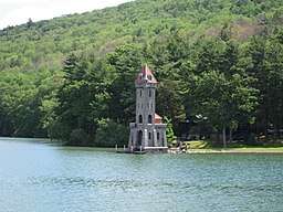
There are many points on Otsego Lake and many of them are named. Brookwood Point is a projection into the west side of the lake located north of Cooperstown. Three Mile Point is a projection located north of Brookwood Point. Five Mile Point is a projection located north of Three Mile Point. Mohican Brook enters Otsego Lake at Five Mile Point. Six Mile Point is a projection located north of Five Mile Point. Hutter Point is a projection located north of Six Mile Point. Point Judith is a projection into the east side of the lake. Point Judith is the location of the historic Kingfisher Tower. It was originally called Two Mile Point, but the point's present name is named after Judith Hutter from The Deerslayer. Point Florence is a projection located north of Point Judith. Cherry Tree Point is a projection located north of Point Florence. Gravelly Point is a projection located north of Cherry Tree Point. Peggs Point is a projection located north of Gravelly Point. Clarke Point is a projection into the north end of the lake on the south end of Mount Wellington.[15][17][18][19][20][21][22][23][24][25][26][27][15][28]
Adjacent mountains
One mountain near the lake is Mount Wellington, which located on the north end of the lake, east of Hyde Bay. Red House Hill is located on the west side of the lake, west of Six Mile Point. Mount Ovis is located on the west side of the lake behind the Farmer's Museum. Mount Vision is located on the east side of the lake by the south end.[15][29][30]
History
Natural history
Between 10,000 and 12,000 years ago, the Wisconsin glaciation filled the valley. Otsego Lake was formed when a tongue of the continental glacier scoured out the Susquehanna River Valley and the Finger Lakes Region. As the glaciers melted slowly, they filled in the valley they carved out. The Glacier exposed limestone which has protected the lake by neutralizing the effects of acid rain. The limestone in the watershed are dissolved by the waters flowing into it, then settles to the lake bottom as white marl.[31]
Human history
Before European colonization, Iroquois Indians inhabited the area around the lake. The name Otsego is from a Mohawk or Oneida word meaning "place of the rock", referring to the large boulder near the lake's outlet,[32] today known as "Council Rock".
Pieter Quackenboss, Jr (1710–1774), an early settler of the Mohawk Valley, dealt extensively with the natives and became known as "The Old Indian Trader." The following incident in his life is recorded in the 1848 book Women of the American Revolution:
Pieter Quackenboss was among the early settlers of the [Montgomery] County, and did not escape the difficulties. He was a trader with the Indians, who placed great confidence in him, frequently consulting him. They were disposed to bestow on him some particular mark of regard, and after meeting for consultation, they decided on giving him the name " Otsego" and christening the lake for him. The ceremony of naming both him and the lake was performed by pouring liquor upon his head as he knelt on the ground, a portion being afterwards poured into the water. It is probable that few are acquainted with this origin of the name of Otsego Lake; but that family tradition has been confirmed by the recollection of some who witnessed the occurrence.[33]

Early in 1779, General James Clinton and his soldiers, began to haul 208 boats and all their supplies from the present day Villages Fort Plain and Canajoharie, along the Mohawk River, towards Otsego Lake. By the end of June they had made it to the lake and began to build a temporary dam at the outlet to raise the water level. The purpose of this was to break the dam and ride the flood water down the river to meet General John Sullivan at Tioga. This event is described by James Fenimore Cooper in the introduction to his popular novel The Pioneers, and commemorated by a Memorial Day canoe race.[34][35][36]
In 1785, William Cooper settled at the south end of the lake and founded the settlement that was to become Cooperstown. A few years after settling there was a food shortage. Cooper stated:
A singular event deemed sent by a good Providence to our relief; it was reported to me that unusual shoals of fish were seen moving in the clear waters of the Susquehanna. l went, and was surprised to find that they were herrings (probably American shad, Alosa sapidissima). We made something like a small net, by the interweaving of twigs, and by this rude and simple contrivance we were able to take them in thousands. In less than two days each family had an ample supply.
In 1870, Elihu Phinney built a fish hatchery at Three Mile Point, and over the next few years many thousands of fish were stocked. At this time, commercial transportation on the lake was developed to facilitate access between rail traffic in the Catskill area and that from Albany to Buffalo via rail and the Erie Canal.
Watershed
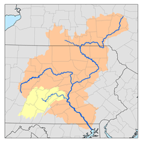
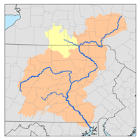
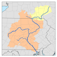
The Otsego Lake watershed covers approximately 75 square miles (190 km2) includes parts of the Towns of Otsego, Springfield, Middlefield, Warren and Richfield in the counties of Herkimer and Otsego in the State of New York. It is the headwaters of the 27,510 square miles (71,300 km2) drainage basin of the Susquehanna River which runs from Otsego Lake in Cooperstown to Havre de Grace where it flows into the Chesapeake Bay of the Atlantic Ocean. The lake is the drinking water source for the Village of Cooperstown and residents who live along the lake shores.[3][37]
The Biological Field Station regularly takes phosphorus sample around the lake. Tributaries to the lake are the major source of phosphorus, contributing 75-88 percent. Shadow Brook contributes the highest, with Hayden Brook being the next highest. Rain and snow contribute 8-15 percent and on-site septic systems contribute 4-10 percent. There is also evidence of some internal recycling of phosphorus from the lake's bottom.[38]
Conservation and management
In 1968, access to the lake and a location to build a field station and biological research facility were acquired by SUNY Oneonta. Also at this time, the Otsego County Conservation Association (OCCA) was formed by a group of local landowners and sportsmen concerned about the water quality. They work closely together to develop their water quality agendas. The main laboratory is located on the west shore of the lake just north of Cooperstown. Further north on the lake is the Thayer Farm, where the boathouse is located, that houses their research boats.[39] Also the Otsego Lake Association, a not for profit group, makes sure that the Otsego Lake Watershed Management Plan is enforced.[40]
Invasive species
Zebra mussels were first introduced into the Great Lakes in the mid- to late-1980s from ballast discharged from freighters originating in the Black and Caspian Sea region of eastern Europe and western Asia. They first became established in Otsego Lake in 2007, and by 2010 carpeted most of the lake trout spawning areas. The mussels impact fry numbers by covering shallow rocky shoals, deep water rocks as well as exposed stony lakeshores were they spawn. The mussels, in high densities, block eggs from being protected in the rocks, making the eggs more vulnerable to predators.[41] Native freshwater pearly mussels have also been negatively impacted by zebra mussels. Six different species of clams once occupied the soft bottoms, but as of 2016, no live clams were observed.[31] In a 2013 study of the lake, other invasive species were found, including eurasian milfoil, japanese knotweed, purple loosestrife, curly leaf pondweed, rusty crayfish, and starry stonewort were all found.
Pollution
When Glimmerglass State Park opened in the late 1960’s, its sand-filter, wastewater treatment system entered the lake through Shadow Brook. The old system, allowed some pollutants to pass, which contributed to increased nutrient levels in the lake. By 1977, a new filtration system was built at the state park. Eutrophic indicators decreased from 10.4 percent relative abundance in 1973 to 1.4 percent relative abundance in 1981. By 1988, there were significant reductions in phosphorus concentrations as well. Then between 1988 and 1994, total phosphorus concentration increased, which was associated with old septic systems around the lake and the runoff from farms and forests, especially in the Cripple Creek, Hayden Creek and Shadow Brook drainage areas. As a result, a ban on phosphate-containing detergents was enacted.
Recreation
Fishing
On Otsego Lake lake trout are the main species targeted by fisherman, as well as walleye and yellow perch. The lake also supports an exceptionally large smallmouth bass population. Other fish species present in the lake are brown trout, rock bass, largemouth bass, chain pickerel, Otsego bass, bluegill, redfin pickerel, pumpkinseed, and landlocked atlantic salmon. The lake is stocked each year with approximately 5,000 brown trout that are 8 to 10 inches (20 to 25 cm) long, approximately 5,000 lake trout that are 8 to 9 inches (20 to 23 cm) long and between 40,000 and 80,000 walleye that are 2 to 3 inches (5.1 to 7.6 cm). Also 5,000 landlocked atlantic salmon that are 5 to 6 inches (13 to 15 cm) long are stocked biennially.[7] There is a boat launch at the south end of the lake maintained by the Village of Cooperstown and a boat launch at the north end of the lake that is only available to residents who live in the Town of Springfield, and is maintained by the Town of Springfield.[42][28] In 1990, the NYSDEC announced plans to build a boat launch at Glimmerglass State Park, which caused a debate on the use of power boats on the lake. Opponents of the new boat launch wanted all boats banned on the lake except those powered by paddle, sail or battery.[43] During the summer, there are multiple bass tournaments to show off who can catch the most impressive sized bass.[44]
Since the disappearance of alewife, the more balanced lake ecosystem has caused the rebound of yellow perch and walleye populations. In early 2017, SUNY Oneonta researchers installed transponder tags in 500 adult walleyes, as they were spawning in tributaries at the north end of the lake. Then a warmwater gill net survey was conducted to recapture tagged walleye for a population estimate. Yellow perch were the most numerous captured, followed by walleye. Just over 65 percent of walleye caught were legal to keep (≥ 15 inches (38 cm)). Smallmouth bass were the most numerous Centrarchid caught, with over 76 percent being legal (≥ 12 inches (30 cm)).[45]
Public swimming areas
Three Mile Point is a public swimming beach located three miles from Cooperstown along the western shore of Otsego Lake accessible via state highway 80. It is open June through August and offers changing rooms, a picnic area, and a pavilion.[46] Another swimming area is Fairy Springs and is located one mile from Cooperstown along the eastern shore of Otsego lake accessible via county road 31. It is open May through September and offers changing rooms, a picnic area, and a pavilion.[47] Another swimming area, Public Landing, is at the northern end of the lake located at the end of Public Landing Road. This swimming area is only open to residents who live in the Town of Springfield and has changing rooms and a picnic area.[48][49] Another area is Glimmerglass State Park. It is located in the Town of Springfield and is accessed by County Route 31. It offers a beach, many picnic areas and a few pavilions.
Appearances in literature
The lake was known to James Fenimore Cooper as Glimmerglass and was a principal feature in his novels The Pioneers, The Deerslayer, and Home as Found in which local landmarks such as Council Rock, Hutters Point, Gravelly Point, and Sunken Island are mentioned. The 1740-1745 historical novel chronicles the lake as being somewhat beyond the frontier, perhaps into French-controlled territory. When the novel was written in 1840, all of New York State was well within civilized territory. In the novel, The Pioneers Blackbird Bay is where Deerslayer rescues Ben Pump from drowning. Also in The Pioneers, the northern point that makes the Blackbird Bay is the location of an annual bass fishing expedition. In the novel The Deerslayer, Gravelly Point is the location where Deerslayer is fired upon by a Huron Indian, then Deerslayer returned fire and killed the Huron. In the novel The Deerslayer, Peggs Point is the location where Deerslayer and Hurry Harry first reach the shore of Otsego Lake. Also it is the location where Deerslayer departs the lake. Six Mile Point is the location in The Deerslayer that Natty Bumppo makes an unsuccessful effort to escape from the Hurons. In The Deerslayer, Three Mile Point is the location where Hetty Hutter docks to seek the Huron Indian camp which was further south at Muskrat Cove. In Home as Found, Three Mile Point is referred to as Fishing Point and is owned by the Effingham family.[15][50][51]
Otsego Lake is also referenced in The Secret of Mirror Bay, a novel in the Nancy Drew Mystery Stories series.[52]
See also
- List of lakes in New York

References
- "Otsego Lake". Geographic Names Information System. United States Geological Survey. Retrieved August 11, 2015.
- "Biological Field Station - About Otsego Lake". Oneonta.edu. SUNY Oneonta. 2015. Retrieved August 11, 2015.
- "New Lake Management Plan". www.oneonta.edu. SUNY Oneonta. April 1998. Retrieved June 19, 2019.
- "ALICE BUSCH OPERA THEATER". The Glimmerglass Festival. The Glimmerglass Festival. Archived from the original on July 2, 2015. Retrieved June 28, 2015.
- Hardy, Hugh (2013). Theater of Architecture. New York: Princeton Architectural Press. pp. 185–189.
- Anderson, Grace (1988). "Open-air opera". Architectural Record (August): 90–93.
- NYS Department of Environmental Conservation. "Otsego Lake". Dec.ny.gov. Retrieved August 11, 2015.
- ottohmuller.com. "Otsego Lake". ottohmuller.com. Retrieved March 24, 2019.
- NYS Department of Environmental Conservation. "Susquehanna River Watershed". Dec.ny.gov. Retrieved March 22, 2019.
- NYS Department of Environmental Conservation. "Oswego River/Finger Lakes Watershed". Dec.ny.gov. Retrieved March 22, 2019.
- Halsey, Francis Whiting (1901). "Indian Villages in the Upper Valley". The Old New York Frontier: Its Wars with Indians and Tories, Its Missionary Schools, Pioneers, and Land Titles, 1614-1800. C. Scribner's Sons. pp. 21–23. Retrieved August 30, 2015.
- MacDougall, Hugh Cooke (1989). "Council Rock Park". Cooper's Otsego County: A Bicentennial Guide of Sites in Otsego County Associated with the Life and Fiction of James Fenimore Cooper, 1789-1851. Cooperstown, NY: New York State Historical Association. p. 94. Retrieved August 30, 2015.
- "Sunken Island". Geographic Names Information System. United States Geological Survey. Retrieved August 12, 2018.
- "Docks open at Lakefront Park". www.allotsego.com. www.allotsego.com. June 10, 2016. Retrieved May 19, 2019.
data
- "Cooper's Otsego County". jfcoopersociety.org. jfcoopersociety.org. 1921. Retrieved June 20, 2019.
data
- "Hyde Bay". Geographic Names Information System. United States Geological Survey. Retrieved August 10, 2018.
- "Clarke Point". Geographic Names Information System. United States Geological Survey. Retrieved August 10, 2018.
- "Peggs Point". Geographic Names Information System. United States Geological Survey. Retrieved August 10, 2018.
- "Gravelly Point". Geographic Names Information System. United States Geological Survey. Retrieved August 10, 2018.
- "Point Florence". Geographic Names Information System. United States Geological Survey. Retrieved December 30, 2017.
- "Otsego County". oneonta.edu. SUNY Oneonta. 1921. Retrieved January 4, 2018.
data
- "Point Judity". Geographic Names Information System. United States Geological Survey. Retrieved December 30, 2017.
- "Hutter Point". Geographic Names Information System. United States Geological Survey. Retrieved December 30, 2017.
- "Sixmile Point". Geographic Names Information System. United States Geological Survey. Retrieved December 30, 2017.
- "Mohican Brook". Geographic Names Information System. United States Geological Survey. Retrieved November 23, 2017.
- "Fivemile Point". Geographic Names Information System. United States Geological Survey. Retrieved December 30, 2017.
- "Brookwood Point". Geographic Names Information System. United States Geological Survey. Retrieved December 30, 2017.
- Sportsman's Connection (Firm) (January 1, 2004), Southeastern New York fishing map guide: includes lakes & streams for the following counties: Albany, Bronx, Columbia, Delaware, Dutchess, Greene, Kings, Montgomery, Nassau, New York, Orange, Otsego, Putnam, Queens, Rensselaer, Richmond, Rockland, Schenectady, Schoharie, Suffolk, Sullivan, Ulster, Westchester, Sportsman's Connection, ISBN 1885010648, OCLC 59148832
- "Mount Wellington". Geographic Names Information System. United States Geological Survey. Retrieved June 3, 2017.
- "Red House Hill". Geographic Names Information System. United States Geological Survey. Retrieved June 3, 2017.
- "Otsego Lake". oneonta.edu. SUNY Oneonta. Retrieved April 30, 2020.
- Beauchamp, William Martin (1907). Aboriginal Place Names of New York (New York State Museum Bulletin, Volume 108). New York State Education Department. p. 174. Retrieved August 12, 2015.
- Andrew, Adriana Suydam Quackenbush (1909). The Quackenbush family in Holland and America. The Library of Congress. Paterson, N.J., Quackenbush & co.
- "History of the Mohawk Valley: Gateway to the West 1614-1925". schenectadyhistory.org. schenectadyhistory.org. 2018. Retrieved June 19, 2019.
data
- "The Story of Old Fort Plain and the Middle Mohawk Valley". threerivershms.com. threerivershms.com. 1915. Retrieved June 19, 2019.
data
- "Clinton's Dam". www.mohawkvalleyhistory.com. www.mohawkvalleyhistory.com. 2019. Retrieved June 19, 2019.
data
- "Susquehanna River Basin Map - Susquehanna River Basin Commission". docs.dcnr.pa.gov. docs.dcnr.pa.gov. 2019. Retrieved June 21, 2019.
data
- "Headwaters Susquehanna Watershed (PDF, 281 KB)" (PDF). www.dec.ny.gov. www.dec.ny.gov. 2019. Retrieved June 22, 2019.
data
- "Biological Field Station". oneonta.edu. SUNY Oneonta. Retrieved April 30, 2020.
- "Who We Are". otsegolakeassociation.org. Otsego Lake Association. Retrieved April 30, 2020.
- "Effects of zebra mussels (Dreissena polymorpha) on lake trout (Salvelinus namaycush) fry recruitment in Otsego Lake - SUNY Oneonta". oneonta.edu. SUNY Oneonta. Retrieved April 30, 2020.
- "Otsego Lake is a fantastic fishery that belongs to everyone". www.thedailystar.com. www.thedailystar.com. Retrieved April 4, 2019.
- Mary Esch (September 4, 1994). "Boat Battle Roils Water on New York's Otsego Lake : Dispute: Issue arose when plans were announced for a boat launch at Glimmerglass State Park. Opponents would bar the lake to all boats except those powered by paddle, sail or battery". www.latimes.com. Los Angeles Times. Retrieved April 30, 2020.
- "Tournament Schedule". www.cooperstownbassguides.com. Susquehanna Bass Association. Retrieved April 3, 2019.
- "Otsego Lake (SR-404) Survey". www.dec.ny.gov. New York State Department of Environmental Conservation. Retrieved April 30, 2020.
- "Three Mile Park". www.thisiscooperstown.com. www.thisiscooperstown.com. 2019. Retrieved June 20, 2019.
data
- "Fairy Springs Park". www.thisiscooperstown.com. www.thisiscooperstown.com. 2019. Retrieved June 20, 2019.
data
- "Town of Springfield - Otsego County". www.otsegocounty.com. www.otsegocounty.com. 2018. Retrieved June 20, 2019.
data
- "Public Swimming Areas". www.thisiscooperstown.com. www.thisiscooperstown.com. 2019. Retrieved June 20, 2019.
data
-

- Ellis, Dave (1998). D. H. Lawrence: Dying Game 1922-1930. Cambridge University Press. p. 66. ISBN 9780521254212.
- The Secret of Mirror Bay at WorldCat