Oltinko‘l District
Oltinkoʻl District (Uzbek: Oltinkoʻl tumani, Олтинкўл тумани, Russian: Алтынкульский район) is a district of Andijan Region, Uzbekistan. The capital of the district is Oltinkoʻl. The district was established on June 26, 1939.[1] The population is 134,500.
Oltinkoʻl District Oltinko‘l tumani | |
|---|---|
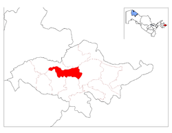 Location in Andijan Region | |
| Coordinates: 40°42′N 72°10′E | |
| Country | |
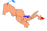
| Region | Andijan Region |
| Capital | Oltinko‘l |
| Established | June 26, 1939 |
| Area | |
| • Total | 607 km2 (234 sq mi) |
| Population | |
| • Total | 134,500 |
| Time zone | UTC+5 (UZT) |
Administrative divisions
The district consists of 8 village councils:
- Altynkul (2 villages)
- Arazi (3 villages)
- Akhunbabaev (4 villages)
- Zhalabek (13 villages)
- Kumakay (2 villages)
- Kushtapasaray (6 villages)
- Maslakhaty (6 villages)
- Suvyulduz (14 villages)
Geography
Oltinkoʻl District lies in the central part of Andijan Region in eastern Uzbekistan. The relief is represented by lowlands and hills. The climate is subtropical high upland, with an average July temperature of 25-28 ˚ C, and an average February temperature of -5 - -7 ˚ C.[2] Sometimes in summer the temperature reaches as high as 43 ˚ C, and as low as -18 ˚ C in the winter. The growing season is 160 - 180 days, with an average annual rainfall of up to 225 mm.[2] Wild animals are rare, but there are rodents, reptiles and birds.[2]
References
- ЦК КПСС. Известия ЦК КПСС (in Russian). Изд. Центрального комитета КПСС. p. 135. Retrieved 12 May 2012.
- "Archived copy" Хакимият Алтынкульского района (in Russian). Government of Andjian. Archived from the original on 28 December 2011. Retrieved 12 May 2012.CS1 maint: archived copy as title (link)
Capital: Andijan | ||
| Districts and seats |
|  |
| Other towns and villages | ||