Old Fort, North Carolina
Old Fort is a town in McDowell County, North Carolina, United States. The population was 908 at the 2010 Census.
Old Fort, North Carolina | |
|---|---|
 Catawba Avenue in Old Fort | |
| Motto(s): "Once you get here, you never want to leave" | |
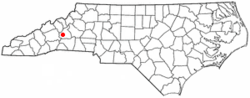 Location of Old Fort, North Carolina | |
| Coordinates: 35°37′46″N 82°10′45″W | |
| Country | United States |
| State | North Carolina |
| County | McDowell |
| Area | |
| • Total | 1.3 sq mi (3.2 km2) |
| • Land | 1.3 sq mi (3.2 km2) |
| • Water | 2.0 sq mi (0.0 km2) |
| Elevation | 1,447 ft (440 m) |
| Population (2010) | |
| • Total | 908 |
| • Estimate (2018)[1] | 919 |
| • Density | 700/sq mi (280/km2) |
| Time zone | UTC-5 (Eastern (EST)) |
| • Summer (DST) | UTC-4 (EDT) |
| ZIP code | 28762 |
| Area code(s) | 828 |
| FIPS code | 37-48920[2] |
| GNIS feature ID | 1014094[3] |
| Website | oldfort.org |
History
Samuel Davidson owned one square mile of land where it was believed settlers built a fort[4] later called Davidson's Fort. A stockade built in 1756 became an outpost for expeditions such as that of Gen. Griffith Rutherford in 1776,[5] "the westernmost outpost of Colonial civilization".[6] Once the railroad reached the area, a hotel and depot were built. In 1871, Sanborn Worthen, who fought in the American Civil War, bought Old Fort Plantation. He hoped the railroad would build its yard there, but this did not happen.[6] On January 25, 1872, the town of Catawba Vale was founded. The name was changed to Old Fort February 23, 1873,[7] honoring Samuel Davidson.[4]
Attractions and events

In 2010, the North Carolina Wildlife Commission added Old Fort to their list of N.C. Mountain Heritage Trout Towns. This designation includes a special $5.00 fishing license that is active for three days and is good for use in any of the state's mountain trout towns. In downtown Old Fort, the section of Mill Creek bordering Mountain Gateway Museum at 102 Water Street is a public portion of this stream and is a delayed harvest stream.
Old Fort festivals include popular annual events such as Pioneer Day hosted by Mountain Gateway Museum on the last Saturday in April. The North Carolina Gold Festival is held the first Friday/Saturday in June, also on the grounds of Mountain Gateway Museum. Old Fort's Chamber of Commerce continues their annual event with Octoberfest taking place the first weekend in October, again on the grounds of Mountain Gateway Museum. This is a N.C. state museum and is part of the N.C. Dept. of Cultural Resources.
Old Fort has several attractions, including Andrews Geyser and the Arrowhead Monument. The granite arrowhead was built as a symbol of peace between the two Native American tribes; the Cherokee and Catawba. At the dedication ceremony in 1930, thousands of onlookers gathered at town square to see the 14 ft. rose granite arrowhead sitting atop a natural stone base. The Arrowhead serves as the focal point for the town, which is traversed by U.S. Highway 70 and Interstate 40. Additionally, residents of Old Fort and travelers alike frequent a "locally famous" establishment known as Mr. Bobs donuts, located on Old Hwy. 70 in downtown Mr. Bobs sponsors the annual "Western North Carolina Donut Fest" and half marathon. Mr. Bobs has quickly established themselves as a favorite, must see attraction when visiting both Old Fort and Marion. Residents are also reconstructing Davidson Fort, the Revolutionary War fort that gave Old Fort its current name. Catawba Falls, the largest waterfall in McDowell County and the headwaters of the Catawba River, is located just outside the town limits. In 2009, a partnership between the N.C. Department of Transportation, the local county and town governments with assistance from the United States Forest Service and the local trails association, a portion of Old Highway 70 reopened to bicycle and foot traffic. Point Lookout Trail is a popular paved trail ascending almost 1,000 feet through the Swannanoa Gap in just under 4 miles. Point Lookout was once a popular tourist stop for travelers driving west to Asheville and the Great Smoky Mountains.
In prior years the town was well known for its weekly mountain music concerts, which attracted large audiences and many musicians from the surrounding areas to Old Fort's downtown each Friday night for a free bluegrass concert in the historic Rockett Building. In mid 2014 the organization that ran the mountain music lost their arrangement with the building owner, and the weekly music shows came to an end after 27 years.[8]
The Welsford Parker Artz House and Old Fort Commercial Historic District are listed on the National Register of Historic Places.[9][10]
Climate
Old Fort, NC temperatures average in the 80s in the summer and in the 20s for lows in the winter. The warmest month of the year is July with an average maximum temperature of 86.7 degrees Fahrenheit, while the coldest month of the year is January with an average minimum temperature of 25.5 degrees Fahrenheit. Temperature variations between night and day tend to be moderate during summer with a difference that can reach 21 degrees Fahrenheit, and moderate during winter with an average difference of 23 degrees Fahrenheit.
The annual average precipitation at Old Fort is 54.01 Inches. Rainfall is fairly evenly distributed throughout the year. The wettest month of the year is March with an average rainfall of 5.59 Inches.
Geography
Old Fort is located at 35°37′46″N 82°10′45″W (35.629541, -82.179178).[11] According to the United States Census Bureau, the town has a total area of 1.2 square miles (3.1 km2), all of it land.
Demographics
| Historical population | |||
|---|---|---|---|
| Census | Pop. | %± | |
| 1890 | 249 | — | |
| 1900 | 253 | 1.6% | |
| 1910 | 778 | 207.5% | |
| 1920 | 931 | 19.7% | |
| 1930 | 866 | −7.0% | |
| 1940 | 774 | −10.6% | |
| 1950 | 771 | −0.4% | |
| 1960 | 787 | 2.1% | |
| 1970 | 676 | −14.1% | |
| 1980 | 752 | 11.2% | |
| 1990 | 720 | −4.3% | |
| 2000 | 963 | 33.8% | |
| 2010 | 908 | −5.7% | |
| Est. 2018 | 919 | [1] | 1.2% |
| U.S. Decennial Census[12] | |||
As of the census[2] of 2000, there were 963 people, 441 households, and 269 families residing in the town. The population density was 769.4 people per square mile (297.5/km²). There were 496 housing units at an average density of 396.3 per square mile (153.2/km²). The racial makeup of the town was 79.13% White, 17.24% African American, 0.21% Native American, 0.10% Asian, 0.83% from other races, and 2.49% from two or more races. Hispanic or Latino of any race were 1.66% of the population.
There were 441 households out of which 25.9% had children under the age of 18 living with them, 37.9% were married couples living together, 14.5% had a female householder with no husband present, and 39.0% were non-families. 35.8% of all households were made up of individuals and 16.1% had someone living alone who was 65 years of age or older. The average household size was 2.18 and the average family size was 2.76.
In the town, the population was spread out with 23.3% under the age of 18, 6.1% from 18 to 24, 27.0% from 25 to 44, 23.6% from 45 to 64, and 20.0% who were 65 years of age or older. The median age was 40 years. For every 100 females, there were 91.5 males. For every 100 females age 18 and over, there were 87.1 males.
The median income for a household in the town was $25,000, and the median income for a family was $28,854. Males had a median income of $25,347 versus $21,058 for females. The per capita income for the town was $20,782. About 8.7% of families and 17.0% of the population were below the poverty line, including 20.2% of those under age 18 and 15.3% of those age 65 or over.
References
| Wikimedia Commons has media related to Category:McDowell County, North Carolina. |
- "Population and Housing Unit Estimates". Retrieved February 23, 2020.
- "U.S. Census website". United States Census Bureau. Retrieved 2008-01-31.
- "US Board on Geographic Names". United States Geological Survey. 2007-10-25. Retrieved 2008-01-31.
- "Davidson's Fort". February 13, 2010. Retrieved November 8, 2018.
- Neufeld, Rob (2019-01-13). "Visiting Our Past: Happy Buncombe Day, and here's a chronology". Asheville Citizen-Times. Retrieved 2019-01-13.
- Boyle, John (2016-02-22). "Answer Man: Dog park a muddy mess? Old Fort sign confusion?". Asheville Citizen-Times. Retrieved 2016-02-22.
- "History of Old Fort" (PDF). Retrieved November 8, 2018.
- McDowell News (2014-07-22). "Tempers flare at Old Fort meeting about music program". Retrieved 2014-12-23.
- "National Register Information System". National Register of Historic Places. National Park Service. July 9, 2010.
- "National Register of Historic Places Listings". Weekly List of Actions Taken on Properties: 4/25/11 through 4/29/11. National Park Service. 2011-05-06.
- "US Gazetteer files: 2010, 2000, and 1990". United States Census Bureau. 2011-02-12. Retrieved 2011-04-23.
- "Census of Population and Housing". Census.gov. Retrieved June 4, 2015.
External links
Municipalities and communities of McDowell County, North Carolina, United States | ||
|---|---|---|
| City |  McDowell County map | |
| Town | ||
| CDP | ||
| Unincorporated communities |
| |
| Footnotes | ‡This populated place also has portions in an adjacent county or counties | |
| Authority control |
|
|---|