Oil City, Louisiana
Oil City is a town in Caddo Parish, Louisiana, United States. The population was 1,008 at the 2010 census.[3] Oil City is located on Louisiana Highway 1, north of Caddo Lake. It is part of the Shreveport–Bossier City Metropolitan Statistical Area.
Oil City, Louisiana | |
|---|---|
Town | |
| Town of Oil City | |
 Oil City Municipal Complex | |
 Location of Oil City in Caddo Parish, Louisiana. | |
.svg.png) Location of Louisiana in the United States | |
| Coordinates: 32°44′32″N 93°58′28″W | |
| Country | United States |
| State | Louisiana |
| Parish | Caddo |
| Government | |
| • Mayor | James Terrell Sims (D) |
| Area | |
| • Total | 1.85 sq mi (4.78 km2) |
| • Land | 1.78 sq mi (4.62 km2) |
| • Water | 0.06 sq mi (0.17 km2) |
| Elevation | 203 ft (62 m) |
| Population (2010) | |
| • Total | 1,008 |
| • Estimate (2018)[2] | 983 |
| • Rank | CD: 5th |
| • Density | 553.00/sq mi (213.57/km2) |
| Time zone | UTC-6 (CST) |
| • Summer (DST) | UTC-5 (CDT) |
| Area code(s) | 318 |
| FIPS code | 22-57590 |
| Website | www |


History
The park in Oil City is named for Earl Williamson. The local politician served for 40 years on the Caddo Parish police jury (1933–1972) and again from 1979–1980. He served as mayor of Vivian from 1938–1946, and again from 1962-1966.

John Charles "Chip" Dickey, Jr., the mayor from 2005 until his death in office in 2016 at the age of sixty, pushed for economic ventures, including the community center and restaurants. He was an ordained minister and led various youth camps. Dickey's father, John Charles Dickey, Sr., was the Oil City mayor from 1968 to 1976.[4]
Geography
Oil City is located in northwestern Caddo Parish at 32°44′32″N 93°58′28″W (32.742170, -93.974376).[5] Downtown Shreveport is 21 miles (34 km) to the southeast along Louisiana Highway 1, and Vivian is 9 miles (14 km) to the north.
According to the United States Census Bureau, Oil City has a total area of 1.85 square miles (4.78 km2), of which 1.78 square miles (4.62 km2) is land and 0.07 square miles (0.17 km2), or 3.45%, is water.[3]
Demographics
| Historical population | |||
|---|---|---|---|
| Census | Pop. | %± | |
| 1950 | 422 | — | |
| 1960 | 1,430 | 238.9% | |
| 1970 | 907 | −36.6% | |
| 1980 | 1,323 | 45.9% | |
| 1990 | 1,282 | −3.1% | |
| 2000 | 1,219 | −4.9% | |
| 2010 | 1,008 | −17.3% | |
| Est. 2018 | 983 | [2] | −2.5% |
| U.S. Decennial Census[6] | |||
As of the census[7] of 2000, there were 1,219 people, 480 households, and 311 families residing in the town. The population density was 679.9 people per square mile (262.9/km²). There were 542 housing units at an average density of 302.3 per square mile (116.9/km²). The racial makeup of the town was 55.13% White, 44.05% African American, 0.08% Native American, and 0.74% from two or more races. Hispanic or Latino of any race were 1.72% of the population.
There were 480 households out of which 34.2% had children under the age of 18 living with them, 38.5% were married couples living together, 21.3% had a female householder with no husband present, and 35.2% were non-families. 33.3% of all households were made up of individuals and 16.3% had someone living alone who was 65 years of age or older. The average household size was 2.54 and the average family size was 3.27.
In the town, the population was spread out with 32.2% under the age of 18, 10.4% from 18 to 24, 26.4% from 25 to 44, 18.1% from 45 to 64, and 12.9% who were 65 years of age or older. The median age was 30 years. For every 100 females, there were 83.9 males. For every 100 females age 18 and over, there were 80.2 males.
The median income for a household in the town was $19,375, and the median income for a family was $25,114. Males had a median income of $23,516 versus $15,667 for females. The per capita income for the town was $9,697. About 28.8% of families and 35.9% of the population were below the poverty line, including 48.1% of those under age 18 and 28.4% of those age 65 or over.
Notable people
- Roy McArthur "Hoppy" Hopkins (1943-2006) served as a Democrat in the Louisiana House of Representatives from 1988 until his death in office. Hopkins was an Oil City automobile dealer.
- James Hollis "Jim" Morris in 2007 succeeded Hopkins as a Republican member of the Louisiana House. Morris is in the oil and natural gas business.
- Earl Holliman, the Golden Globe winning film and TV actor, lived in Oil City during his teenage years and graduated from Oil City High School with several scholastic honors in 1946.[8]
| Wikimedia Commons has media related to Oil City, Louisiana. |
References
- "2016 U.S. Gazetteer Files". United States Census Bureau. Retrieved Jul 2, 2017.
- "Population and Housing Unit Estimates". Retrieved February 18, 2020.
- "Geographic Identifiers: 2010 Demographic Profile Data (G001): Oil City town, Louisiana". U.S. Census Bureau, American Factfinder. Archived from the original on February 12, 2020. Retrieved August 13, 2014.
- Miles Jay Oliver (May 25, 2016). "Update: Funeral services announced for Oil City mayor". The Shreveport Times. Retrieved August 16, 2016.
- "US Gazetteer files: 2010, 2000, and 1990". United States Census Bureau. 2011-02-12. Retrieved 2011-04-23.
- "Census of Population and Housing". Census.gov. Retrieved June 4, 2015.
- "U.S. Census website". United States Census Bureau. Retrieved 2008-01-31.
- https://www.newspapers.com/newspage/30506384/
External links
Municipalities and communities of Caddo Parish, Louisiana, United States | ||
|---|---|---|
Parish seat: Shreveport | ||
| City | 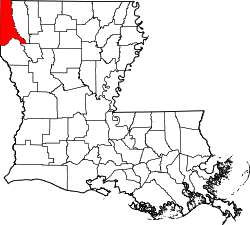 | |
| Towns | ||
| Villages | ||
| CDP | ||
| Other unincorporated communities |
| |
| Ghost town | ||
| Footnotes | ‡This populated place also has portions in an adjacent parish or parishes | |