Ohangwena Region
Ohangwena is one of the fourteen regions of Namibia, its capital is Eenhana. The northern and western parts of the region are the most densely populated of this essentially subsistence agricultural region in which small scale mahangu cultivation and the keeping of cattle form the predominant activities. Although the region depends on rain fed agriculture, other crops can be established under intensive cultivation.
Ohangwena Region | |
|---|---|
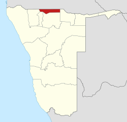 Location of the Ohangwena Region in Namibia | |
| Country | Namibia |
| Capital | Eenhana |
| Government | |
| • Governor | Walde Ndevashiya[1] |
| Area | |
| • Total | 10,706 km2 (4,134 sq mi) |
| Population (2011)[3] | |
| • Total | 245,446 |
| • Density | 23/km2 (59/sq mi) |
| Time zone | South African Standard Time: UTC+2 |
| HDI (2017) | 0.598[4] medium · 11th |
The main settlements in the region straddle the good paved road from the Angolan border to Ondangwa, where it joins the Oshakati-Tsumeb trunk road. The eastern part of the region possesses good grazing land, but the shortage of water and poor communications render it uninhabitable at present. There is a tarred road from Onhuno to Okongo that was recently completed, it is thought to greatly increase the area's agricultural potential.
In the north, Ohangwena borders Angola: the Cunene Province, except for a small border with Cuando Cubango Province in the far northeast. Domestically, it borders the following regions:
- Kavango West - east
- Oshikoto - south
- Oshana - southwest
- Omusati - west
It is traversed by the northwesterly line of equal latitude and longitude.
The region comprises twelve constituencies:
Economy and infrastructure
Ohangwena has 234 schools with a total of 90,703 pupils.[5]
Demographics
According to the Namibia 2001 Population and Housing Census, Ohangwena had a population of 228,384 (124,823 females and 103,556 males or 83 males for every 100 females) growing at an annual rate of 2.4%. The fertility rate was 5.3 children per woman. 1% lived in urban areas while 99% lived in rural areas, and with an area of 10,703 km2, the population density was 21.3 persons per km2. By age, 15% of the population was under 5 years old, 33% between 5–14 years, 41% between 15–59 years, and 9% 60 years and older. The population was divided into 35,958 households, with an average size of 6.3 persons. 60% of households had a female head of house, while 40% had a male. For those 15 years and older, 59% had never married, 17% married with certificate, 9% married traditionally, 4% married consensually, 4% were divorced or separated, and 6% were widowed.[6]
The most commonly spoken languages at home were Oshiwambo languages, spoken in 97% of households. For those 15 years and older, the literacy rate was 79%. In terms of education, 53% of girls and 47% of boys between the ages of 6-15 were attending school, and of those 15 years and older, 51% had left school, 23% were currently at school, and 23% had never attended.[6]
In 2001 the employment rate for the labor force (43% of those 15+) was 64% employed and 36% unemployed. For those 15+ years old and not in the labor force (53%), 35% were students, 41% homemakers, and 24% retired, too old, etc.[6] According to the 2012 Namibia Labour Force Survey, unemployment in the Ohangwena Region stood at 34.6%. The two studies are methodologically not comparable.[7]
Among households, 78% had access to safe water but only 11% to improved sanitation (toilet facilities).[8] 4% of the households have electricity for lighting, 72% access to radio, and 94% had wood or charcoal for cooking. In terms of households' main sources of income, 52% derived it from farming, 13% from wages and salaries, 5% cash remittances, 8% from business or non-farming, and 20% from pension.[6]
For every 1000 live births there were 56 female infant deaths and 56 male. The life expectancy at birth was 45 years for females and 43 for males. Among children younger than 15, 5% had lost a mother, 11% a father, and 2% were orphaned by both parents. 5% of the entire population had a disability, of which 22% were deaf, 32% blind, 11% had a speech disability, 15% hand disability, 26% leg disability, and 5% mental disability.[6]
Politics in Ohangwena region
Ohangwena is one of the regions where many Namibian politicians are from, including former President Hifikepunye Pohamba, Hidipo Hamutenya (President of the Rally for Democracy and Progress, RDP), Minister of Environment and Tourism Pohamba Shifeta, founding member of SWAPO Mzee Kaukungwa and several other ministers and high-profile politicians.
A significant amount of fighting occurred in the region during the Namibian War of Independence. Just as Namibia was set for independence, fighting broke out on April 1, 1989 in the region between People's Liberation Army of Namibia combatants and soldiers in the occupying South African Defence Force. The resulting "9 day war" left many dead.[9]
In the 2015 regional elections SWAPO won all twelve constituencies with 90% or more. The RDP managed to name opposition candidates in all constituencies but one, and the Democratic Turnhalle Alliance (DTA) in two.[10]
Governors
- Usko Nghaamwa (2015–2020)[11]
- Walde Ndevashiya (2020–present)[1]
Villages
- Eehongo
- Ongenga, 47 kilometres (29 mi) from Oshakati and approximately 20 kilometres (12 mi) from the Angolan border. As of 2011 the village was headed by Paulus Muxwangi Nghifilenya and the village counselor was Shimutwikeni Leonard. The village hosts about 10,000 inhabitants. There is a clinic, a church, community hall, sub-police station and three schools: Ongenga Primary School, Ongenga Junior School and Ongenga English Private School. Entrepreneurs established businesses such as salons, lodges, tailoring, Omahangu pounding machines and China shops.
- Onamahoka, approximately 45 kilometres (28 mi) from the Angolan border. The village is headed by mr David Kasheshe. It has one combined school known as Onamahoka Combined School ruled by Ms Hambeleleni Shikulo and it also has multiples of pre-primary schools such as Okasheshe Kindergarten.
- Omukukutu is a village in Epembe Constituency, located some 12 km from the main tar road from Eenhana to Okongo along a two-track gravel road with relatively thick sand. Th e distance from Eenhana to the turnoff from the main tar road is just under 40km.[12]
- Omundaungilo is a settlement area, not offi cially proclaimed, but regarded as the de facto capital of Omundaungilo Constituency. Omundaungilo is located about 15 km north of the main tar road from Eenhana to Okongo; the turnoff is about 40 km east of Eenhana. Th e San community lived on the outskirts of the settlement in an area called Omiishi in Oshikwanyama and N!u10 in the local !Xun dialect.[12]
- Onane, a village in Okongo Constituency, is located about 12 km from the main tar road from Okongo to the Okongo Community Forest and Conservancy and on to Rundu. Onane is reached via a two-track gravel/sand road (primarily gravel, with relatively thick sand in parts). Th e distance along the tar road from Okongo to the turnoff to Onane village is approximately 30 km.[12]
- Ouholamo is a neighbourhood of the town of Eenhana. Located on the eastern outskirts of the town, Ouholamo is reached via a small sandy track through the bush.[12]
References
- "Goodbye". Namibian Sun. 10 April 2020. p. 1.
- "Namibia's Population by Region". Election Watch. Institute for Public Policy Research (1): 3. 2013.
- "Ohangwena 2011 Census Regional Profile" (PDF). Statistics Namibia. Retrieved 10 April 2020.
- "Sub-national HDI - Area Database - Global Data Lab". hdi.globaldatalab.org. Retrieved 2018-09-13.
- Miyanicwe, Clemans; Kahiurika, Ndanki (27 November 2013). "School counsellors overstretched". The Namibian. p. 1.
- "Ohangwena Region – Census Indicators, 2001". National Planning Commission. 2001. Archived from the original on January 11, 2012. Retrieved 2008-12-28.
- Duddy, Jo Maré (11 April 2013). "Unemployment rate still alarmingly high". The Namibian. Archived from the original on 14 April 2013.
- Tjihenuna, Theresia (2 April 2014). "More than 1 million Namibians defecate in open". The Namibian. Archived from the original on 7 April 2014. Retrieved 4 April 2014.
- Maletsky, Christof (25 November 2005). "April 1: Nujoma lays the blame at Thatcher's door". The Namibian. Retrieved 16 October 2011.
- "Regional Council Election Results 2015". Electoral Commission of Namibia. 3 December 2015. pp. 13–14. Archived from the original on 8 December 2015.
- "President announces governors". The Namibian. 10 April 2015. Archived from the original on 14 April 2015. Retrieved 14 April 2015.
- Mouton, Dirkx, Randolph, Erik (2014). "Ohangwena Region" (PDF). In Ute Dieckmann; Maarit Thiem; Erik Dirkx; Jennifer Hays (eds.). "Scraping the Pot" San in Namibia:Two Decades After Independence. Legal Assistance Centre and Desert Research Foundation of Namibia. pp. 233–288. ISBN 978-99945-61-52-0.