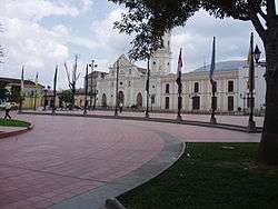
Ocaña, Norte de Santander
Ocaña is a town and municipality in the Colombian Department of Norte de Santander. Ocaña is the second largest populated center of this department. It played an important role during the Independence of Colombia from the Spanish monarchy.
Ocaña | |
|---|---|
Municipality and town | |
 | |
 Flag .svg.png) Seal | |
 Location of the municipality and town of Ocaña, Norte de Santander in the Norte de Santander Department of Colombia. | |
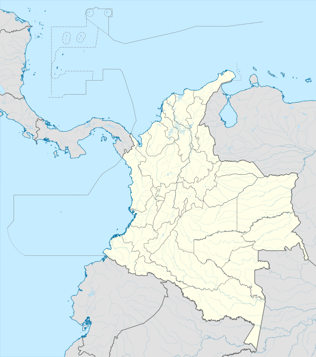 Ocaña Location in Colombia | |
| Coordinates: 8°14′N 73°21′W | |
| Country | |
| Department | Norte de Santander Department |
| Founded | 1570 |
| Incorporated | 1857 |
| Government | |
| • Mayor | Miriam Prado Carrascal |
| Area | |
| • Total | 672.27 km2 (259.56 sq mi) |
| Elevation | 1,202 m (3,944 ft) |
| Population (2019 est.) | |
| • Total | 101,158[1] |
| Demonym(s) | Ocañero |
| Time zone | UTC-5 (Colombia Standard Time) |
| Area code(s) | 57 + 7 |
| Website | Official website (in Spanish) |
History
The city was founded on 14 December of 1570 by Captain Francisco Fernández de Contreras, as part of the third populating project of the east, patronised by the Audiencia y Cabildo de Pamplona. The objective of the foundation was the opening of a route which would connect the urban centre Pamplona with the Caribbean Sea and the centre of the new kingdom. Given the geographic location of the settlement, the Audiencia de Santafé, presided over by Andrés Díaz Venero de Leiva, decided that the new town would fall under the jurisdiction of the province of Santa Maria, the governor of which was, at the time, Don Pedro Fernández del Busto. The name Ocaña was given to the new town to honour Fernández del Busto, who was born in Ocaña, Spain. The native peoples in the region were those traditionally called Hacaritamas and those called Cultura Mosquito (Mosquito Culture) or Bajomagdalenense.
Geography and climate
- Location: 8°14′N 73°21′W. The city of Ocaña is 610 km from Bogotá.
- Surface: 460 km2, 2.2% of the North Santander Department total area
- Height: 1,202 meters on the level of the sea Ocaña are on the Andean Eastern mountain range. The 2,600 mountains surround that reach msnm. Its average temperature is 22 °C.
Economy
The main economic activities are agriculture, the livestock raising, commerce, small industries and mining, with silver operation, copper and iron. The city is served by the Aguas Claras airport.
See also
- Cúcuta, the state capital.
- Pamplona, the third municipality of the state.
- Roman Catholic Diocese of Ocaña
- St. Anne's Cathedral, Ocaña
References
- "Estimaciones de Población 1985 - 2005 y Proyecciones de Población 2005 - 2020 Total Municipal por Área (estimate)". DANE. Retrieved 10 November 2016.
- (in Spanish) Ocaña official website
- (in Spanish) Ocaña Information
- (in Spanish) News