Hofbieber
Hofbieber is a municipality in the district of Fulda, in Hesse, Germany.
Hofbieber | |
|---|---|
 Coat of arms | |
Location of Hofbieber within Fulda district   | |
 Hofbieber 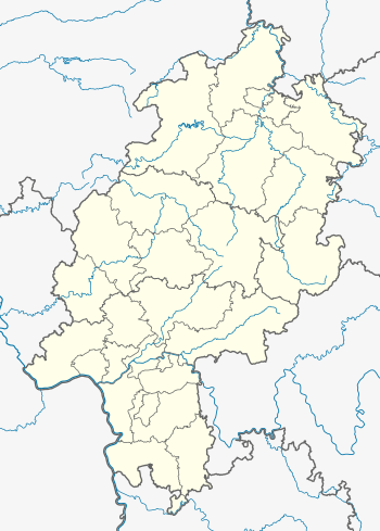 Hofbieber | |
| Coordinates: 50°35′N 09°50′E | |
| Country | Germany |
| State | Hesse |
| Admin. region | Kassel |
| District | Fulda |
| Government | |
| • Mayor | Markus Röder (non party) |
| Area | |
| • Total | 87.2 km2 (33.7 sq mi) |
| Elevation | 390 m (1,280 ft) |
| Population (2018-12-31)[1] | |
| • Total | 6,072 |
| • Density | 70/km2 (180/sq mi) |
| Time zone | CET/CEST (UTC+1/+2) |
| Postal codes | 36145 |
| Dialling codes | 06657 |
| Vehicle registration | FD |
| Website | www.hofbieber.de |
General
Hofbieber is situated in the center of the Hessian Rhön Mountains near the Mountain Milseburg. The municipality of Hofbieber has approximately 6,500 citizens living within eighteen urban districts and some outlying lonesome farms widespread over 90 km² (34.75 mi²). The main income of the city is farming and tourism from weekend visitors from the Frankfurt Rhine-Main Region.
The urban districts are:
- Allmus
- Danzwiesen
- Elters
- Hofbieber
- Kleinsassen
- Langenberg
- Langenbieber
- Mahlerts
- Mittelberg
- Niederbieber
- Obergruben
- Obernüst
- Rödergrund/Egelmes
- Schackau
- Schwarzbach
- Steens
- Wiesen
- Wittges
Attractions
The picturesque surroundings and a lot of well indicated hiking & biking trails are the credits of these region.

A view from Castle Bieberstein now a boarding school to Milseburg, Wasserkuppe and Stellberg
Gallery
 Panoramic View from urban district of Hofbieber, Village Kleinsassen
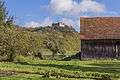 A garden with a view
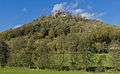 Castle Bieberstein View from brook Bieber
 Castle Bieberstein (Eastside)
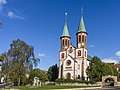 The "Cathedral of the Rhön Mountains" Church St. George in Hofbieber
References
- "Bevölkerungsstand am 31.12.2018". Hessisches Statistisches Landesamt (in German). July 2019.
| Authority control |
|
|---|
Towns and municipalities in Fulda district | ||
|---|---|---|
Wappen des Landkreises Fulda | ||
This article is issued from Wikipedia. The text is licensed under Creative Commons - Attribution - Sharealike. Additional terms may apply for the media files.