Nyandoma
Nyandoma (Russian: Ня́ндома) is a town and the administrative center of Nyandomsky District in Arkhangelsk Oblast, Russia, located 347 kilometers (216 mi) south of Arkhangelsk, the administrative center of the oblast. Population: 22,356 (2010 Census);[3] 22,619 (2002 Census);[8] 24,826 (1989 Census).[9]
Nyandoma Няндома | |
|---|---|
Town[1] | |
 Nyandoma railway station | |
.png) Coat of arms | |
Location of Nyandoma 
| |
 Nyandoma Location of Nyandoma 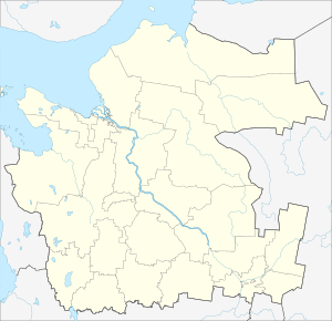 Nyandoma Nyandoma (Arkhangelsk Oblast) | |
| Coordinates: 61°40′N 40°13′E | |
| Country | Russia |
| Federal subject | Arkhangelsk Oblast[1] |
| Administrative district | Nyandomsky District[1] |
| Town of district significance | Nyandoma[1] |
| Founded | 1896[2] |
| Town status since | 1939 |
| Area | |
| • Total | 21 km2 (8 sq mi) |
| Elevation | 220 m (720 ft) |
| Population | |
| • Total | 22,356 |
| • Estimate (2018)[4] | 19,783 (-11.5%) |
| • Density | 1,100/km2 (2,800/sq mi) |
| • Capital of | Nyandomsky District[1], town of district significance of Nyandoma[1] |
| • Municipal district | Nyandomsky Municipal District[5] |
| • Urban settlement | Nyandomskoye Urban Settlement[5] |
| • Capital of | Nyandomsky Municipal District[5], Nyandomskoye Urban Settlement[5] |
| Time zone | UTC+3 (MSK |
| Postal code(s)[7] | 164200 |
| OKTMO ID | 11644101001 |
| Website | nyandomamo |
History
Nyandoma was founded in 1896 as a settlement around the railway station Nyandoma on the newly constructed railway between Vologda and Arkhangelsk.[2] The railway traffic was open in 1898.[10] At the time, Nyandoma was a part of Kargopolsky Uyezd of Olonets Governorate. On July 15, 1929, the uyezds were abolished, the governorates merged into Northern Krai, and Nyandomsky District was established among others. It became a part of Nyandoma Okrug, one of the five in Northern Krai.[11] Nyandoma served as the administrative center of Nyandoma Okrug. In 1930, the okrug was abolished, and the district was subordinated to the central administration of Northern Krai. In 1936, the krai itself was transformed into Northern Oblast. In 1937, Northern Oblast was split into Arkhangelsk Oblast and Vologda Oblast, with Nyandoma being transferred to Arkhangelsk Oblast. The settlement was granted town status in 1939.
Administrative and municipal status
Within the framework of administrative divisions, Nyandoma serves as the administrative center of Nyandomsky District.[1] As an administrative division, it is, together with three rural localities, incorporated within Nyandomsky District as the town of district significance of Nyandoma.[1] As a municipal division, the town of district significance of Nyandoma, together with the territories of Andreyevsky, Burachikhinsky, and Shozhemsky Selsoviets (which comprise, correspondingly, nine, five, and one rural localities, for the total of fifteen rural localities) in Nyandomsky District, are incorporated within Nyandomsky Municipal District as Nyandomskoye Urban Settlement.[5]
Economy
Industry
Timber industry is the most developed industry in the district. Food industry is also present, represented, in particular, by the broiler factory "Nyandoma-Broiler".[10]
Transportation
Nyandoma is located on the paved road connecting Dolmatovo with Kargopol. This road also provide access to one of the principal highways in Russia, M8 connecting Moscow and Arkhangelsk. Another paved road, in the southern direction, connects Nyandoma with Konosha.
Nyandoma is also located on the railway line between Moscow and Arkhangelsk (built in the south-north direction).
Culture and recreation
Nyandoma hosts a state museum, the House of Nyan.[12]
Climate
| Climate data for Nyandoma | |||||||||||||
|---|---|---|---|---|---|---|---|---|---|---|---|---|---|
| Month | Jan | Feb | Mar | Apr | May | Jun | Jul | Aug | Sep | Oct | Nov | Dec | Year |
| Daily mean °C (°F) | −13 (9) |
−12 (10) |
−6 (21) |
1 (34) |
8 (46) |
14 (57) |
16 (61) |
14 (57) |
8 (46) |
1 (34) |
−5 (23) |
−10 (14) |
1 (34) |
| Source: Weatherbase[13] | |||||||||||||
References
Notes
- Государственный комитет Российской Федерации по статистике. Комитет Российской Федерации по стандартизации, метрологии и сертификации. №ОК 019-95 1 января 1997 г. «Общероссийский классификатор объектов административно-территориального деления. Код 11 244», в ред. изменения №278/2015 от 1 января 2016 г.. (State Statistics Committee of the Russian Federation. Committee of the Russian Federation on Standardization, Metrology, and Certification. #OK 019-95 January 1, 1997 Russian Classification of Objects of Administrative Division (OKATO). Code 11 244, as amended by the Amendment #278/2015 of January 1, 2016. ).
- Энциклопедия Города России. Moscow: Большая Российская Энциклопедия. 2003. p. 322. ISBN 5-7107-7399-9.
- Russian Federal State Statistics Service (2011). "Всероссийская перепись населения 2010 года. Том 1" [2010 All-Russian Population Census, vol. 1]. Всероссийская перепись населения 2010 года [2010 All-Russia Population Census] (in Russian). Federal State Statistics Service.
- "26. Численность постоянного населения Российской Федерации по муниципальным образованиям на 1 января 2018 года". Federal State Statistics Service. Retrieved January 23, 2019.
- Law #258-vneoch.-OZ
- "Об исчислении времени". Официальный интернет-портал правовой информации (in Russian). June 3, 2011. Retrieved January 19, 2019.
- Почта России. Информационно-вычислительный центр ОАСУ РПО. (Russian Post). Поиск объектов почтовой связи (Postal Objects Search) (in Russian)
- Russian Federal State Statistics Service (May 21, 2004). "Численность населения России, субъектов Российской Федерации в составе федеральных округов, районов, городских поселений, сельских населённых пунктов – районных центров и сельских населённых пунктов с населением 3 тысячи и более человек" [Population of Russia, Its Federal Districts, Federal Subjects, Districts, Urban Localities, Rural Localities—Administrative Centers, and Rural Localities with Population of Over 3,000] (XLS). Всероссийская перепись населения 2002 года [All-Russia Population Census of 2002] (in Russian).
- "Всесоюзная перепись населения 1989 г. Численность наличного населения союзных и автономных республик, автономных областей и округов, краёв, областей, районов, городских поселений и сёл-райцентров" [All Union Population Census of 1989: Present Population of Union and Autonomous Republics, Autonomous Oblasts and Okrugs, Krais, Oblasts, Districts, Urban Settlements, and Villages Serving as District Administrative Centers]. Всесоюзная перепись населения 1989 года [All-Union Population Census of 1989] (in Russian). Институт демографии Национального исследовательского университета: Высшая школа экономики [Institute of Demography at the National Research University: Higher School of Economics]. 1989 – via Demoscope Weekly.
- Няндома (in Russian). www.arhangelskobl.ru. Retrieved July 2, 2011.
- "Archived copy" Постановление Президиума ВЦИК от 15 июля 1929 года о составе округов и районов Северного Края и их центрах (in Russian). consultant.ru. Archived from the original on January 4, 2016. Retrieved June 12, 2011.CS1 maint: archived copy as title (link)
- Няндомский музей "Дом Няна" (in Russian). Российская сеть культурного наследия. Retrieved July 2, 2011.
- "Weatherbase: Historical Weather for Nyandoma". Retrieved September 24, 2013.
Sources
- Архангельское областное Собрание депутатов. Областной закон №258-внеоч.-ОЗ от 23 сентября 2004 г. «О статусе и границах территорий муниципальных образований в Архангельской области», в ред. Областного закона №224-13-ОЗ от 16 декабря 2014 г. «Об упразднении отдельных населённых пунктов Соловецкого района Архангельской области и о внесении изменения в статью 46 Областного закона "О статусе и границах территорий муниципальных образований в Архангельской области"». Вступил в силу со дня официального опубликования. Опубликован: "Волна", №38, 8 октября 2004 г. (Arkhangelsk Oblast Council of Deputies. Oblast Law #258-vneoch.-OZ of September 23, 2004 On the Status and Borders of the Territories of the Municipal Formations in Arkhangelsk Oblast, as amended by the Oblast Law #224-13-OZ of December 16, 2014 On Abolishing Several Inhabited Localities in Solovetsky District of Arkhangelsk Oblast and on Amending Article 46 of the Oblast Law "On the Status and Borders of the Territories of the Municipal Formations in Arkhangelsk Oblast". Effective as of the day of the official publication.).
Administrative center: Arkhangelsk • Rural localities | ||
| Administrative districts | .png) | |
| Cities and towns | ||
| Urban-type settlements | ||