Nunda, South Dakota
Nunda is a town in Lake County, South Dakota, United States. The population was 43 at the 2010 census.
Nunda, South Dakota | |
|---|---|
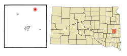 Location in Lake County and the state of South Dakota | |
| Coordinates: 44°9′42″N 97°1′1″W | |
| Country | United States |
| State | South Dakota |
| County | Lake |
| Area | |
| • Total | 1.01 sq mi (2.61 km2) |
| • Land | 1.01 sq mi (2.61 km2) |
| • Water | 0.00 sq mi (0.00 km2) |
| Elevation | 1,762 ft (537 m) |
| Population | |
| • Total | 43 |
| • Estimate (2018)[3] | 52 |
| • Density | 51.59/sq mi (19.92/km2) |
| Time zone | UTC-6 (Central (CST)) |
| • Summer (DST) | UTC-5 (CDT) |
| ZIP code | 57050 |
| Area code(s) | 605 |
| FIPS code | 46-46060[4] |
| GNIS feature ID | 1256807[5] |
The first settlement at Nunda was made in 1877 by a colony of Scandinavians.[6]
Geography
Nunda is located at 44°9′42″N 97°1′1″W (44.161576, -97.016830).[7]
According to the United States Census Bureau, the town has a total area of 1.01 square miles (2.62 km2), all of it land.[8]
Nunda has been assigned the ZIP code 57050 and the FIPS place code 46060.
Demographics
| Historical population | |||
|---|---|---|---|
| Census | Pop. | %± | |
| 1910 | 137 | — | |
| 1920 | 206 | 50.4% | |
| 1930 | 163 | −20.9% | |
| 1940 | 147 | −9.8% | |
| 1950 | 102 | −30.6% | |
| 1960 | 106 | 3.9% | |
| 1970 | 85 | −19.8% | |
| 1980 | 60 | −29.4% | |
| 1990 | 45 | −25.0% | |
| 2000 | 47 | 4.4% | |
| 2010 | 43 | −8.5% | |
| Est. 2018 | 52 | [3] | 20.9% |
| U.S. Decennial Census[9] | |||
2010 census
As of the census[2] of 2010, there were 43 people, 21 households, and 15 families residing in the town. The population density was 42.6 inhabitants per square mile (16.4/km2). There were 24 housing units at an average density of 23.8 per square mile (9.2/km2). The racial makeup of the town was 100.0% White.
There were 21 households of which 19.0% had children under the age of 18 living with them, 61.9% were married couples living together, 4.8% had a female householder with no husband present, 4.8% had a male householder with no wife present, and 28.6% were non-families. 28.6% of all households were made up of individuals and 9.5% had someone living alone who was 65 years of age or older. The average household size was 2.05 and the average family size was 2.47.
The median age in the town was 52.8 years. 20.9% of residents were under the age of 18; 0.1% were between the ages of 18 and 24; 16.3% were from 25 to 44; 35% were from 45 to 64; and 27.9% were 65 years of age or older. The gender makeup of the town was 51.2% male and 48.8% female.
2000 census
As of the census[4] of 2000, there were 47 people, 25 households, and 13 families residing in the town. The population density was 46.9 people per square mile (18.1/km²). There were 27 housing units at an average density of 26.9 per square mile (10.4/km²). The racial makeup of the town was 100.00% White.
There were 25 households out of which 20.0% had children under the age of 18 living with them, 44.0% were married couples living together, 4.0% had a female householder with no husband present, and 48.0% were non-families. 44.0% of all households were made up of individuals and 12.0% had someone living alone who was 65 years of age or older. The average household size was 1.88 and the average family size was 2.62.
In the town, the population was spread out with 19.1% under the age of 18, 2.1% from 18 to 24, 29.8% from 25 to 44, 36.2% from 45 to 64, and 12.8% who were 65 years of age or older. The median age was 44 years. For every 100 females, there were 147.4 males. For every 100 females age 18 and over, there were 171.4 males.
The median income for a household in the town was $23,750, and the median income for a family was $26,875. Males had a median income of $26,250 versus $16,667 for females. The per capita income for the town was $14,154. There were no families and 9.6% of the population living below the poverty line, including no under eighteens and 21.4% of those over 64.
References
- "2018 U.S. Gazetteer Files". United States Census Bureau. Retrieved February 22, 2020.
- "U.S. Census website". United States Census Bureau. Retrieved 2012-06-21.
- "Population and Housing Unit Estimates". United States Census Bureau. June 27, 2019. Retrieved June 4, 2019.
- "U.S. Census website". United States Census Bureau. Retrieved 2008-01-31.
- "US Board on Geographic Names". United States Geological Survey. 2007-10-25. Retrieved 2008-01-31.
- Federal Writers' Project (1940). South Dakota place-names, v.1-3. University of South Dakota. p. 52.
- "US Gazetteer files: 2010, 2000, and 1990". United States Census Bureau. 2011-02-12. Retrieved 2011-04-23.
- "US Gazetteer files 2010". United States Census Bureau. Archived from the original on 2012-01-24. Retrieved 2012-06-21.
- "Census of Population and Housing". Census.gov. Retrieved June 4, 2015.
Municipalities and communities of Lake County, South Dakota, United States | ||
|---|---|---|
| City | 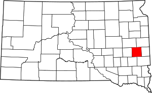 | |
| Towns | ||
| Village | ||
| CDPs |
| |
| Other unincorporated communities | ||
| Authority control |
|
|---|