Nowy Bytom
Nowy Bytom (German: Friedenshütte) is a district serving as administrative centre of Ruda Śląska, Silesian Voivodeship, southern Poland. In 2006 it had an area of 4.6 km2 and was inhabited by 12,058 people.[1] On January 12, 2006 a part of it was split off to form a new district, Czarny Las.
Nowy Bytom | |
|---|---|
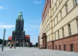 John Paul II Square | |
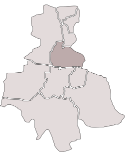 Location of Nowy Bytom within Ruda Śląska | |
| Coordinates: 50°17′08″N 18°52′31″E | |
| Country | |
| Voivodeship | Silesian |
| County/City | Ruda Śląska |
| Time zone | UTC+1 (CET) |
| • Summer (DST) | UTC+2 (CEST) |
| Area code(s) | (+48) 032 |
History
Until the early 19th century the area was covered by Bytom's Black Forest (German: Beuthener Schwarzwald, Polish: Czarny Las), which was first mentioned in 1369. In the course of the 19th-century industrial development steel mills and coal mines had been established on its territory, among them Friedenshütte (Polish: Frydenshuta), after which a wider area took name. Administratively it formed an exclave of Bytom up to 1921. After World War I and the Upper Silesia plebiscite became a part of Silesian Voivodeship, Second Polish Republic and gained status of an independent municipality (gmina) named Nowy Bytom (lit. New Bytom) in place of colloquial Polish Frydenshuta (after the local steel mill) and temporarily Polski Bytom (lit. Polish Bytom). In 1929 Zgoda was split off to be joined with Świętochłowice. Nowy Bytom was then annexed by Nazi Germany at the beginning of World War II. After the war it was restored to Poland. In 1947 it gained town rights. In 1951 it absorbed Wirek.[2] On December 31, 1958 it was amalgamated with Ruda to form contemporary Ruda Śląska.[3]
Gallery
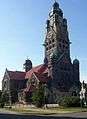 Saint Paul church
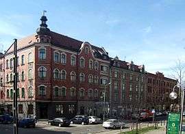 Niedurnego Street
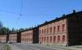
References
- "Tab. 47 Rozkład dysfunkcji w mieście w latach 2003-2006". Lokalny Program Rewitalizacji Miasta Ruda Śląska na lata 2007-2015 (PDF) (in Polish). Ruda Śląska: Urząd Miasta Ruda Śląska. September 2007. p. 52.
- Rozporządzenie Rady Ministrów z dnia 17 marca 1951 r. w sprawie zniesienia i zmiany granic niektórych powiatów oraz utworzenia i zmiany granic niektórych miast, stanowiących powiaty miejskie w województwie katowickim., Dz. U. z 1951 r. Nr 18, poz. 147
- Rozporządzenie Rady Ministrów z dnia 18 listopada 1958 r. w sprawie utworzenia miasta Ruda Śląska stanowiącego powiat miejski w województwie katowickim., Dz. U. z 1958 r. Nr 69, poz. 342
| Wikimedia Commons has media related to Nowy Bytom. |
| ||