Ninnekah, Oklahoma
Ninnekah is a town in Grady County, Oklahoma, United States. The population was 1,002 at the 2010 census.[5]
Ninnekah, Oklahoma | |
|---|---|
 Location of Ninnekah, Oklahoma | |
| Coordinates: 34°57′25″N 97°56′6″W | |
| Country | United States |
| State | Oklahoma |
| County | Grady |
| Area | |
| • Total | 10.18 sq mi (26.37 km2) |
| • Land | 10.18 sq mi (26.37 km2) |
| • Water | 0.00 sq mi (0.00 km2) |
| Elevation | 1,112 ft (339 m) |
| Population (2010) | |
| • Total | 1,002 |
| • Estimate (2018)[2] | 1,037 |
| • Density | 101.84/sq mi (39.32/km2) |
| Time zone | UTC-6 (Central (CST)) |
| • Summer (DST) | UTC-5 (CDT) |
| ZIP code | 73067 |
| Area code(s) | 405 |
| FIPS code | 40-52100[3] |
| GNIS feature ID | 1095886[4] |
History
A post office was established at Ninnekah, Indian Territory on July 28, 1892. The name is from the Choctaw word, ninek, meaning "night" or "darkness."[6]
At the time of its founding, Ninnekah was located in Pickens County, Chickasaw Nation.[7]
Geography
Ninnekah is located in west-central Grady County at 34°57′25″N 97°56′6″W (34.956883, -97.935011).[8] It is bordered to the north by the city of Chickasha, the county seat. U.S. Route 81 passes through the town, leading north 7 miles (11 km) into Chickasha and south 32 miles (51 km) to Duncan. U.S. Route 277 splits west from US 81 in Ninnekah and leads 11 miles (18 km) to Cement. Oklahoma City is 49 miles (79 km) to the northeast via US 81 and Interstate 44.
According to the United States Census Bureau, the town has a total area of 10.2 square miles (26.4 km2), all of it land.[5]
Demographics
| Historical population | |||
|---|---|---|---|
| Census | Pop. | %± | |
| 2000 | 994 | — | |
| 2010 | 1,002 | 0.8% | |
| Est. 2018 | 1,037 | [2] | 3.5% |
| U.S. Decennial Census[9] | |||
At the 2000 census there were 994 people, 400 households, and 304 families in the town. The population density was 97.7 people per square mile (37.7/km²). There were 440 housing units at an average density of 43.3 per square mile (16.7/km²). The racial makeup of the town was 89.44% White, 0.60% African American, 3.82% Native American, 0.40% Asian, 0.50% from other races, and 5.23% from two or more races. Hispanic or Latino of any race were 1.91%.[3]
Of the 400 households 31.0% had children under the age of 18 living with them, 62.0% were married couples living together, 10.3% had a female householder with no husband present, and 24.0% were non-families. 20.8% of households were one person and 7.3% were one person aged 65 or older. The average household size was 2.49 and the average family size was 2.85.
The age distribution was 23.5% under the age of 18, 9.2% from 18 to 24, 27.7% from 25 to 44, 28.7% from 45 to 64, and 11.0% 65 or older. The median age was 39 years. For every 100 females, there were 98.8 males. For every 100 females age 18 and over, there were 94.9 males.
The median household income was $31,181 and the median family income was $37,656. Males had a median income of $29,659 versus $21,328 for females. The per capita income for the town was $16,434. About 14.1% of families and 19.5% of the population were below the poverty line, including 30.3% of those under age 18 and 13.5% of those age 65 or over.
References
- "2018 U.S. Gazetteer Files". United States Census Bureau. Retrieved Feb 12, 2020.
- "Population and Housing Unit Estimates". Retrieved June 4, 2019.
- "U.S. Census website". United States Census Bureau. Retrieved 2008-01-31.
- "US Board on Geographic Names". United States Geological Survey. 2007-10-25. Retrieved 2008-01-31.
- "Geographic Identifiers: 2010 Demographic Profile Data (G001): Ninnekah town, Oklahoma". American Factfinder. U.S. Census Bureau. Retrieved January 26, 2017.
- George H. Shirk. Oklahoma Place Names (Norman: University of Oklahoma Press, 1965), p. 150.
- Charles Goins, Historical Atlas of Oklahoma (Norman: University of Oklahoma Press, 2006), plate 105.
- "US Gazetteer files: 2010, 2000, and 1990". United States Census Bureau. 2011-02-12. Retrieved 2011-04-23.
- "Census of Population and Housing". Census.gov. Retrieved June 4, 2015.
Municipalities and communities of Grady County, Oklahoma, United States | ||
|---|---|---|
| Cities | 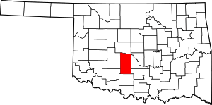 Grady County map | |
| Towns | ||
| Unincorporated communities | ||
| Ghost towns | ||
| Footnotes | ‡This populated place also has portions in an adjacent county or counties | |
- NewsOK, G. H. (2001, January 6). Ninnekah. Retrieved July 27, 2016, from http://newsok.com/article/881907